TopoQuest Logo
Do you find TopoQuest useful?
Help keep TopoQuest running and adding new maps/features by donating!
Bitcoin:  19c7KJd3qBynnjoSw5npx9KScwjBe4ifkT
Litecoin:  LXs6TkuXGGXo1vDsWCkWVdjQX94eUKd6ui
Home View Maps Find Maps Find Places Resources & Links


Cooktown, Georgia Topographic Map

USGS Map Title: Cooktown, GA
USGS Map MRC: 31084B5
DRG (GeoTIFF) Download: o31084b5.tif


Neighboring USGS Topographic Map Quads:


  Damascus, GA  
31084C6
 

  Bethany, GA  
31084C5
 

  Elmodel, GA  
31084C4
 

  Colquitt, GA  
31084B6
 

  Cooktown, GA  
31084B5
 

  Hopeful, GA  
31084B4
 

  Boykin, GA  
31084A6
 

  Steadhams Store, GA  
31084A5
 

  Vada, GA  
31084A4


Map MRC Location:

N32°
W85°
N32°
W84°
H8 H7 H6 H5 H4 H3 H2 H1
G8 G7 G6 G5 G4 G3 G2 G1
F8 F7 F6 F5 F4 F3 F2 F1
E8 E7 E6 E5 E4 E3 E2 E1
D8 D7 D6 D5 D4 D3 D2 D1
C8 C7 C6 C5 C4 C3 C2 C1
B8 B7 B6 B5 B4 B3 B2 B1
A8 A7 A6 A5 A4 A3 A2 A1
N31°
W85°
N31°
W84°

Cooktown, GA USGS 1:24K Topographic Map Preview:
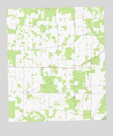
Cooktown, GA USGS Topographic Map
Click on map above to begin viewing in our Map Viewer.

This topographic map contains these locations and features:
Feature Name Type Latitude Longitude GNIS ID View Map
BellviewPopulated PlaceN31.1574°W84.5994°354536View Map
Bellview CemeteryCemeteryN31.1571°W84.5992°335312View Map
Bellview DivisionCivilN31.1702°W84.6028°1936106View Map
Bellview Freewill Baptist ChurchChurchN31.1574°W84.5994°335313View Map
Big Pond (historical)LakeN31.1438°W84.5460°335148View Map
Cheevertown (historical)Populated PlaceN31.1907°W84.5179°2705539View Map
Cook PondLakeN31.1616°W84.5799°312919View Map
Cooks Union ChurchChurchN31.1655°W84.5794°355280View Map
Cooks Union United Methodist CemeteryCemeteryN31.1662°W84.5796°335318View Map
CooktownPopulated PlaceN31.2071°W84.5602°312928View Map
County Line ChurchChurchN31.1313°W84.5296°355333View Map
Davis CemeteryCemeteryN31.1677°W84.5675°335319View Map
Davis PondLakeN31.1713°W84.5730°313357View Map
Kelley CemeteryCemeteryN31.1862°W84.5397°316356View Map
Kimbell ChapelChurchN31.1846°W84.5721°316417View Map
Little Zion ChurchChurchN31.2491°W84.6130°317246View Map
New Hope ChurchChurchN31.1830°W84.5402°319366View Map
Newberry CemeteryCemeteryN31.1710°W84.5199°342843View Map
Notchaway Baptist ChurchChurchN31.1913°W84.5174°319715View Map
Notchaway Baptist Church CemeteryCemeteryN31.1916°W84.5174°1934414View Map
Saint Pauls ChurchChurchN31.2285°W84.5688°322247View Map
Springfield ChurchChurchN31.1913°W84.5074°323459View Map
Widners School (historical)SchoolN31.2243°W84.6138°335187View Map
WJAD-FM (Bainbridge)TowerN31.1535°W84.5449°352635View Map

Note: Coordinates in the location and feature list above are referenced to NAD83 datum.


Copyright (C) 2008-2024 Ryan Niemi / Sunset Dynamics ... All Rights Reserved