TopoQuest Logo
Do you find TopoQuest useful?
Help keep TopoQuest running and adding new maps/features by donating!
Bitcoin:  19c7KJd3qBynnjoSw5npx9KScwjBe4ifkT
Litecoin:  LXs6TkuXGGXo1vDsWCkWVdjQX94eUKd6ui
Home View Maps Find Maps Find Places Resources & Links


Bethany, Georgia Topographic Map

USGS Map Title: Bethany, GA
USGS Map MRC: 31084C5
DRG (GeoTIFF) Download: o31084c5.tif


Neighboring USGS Topographic Map Quads:


  Arlington, GA  
31084D6
 

  Leary, GA  
31084D5
 

  Bermuda, GA  
31084D4
 

  Damascus, GA  
31084C6
 

  Bethany, GA  
31084C5
 

  Elmodel, GA  
31084C4
 

  Colquitt, GA  
31084B6
 

  Cooktown, GA  
31084B5
 

  Hopeful, GA  
31084B4


Map MRC Location:

N32°
W85°
N32°
W84°
H8 H7 H6 H5 H4 H3 H2 H1
G8 G7 G6 G5 G4 G3 G2 G1
F8 F7 F6 F5 F4 F3 F2 F1
E8 E7 E6 E5 E4 E3 E2 E1
D8 D7 D6 D5 D4 D3 D2 D1
C8 C7 C6 C5 C4 C3 C2 C1
B8 B7 B6 B5 B4 B3 B2 B1
A8 A7 A6 A5 A4 A3 A2 A1
N31°
W85°
N31°
W84°

Bethany, GA USGS 1:24K Topographic Map Preview:
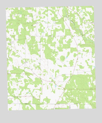
Bethany, GA USGS Topographic Map
Click on map above to begin viewing in our Map Viewer.

This topographic map contains these locations and features:
Feature Name Type Latitude Longitude GNIS ID View Map
Alligator CreekStreamN31.3635°W84.5407°310479View Map
Baker AcademySchoolN31.3396°W84.5613°310729View Map
BethanyPopulated PlaceN31.3077°W84.5996°311125View Map
Bethany ChurchChurchN31.3085°W84.5988°342835View Map
Cedar Grove CemeteryCemeteryN31.2566°W84.5791°312467View Map
Christ ChurchChurchN31.3357°W84.6080°312653View Map
CrestviewPopulated PlaceN31.3330°W84.6194°326238View Map
Dewsville (historical)Populated PlaceN31.3381°W84.5285°2705540View Map
Ichaway ChurchChurchN31.2738°W84.5046°315874View Map
Little Cypress CreekStreamN31.2507°W84.5757°317052View Map
Live Oak ChurchChurchN31.2841°W84.5613°317251View Map
Milford DivisionCivilN31.3064°W84.5424°1936407View Map
MimsvillePopulated PlaceN31.2557°W84.5285°326399View Map
Morgan CemeteryCemeteryN31.3543°W84.5013°318454View Map
Mount Enon ChurchChurchN31.3566°W84.5135°318631View Map
New Evergreen ChurchChurchN31.3205°W84.5241°319310View Map
Oak Grove CemeteryCemeteryN31.3530°W84.5891°319744View Map
Oak Grove ChurchChurchN31.3557°W84.5819°319768View Map
Patmos Community Volunteer Fire DepartmentBuildingN31.3506°W84.5657°2604183View Map
Pleasant View ChurchChurchN31.2671°W84.6138°320942View Map
Smith CemeteryCemeteryN31.3366°W84.6113°342847View Map
Stephen Bush CemeteryCemeteryN31.3249°W84.5774°342848View Map

Note: Coordinates in the location and feature list above are referenced to NAD83 datum.


Copyright (C) 2008-2025 Ryan Niemi / Sunset Dynamics ... All Rights Reserved