TopoQuest Logo
Do you find TopoQuest useful?
Help keep TopoQuest running and adding new maps/features by donating!
Bitcoin:  19c7KJd3qBynnjoSw5npx9KScwjBe4ifkT
Litecoin:  LXs6TkuXGGXo1vDsWCkWVdjQX94eUKd6ui
Home View Maps Find Maps Find Places Resources & Links


Hopeulikit, Georgia Topographic Map

USGS Map Title: Hopeulikit, GA
USGS Map MRC: 32081E7
DRG (GeoTIFF) Download: o32081e7.tif


Neighboring USGS Topographic Map Quads:


  Four Points, GA  
32081F8
 

  Rocky Ford, GA  
32081F7
 

  Sylvania South, GA  
32081F6
 

  Portal, GA  
32081E8
 

  Hopeulikit, GA  
32081E7
 

  Dover, GA  
32081E6
 

  Pulaski, GA  
32081D8
 

  Statesboro, GA  
32081D7
 

  Brooklet, GA  
32081D6


Map MRC Location:

N33°
W82°
N33°
W81°
H8 H7 H6 H5 H4 H3 H2 H1
G8 G7 G6 G5 G4 G3 G2 G1
F8 F7 F6 F5 F4 F3 F2 F1
E8 E7 E6 E5 E4 E3 E2 E1
D8 D7 D6 D5 D4 D3 D2 D1
C8 C7 C6 C5 C4 C3 C2 C1
B8 B7 B6 B5 B4 B3 B2 B1
A8 A7 A6 A5 A4 A3 A2 A1
N32°
W82°
N32°
W81°

Hopeulikit, GA USGS 1:24K Topographic Map Preview:
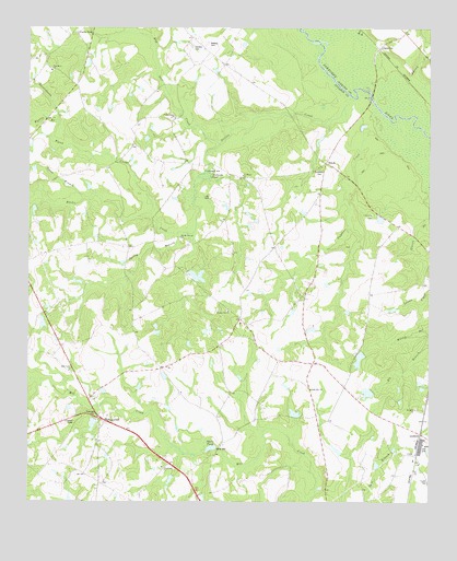
Hopeulikit, GA USGS Topographic Map
Click on map above to begin viewing in our Map Viewer.

This topographic map contains these locations and features:
Feature Name Type Latitude Longitude GNIS ID View Map
Akins MillPopulated PlaceN32.5143°W81.8159°331005View Map
Akins PondLakeN32.5143°W81.8177°310419View Map
Alexander School (historical)SchoolN32.5657°W81.8668°350283View Map
Banks CreekStreamN32.5943°W81.8154°310773View Map
Bay Gall CreekStreamN32.5946°W81.8154°354489View Map
Beasley CemeteryCemeteryN32.6210°W81.8190°310960View Map
Bland CreekStreamN32.5760°W81.8368°311517View Map
BlitchPopulated PlaceN32.5896°W81.7823°331190View Map
Brown Chapel (historical)ChurchN32.5546°W81.7901°350300View Map
ClitoPopulated PlaceN32.5124°W81.7537°331417View Map
Coleman CreekStreamN32.6010°W81.7637°312826View Map
Donaldson CemeteryCemeteryN32.5877°W81.7846°313538View Map
E S Lane BridgeBridgeN32.6066°W81.7682°350332View Map
Finchs StoreLocaleN32.6235°W81.8596°314124View Map
Free ChapelChurchN32.5574°W81.8432°350353View Map
Friendship CemeteryCemeteryN32.5096°W81.8332°350355View Map
Friendship ChurchChurchN32.5096°W81.8326°355931View Map
Hendrix CemeteryCemeteryN32.6207°W81.8237°315330View Map
HIA AirportAirportN32.5622°W81.8585°2770251View Map
HopeulikitPopulated PlaceN32.5216°W81.8504°332022View Map
Lakeview ChurchChurchN32.5299°W81.7868°316579View Map
Lee CemeteryCemeteryN32.5804°W81.8184°316731View Map
Little Bethel Church (historical)ChurchN32.5429°W81.7876°350386View Map
Lone BridgeBridgeN32.6068°W81.7682°350387View Map
Mallards MillLocaleN32.5874°W81.8196°317642View Map
Mallards PondLakeN32.5861°W81.8199°317643View Map
Marsh PondReservoirN32.5596°W81.8221°341510View Map
Marsh Pond DamDamN32.5618°W81.8248°341509View Map
Middle Ground ChurchChurchN32.5702°W81.8276°318076View Map
Mill BranchStreamN32.6146°W81.7773°318182View Map
Mill Creek ChurchChurchN32.5346°W81.8618°318241View Map
Mill Creek School (historical)SchoolN32.5299°W81.8573°350397View Map
Mount Oliff CemeteryCemeteryN32.5249°W81.7537°350402View Map
Mount Olliff ChurchChurchN32.5246°W81.7540°318792View Map
Nevills CreekStreamN32.6063°W81.7746°319257View Map
Nevills Creek ChurchChurchN32.6013°W81.8293°319258View Map
Nevills Creek School (historical)SchoolN32.6013°W81.8293°350404View Map
Oak Grove Baptist ChurchChurchN32.6138°W81.8679°319793View Map
Oak Grove CemeteryCemeteryN32.6135°W81.8684°350416View Map
OgeecheePopulated PlaceN32.6199°W81.7648°356445View Map
Peavey CreekStreamN32.6049°W81.7621°320329View Map
Rattlesnake CreekStreamN32.5963°W81.8679°321321View Map
Saint Marys CemeteryCemeteryN32.5871°W81.8087°350441View Map
Saint Marys ChurchChurchN32.5863°W81.8082°322200View Map
Spring BranchStreamN32.5710°W81.8282°323363View Map
Spring BranchStreamN32.5943°W81.8154°323367View Map
Sweat BranchStreamN32.5799°W81.8571°310360View Map
Swint PondReservoirN32.5378°W81.7717°341634View Map
Swint Pond DamDamN32.5402°W81.7698°341633View Map
Temple Hill Baptist ChurchChurchN32.5505°W81.8124°2502265View Map
Temple Hill CemeteryCemeteryN32.5507°W81.8129°350470View Map
Temple Hill ChurchChurchN32.5504°W81.8126°323986View Map
Tillman PondReservoirN32.5290°W81.7689°341083View Map
Tillman Pond DamDamN32.5302°W81.7682°341082View Map
Union CemeteryCemeteryN32.5757°W81.7684°350475View Map
Union ChurchChurchN32.5757°W81.7679°324522View Map
Williams Chapel (historical)ChurchN32.6013°W81.8546°350485View Map
Wyatts BranchStreamN32.6004°W81.8654°325587View Map

Note: Coordinates in the location and feature list above are referenced to NAD83 datum.


Copyright (C) 2008-2024 Ryan Niemi / Sunset Dynamics ... All Rights Reserved