TopoQuest Logo
Do you find TopoQuest useful?
Help keep TopoQuest running and adding new maps/features by donating!
Bitcoin:  19c7KJd3qBynnjoSw5npx9KScwjBe4ifkT
Litecoin:  LXs6TkuXGGXo1vDsWCkWVdjQX94eUKd6ui
Home View Maps Find Maps Find Places Resources & Links


Hornbeak, Tennessee Topographic Map

USGS Map Title: Hornbeak, TN
USGS Map MRC: 36089C3
DRG (GeoTIFF) Download: o36089c3.tif


Neighboring USGS Topographic Map Quads:


  Tiptonville, TN  
36089D4
 

  Samburg, TN  
36089D3
 

  Clayton, TN  
36089D2
 

  Ridgely, TN  
36089C4
 

  Hornbeak, TN  
36089C3
 

  Obion, TN  
36089C2
 

  Miston, TN  
36089B4
 

  Lane, TN  
36089B3
 

  Trimble, TN  
36089B2


Map MRC Location:

N37°
W90°
N37°
W89°
H8 H7 H6 H5 H4 H3 H2 H1
G8 G7 G6 G5 G4 G3 G2 G1
F8 F7 F6 F5 F4 F3 F2 F1
E8 E7 E6 E5 E4 E3 E2 E1
D8 D7 D6 D5 D4 D3 D2 D1
C8 C7 C6 C5 C4 C3 C2 C1
B8 B7 B6 B5 B4 B3 B2 B1
A8 A7 A6 A5 A4 A3 A2 A1
N36°
W90°
N36°
W89°

Hornbeak, TN USGS 1:24K Topographic Map Preview:
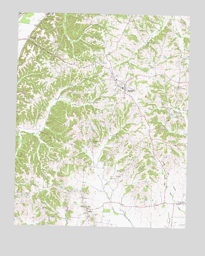
Hornbeak, TN USGS Topographic Map
Click on map above to begin viewing in our Map Viewer.

This topographic map contains these locations and features:
Feature Name Type Latitude Longitude GNIS ID View Map
Antioch Baptist CemeteryCemeteryN36.3463°W89.3141°2775766View Map
Antioch Baptist ChurchChurchN36.3465°W89.3140°1304858View Map
Atkins CreekStreamN36.3037°W89.3603°1304893View Map
Bethel (historical)Populated PlaceN36.3234°W89.3620°1326712View Map
Bethel Church (historical)ChurchN36.3231°W89.3620°1320448View Map
Burnt Mill HollowValleyN36.2611°W89.2536°1279101View Map
Cobbs ChapelChurchN36.3712°W89.2940°1326804View Map
Cobbs Chapel CemeteryCemeteryN36.3709°W89.2934°1326716View Map
Commissioner District 5CivilN36.3453°W89.3131°2464480View Map
ElbridgePopulated PlaceN36.2603°W89.3220°1283596View Map
Elbridge Post OfficePost OfficeN36.2609°W89.3217°1651468View Map
Elbridge-Cloverdale Division (historical)CensusN36.2540°W89.3531°1648895View Map
Glady HollowValleyN36.3596°W89.3674°1285485View Map
Glady Hollow 41-1 DamDamN36.3401°W89.3484°1302522View Map
Glady Hollow 41-1 LakeReservoirN36.3401°W89.3484°1302521View Map
Glady School (historical)SchoolN36.3492°W89.3470°1320458View Map
GlassPopulated PlaceN36.2648°W89.2537°1285490View Map
Glass Church of ChristChurchN36.2651°W89.2545°1325951View Map
Graves ChapelChurchN36.3331°W89.2565°1285958View Map
HornbeakPopulated PlaceN36.3312°W89.2965°1288362View Map
Hornbeak CemeteryCemeteryN36.3320°W89.2898°1326719View Map
Hornbeak Post OfficePost OfficeN36.3306°W89.2967°1651473View Map
Hornbeak School (historical)SchoolN36.3320°W89.3148°1320462View Map
Hornbeak Volunteer Fire DepartmentBuildingN36.3317°W89.2991°2653824View Map
JacksonvillePopulated PlaceN36.3001°W89.3195°1315292View Map
Jones BranchStreamN36.3012°W89.3587°1289702View Map
Kendall CreekStreamN36.3048°W89.2503°1290062View Map
L E Dellinger DamDamN36.2901°W89.2701°1302478View Map
L E Dellinger LakeReservoirN36.2901°W89.2701°1302479View Map
Lassiter CornerPopulated PlaceN36.3601°W89.3670°1290662View Map
Luker DamDamN36.3084°W89.2684°1302497View Map
Luker LakeReservoirN36.3082°W89.2694°1302496View Map
MinnickPopulated PlaceN36.2681°W89.3659°1294057View Map
Minnick CemeteryCemeteryN36.2680°W89.3664°2775767View Map
New ChapelChurchN36.2617°W89.3237°1295461View Map
New Chapel CemeteryCemeteryN36.2623°W89.3237°1325953View Map
North Branch Pawpaw CreekStreamN36.3226°W89.3465°1295847View Map
Oak Ridge CemeteryCemeteryN36.2784°W89.3009°1296157View Map
Oak Ridge ChurchChurchN36.2826°W89.2965°1296158View Map
Oakridge School (historical)SchoolN36.2920°W89.2862°1320478View Map
Obion ChapelChurchN36.3323°W89.2573°1296223View Map
Obion Chapel CemeteryCemeteryN36.3320°W89.2578°1326723View Map
Obion Chapel School (historical)SchoolN36.3323°W89.2570°1326724View Map
Robinson CreekStreamN36.3220°W89.2628°1299704View Map
South Branch Pawpaw CreekStreamN36.3226°W89.3465°1270835View Map
Thompson CemeteryCemeteryN36.2665°W89.3253°1272528View Map
Town of HornbeakCivilN36.3355°W89.2954°2405863View Map
Turnage School (historical)SchoolN36.2876°W89.3426°1320505View Map

Note: Coordinates in the location and feature list above are referenced to NAD83 datum.


Copyright (C) 2008-2024 Ryan Niemi / Sunset Dynamics ... All Rights Reserved