TopoQuest Logo
Do you find TopoQuest useful?
Help keep TopoQuest running and adding new maps/features by donating!
Bitcoin:  19c7KJd3qBynnjoSw5npx9KScwjBe4ifkT
Litecoin:  LXs6TkuXGGXo1vDsWCkWVdjQX94eUKd6ui
Home View Maps Find Maps Find Places Resources & Links


Trimble, Tennessee Topographic Map

USGS Map Title: Trimble, TN
USGS Map MRC: 36089B2
DRG (GeoTIFF) Download: o36089b2.tif


Neighboring USGS Topographic Map Quads:


  Hornbeak, TN  
36089C3
 

  Obion, TN  
36089C2
 

  Rives, TN  
36089C1
 

  Lane, TN  
36089B3
 

  Trimble, TN  
36089B2
 

  Kenton, TN  
36089B1
 

  Newbern, TN  
36089A3
 

  Tatumville, TN  
36089A2
 

  Yorkville, TN  
36089A1


Map MRC Location:

N37°
W90°
N37°
W89°
H8 H7 H6 H5 H4 H3 H2 H1
G8 G7 G6 G5 G4 G3 G2 G1
F8 F7 F6 F5 F4 F3 F2 F1
E8 E7 E6 E5 E4 E3 E2 E1
D8 D7 D6 D5 D4 D3 D2 D1
C8 C7 C6 C5 C4 C3 C2 C1
B8 B7 B6 B5 B4 B3 B2 B1
A8 A7 A6 A5 A4 A3 A2 A1
N36°
W90°
N36°
W89°

Trimble, TN USGS 1:24K Topographic Map Preview:
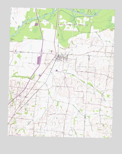
Trimble, TN USGS Topographic Map
Click on map above to begin viewing in our Map Viewer.

This topographic map contains these locations and features:
Feature Name Type Latitude Longitude GNIS ID View Map
Bethlehem School (historical)SchoolN36.1328°W89.2192°1316125View Map
Burnt Mill Hollow CreekStreamN36.2251°W89.2423°1279102View Map
Carmel ChurchChurchN36.1295°W89.1828°1305688View Map
Cool SpringsPopulated PlaceN36.1628°W89.1387°1314886View Map
Cool Springs BranchStreamN36.1806°W89.2228°1306088View Map
Cool Springs CemeteryCemeteryN36.1620°W89.1395°1322081View Map
Cool Springs ChurchChurchN36.1467°W89.1398°1281149View Map
Cool Springs Cumberland Presbyterian ChurchChurchN36.1623°W89.1395°1322082View Map
Cool Springs School (historical)SchoolN36.1567°W89.1395°1322083View Map
Dillard CreekStreamN36.2420°W89.1720°1282472View Map
Dillard CreekStreamN36.2276°W89.1467°1282473View Map
District 15 (historical)CivilN36.1890°W89.2042°1310267View Map
District 9 (historical)CivilN36.1334°W89.2056°1310263View Map
Harmony ChurchChurchN36.1626°W89.2287°1286899View Map
Harmony School (historical)SchoolN36.1626°W89.2292°1316129View Map
Jones CemeteryCemeteryN36.1890°W89.1584°1289747View Map
McCorkle CemeteryCemeteryN36.1265°W89.1912°1293193View Map
Mill CreekStreamN36.2495°W89.1751°1293847View Map
Mount Carmel CemeteryCemeteryN36.1292°W89.1842°1643408View Map
Mulherin CreekStreamN36.1678°W89.2003°1295074View Map
New Bethlehem ChurchChurchN36.1326°W89.2181°1295445View Map
Newbern Division (historical)CensusN36.1315°W89.2445°1648681View Map
Obion River Drainage CanalCanalN36.2270°W89.1592°1296226View Map
Old Obion River Drainage CanalCanalN36.2378°W89.2084°1296343View Map
Palestine Church (historical)ChurchN36.1526°W89.2417°1316136View Map
Parker BranchStreamN36.1462°W89.1540°1296798View Map
Pierce CemeteryCemeteryN36.1998°W89.2034°1297419View Map
Poplar RidgePopulated PlaceN36.2073°W89.2453°1315761View Map
TempletonPopulated PlaceN36.1567°W89.2290°1314386View Map
Town of TrimbleCivilN36.2021°W89.1888°2406754View Map
TrimblePopulated PlaceN36.2031°W89.1909°1304164View Map
Trimble Elementary SchoolSchoolN36.2006°W89.1845°1309854View Map
Trimble Fire DepartmentBuildingN36.2042°W89.1906°2654179View Map
Trimble First Baptist ChurchChurchN36.2028°W89.1895°1643418View Map
Trimble Police DepartmentBuildingN36.2034°W89.1913°2765837View Map
Trimble Post OfficePost OfficeN36.2041°W89.1913°1650115View Map
Union Grove ChurchChurchN36.1276°W89.1762°1273225View Map

Note: Coordinates in the location and feature list above are referenced to NAD83 datum.


Copyright (C) 2008-2024 Ryan Niemi / Sunset Dynamics ... All Rights Reserved