TopoQuest Logo
Do you find TopoQuest useful?
Help keep TopoQuest running and adding new maps/features by donating!
Bitcoin:  19c7KJd3qBynnjoSw5npx9KScwjBe4ifkT
Litecoin:  LXs6TkuXGGXo1vDsWCkWVdjQX94eUKd6ui
Home View Maps Find Maps Find Places Resources & Links


Collier Butte, Oregon Topographic Map

USGS Map Title: Collier Butte, OR
USGS Map MRC: 42124C2
DRG (GeoTIFF) Download: o42124c2.tif


Neighboring USGS Topographic Map Quads:


  Signal Buttes, OR  
42124D3
 

  Quosatana Butte, OR  
42124D2
 

  Horse Sign Butte, OR  
42124D1
 

  Sundown Mountain, OR  
42124C3
 

  Collier Butte, OR  
42124C2
 

  Big Craggies, OR  
42124C1
 

  Carpenterville, OR  
42124B3
 

  Bosley Butte, OR  
42124B2
 

  Quail Prairie Mountain, OR  
42124B1


Map MRC Location:

N43°
W125°
N43°
W124°
H8 H7 H6 H5 H4 H3 H2 H1
G8 G7 G6 G5 G4 G3 G2 G1
F8 F7 F6 F5 F4 F3 F2 F1
E8 E7 E6 E5 E4 E3 E2 E1
D8 D7 D6 D5 D4 D3 D2 D1
C8 C7 C6 C5 C4 C3 C2 C1
B8 B7 B6 B5 B4 B3 B2 B1
A8 A7 A6 A5 A4 A3 A2 A1
N42°
W125°
N42°
W124°

Collier Butte, OR USGS 1:24K Topographic Map Preview:
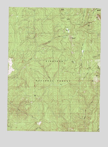
Collier Butte, OR USGS Topographic Map
Click on map above to begin viewing in our Map Viewer.

This topographic map contains these locations and features:
Feature Name Type Latitude Longitude GNIS ID View Map
Brookings DivisionCivilN42.2825°W124.1673°1937969View Map
Cedar CampLocaleN42.3154°W124.1404°1139490View Map
Cedar CreekStreamN42.2990°W124.1540°1139491View Map
Collier ButteSummitN42.3655°W124.1289°1139990View Map
Eagle Creek TrailTrailN42.2599°W124.1370°1141476View Map
East Fork Pistol RiverStreamN42.3232°W124.2184°1141591View Map
Fairview CampParkN42.3646°W124.1751°1156850View Map
Fairview MeadowFlatN42.3643°W124.1719°1141949View Map
Fairview MountainSummitN42.3726°W124.1810°1141950View Map
Hazel CampLocaleN42.2548°W124.2476°1143423View Map
Huntley SpringSpringN42.3602°W124.1443°1143952View Map
Jacoby ButteSummitN42.3588°W124.1403°1155721View Map
Meadow CreekStreamN42.3354°W124.2109°1146046View Map
Mineral HillSummitN42.3065°W124.1326°1146315View Map
Mineral SpringSpringN42.3013°W124.1379°1155722View Map
Panther LakeLakeN42.3199°W124.1615°1147399View Map
Snow Camp MeadowFlatN42.3526°W124.1715°1149801View Map
Snow Camp MountainSummitN42.3441°W124.1657°1149802View Map
Snow Camp TrailTrailN42.3032°W124.1312°1149803View Map
Stack YardsSummitN42.2858°W124.2163°1150315View Map
Three Tree Camp (historical)ParkN42.2734°W124.1984°1132539View Map
Three Tree Lookout (historical)LocaleN42.2737°W124.1998°1151180View Map
Three TreesSummitN42.2751°W124.2148°1155933View Map
Windy CreekStreamN42.2993°W124.1534°1152504View Map
Windy ValleyValleyN42.3287°W124.1515°1155723View Map

Note: Coordinates in the location and feature list above are referenced to NAD83 datum.


Copyright (C) 2008-2024 Ryan Niemi / Sunset Dynamics ... All Rights Reserved