TopoQuest Logo
Do you find TopoQuest useful?
Help keep TopoQuest running and adding new maps/features by donating!
Bitcoin:  19c7KJd3qBynnjoSw5npx9KScwjBe4ifkT
Litecoin:  LXs6TkuXGGXo1vDsWCkWVdjQX94eUKd6ui
Home View Maps Find Maps Find Places Resources & Links


Junction City, California Topographic Map

USGS Map Title: Junction City, CA
USGS Map MRC: 40123F1
DRG (GeoTIFF) Download: o40123f1.tif


Neighboring USGS Topographic Map Quads:


  Helena, CA  
40123G2
 

  Dedrick, CA  
40123G1
 

  Rush Creek Lakes, CA  
40122G8
 

  Hayfork Bally, CA  
40123F2
 

  Junction City, CA  
40123F1
 

  Weaverville, CA  
40122F8
 

  Hayfork, CA  
40123E2
 

  Hayfork Summit, CA  
40123E1
 

  Hoosimbim Mountain, CA  
40122E8


Map MRC Location:

N41°
W124°
N41°
W123°
H8 H7 H6 H5 H4 H3 H2 H1
G8 G7 G6 G5 G4 G3 G2 G1
F8 F7 F6 F5 F4 F3 F2 F1
E8 E7 E6 E5 E4 E3 E2 E1
D8 D7 D6 D5 D4 D3 D2 D1
C8 C7 C6 C5 C4 C3 C2 C1
B8 B7 B6 B5 B4 B3 B2 B1
A8 A7 A6 A5 A4 A3 A2 A1
N40°
W124°
N40°
W123°

Junction City, CA USGS 1:24K Topographic Map Preview:
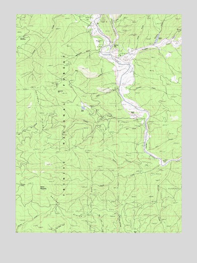
Junction City, CA USGS Topographic Map
Click on map above to begin viewing in our Map Viewer.

This topographic map contains these locations and features:
Feature Name Type Latitude Longitude GNIS ID View Map
Barker MountainSummitN40.6499°W123.1089°256520View Map
Bell GulchValleyN40.6874°W123.0306°256804View Map
Benjamin FlatFlatN40.7338°W123.0670°256824View Map
Canyon CreekStreamN40.7318°W123.0570°257949View Map
Carr CreekStreamN40.6729°W123.0297°257997View Map
Carter RanchLocaleN40.6954°W123.0761°258020View Map
Chapman RanchLocaleN40.6926°W123.0386°258209View Map
Clear GulchValleyN40.7465°W123.0536°258438View Map
Clems FlatFlatN40.6268°W123.0384°258452View Map
Deep GulchValleyN40.7068°W123.0517°259188View Map
Dog Run SpringSpringN40.6525°W123.1240°259443View Map
Dutch CreekStreamN40.6649°W123.0167°259624View Map
Evans BarBarN40.6776°W123.0275°259984View Map
Felter GulchValleyN40.7310°W123.0359°260075View Map
Hayfork DivideRidgeN40.6340°W123.0784°261175View Map
Hocker FlatFlatN40.7449°W123.0698°261384View Map
Johnson PointCapeN40.6640°W123.0150°261986View Map
Junction CityPopulated PlaceN40.7332°W123.0536°1658873View Map
Junction City CampgroundLocaleN40.7463°W123.0631°276991View Map
Junction City Census Designated PlaceCensusN40.7274°W123.0614°2583043View Map
Junction City Elementary SchoolSchoolN40.7333°W123.0594°1683041View Map
Junction City Fire Protection District Station 1BuildingN40.7277°W123.0567°2621924View Map
Junction City Guard StationLocaleN40.7282°W123.0564°276992View Map
Junction City Post OfficePost OfficeN40.7304°W123.0548°1683042View Map
La Grange PitMineN40.7264°W123.0508°2678216View Map
Maple CreekStreamN40.6596°W123.0300°263170View Map
Maxwell CreekStreamN40.6654°W123.0086°263280View Map
McKinney GulchValleyN40.7293°W123.0692°228415View Map
Mill CreekStreamN40.7218°W123.0506°263589View Map
Oregon GulchValleyN40.7238°W123.0414°264390View Map
Poison GulchValleyN40.7335°W123.0128°264889View Map
Rattlesnake GapGapN40.7046°W123.0975°265209View Map
Sheridan CreekStreamN40.7088°W123.0461°266102View Map
Slattery GulchValleyN40.7346°W123.0200°266280View Map
Slattery PondLakeN40.7356°W123.0197°266281View Map
Soldier CreekStreamN40.6907°W123.0272°267379View Map
Trinity CountyCivilN40.6507°W123.1126°277317View Map

Note: Coordinates in the location and feature list above are referenced to NAD83 datum.


Copyright (C) 2008-2025 Ryan Niemi / Sunset Dynamics ... All Rights Reserved