TopoQuest Logo
Do you find TopoQuest useful?
Help keep TopoQuest running and adding new maps/features by donating!
Bitcoin:  19c7KJd3qBynnjoSw5npx9KScwjBe4ifkT
Litecoin:  LXs6TkuXGGXo1vDsWCkWVdjQX94eUKd6ui
Home View Maps Find Maps Find Places Resources & Links


Hot Springs, Montana Topographic Map

USGS Map Title: Hot Springs, MT
USGS Map MRC: 47114E6
DRG (GeoTIFF) Download: o47114e6.tif


Neighboring USGS Topographic Map Quads:


  Coney Peak, MT  
47114F7
 

  Lonepine, MT  
47114F6
 

  Hot Springs NE, MT  
47114F5
 

  Baldy Lake, MT  
47114E7
 

  Hot Springs, MT  
47114E6
 

  Markle Pass, MT  
47114E5
 

  Paradise, MT  
47114D7
 

  Sunrise Spring, MT  
47114D6
 

  Camas Prairie, MT  
47114D5


Map MRC Location:

N48°
W115°
N48°
W114°
H8 H7 H6 H5 H4 H3 H2 H1
G8 G7 G6 G5 G4 G3 G2 G1
F8 F7 F6 F5 F4 F3 F2 F1
E8 E7 E6 E5 E4 E3 E2 E1
D8 D7 D6 D5 D4 D3 D2 D1
C8 C7 C6 C5 C4 C3 C2 C1
B8 B7 B6 B5 B4 B3 B2 B1
A8 A7 A6 A5 A4 A3 A2 A1
N47°
W115°
N47°
W114°

Hot Springs, MT USGS 1:24K Topographic Map Preview:
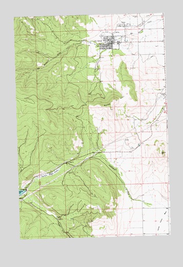
Hot Springs, MT USGS Topographic Map
Click on map above to begin viewing in our Map Viewer.

This topographic map contains these locations and features:
Feature Name Type Latitude Longitude GNIS ID View Map
20N24W03CCCD01 WellWellN47.5160°W114.6460°823538View Map
20N24W03CCD_01 WellWellN47.5169°W114.6443°823549View Map
20N24W11CCC_01 WellWellN47.5024°W114.6257°823444View Map
20N24W15ABB_01 WellWellN47.5005°W114.6362°823429View Map
21N24W01CCC_01 WellWellN47.6024°W114.6251°824004View Map
21N24W02ADC_01 WellWellN47.6099°W114.6299°824043View Map
21N24W02BDBC01 WellWellN47.6105°W114.6418°824047View Map
21N24W03BBA_01 SpringSpringN47.6146°W114.6664°824076View Map
21N24W03BBC_01 WellWellN47.6155°W114.6487°824075View Map
21N24W03DBAB01 WellWellN47.6085°W114.6546°824037View Map
21N24W03DCBB01 WellWellN47.6047°W114.6560°824015View Map
21N24W04ADAB01 WellWellN47.6119°W114.6707°824052View Map
21N24W04DABD01 WellWellN47.6069°W114.6712°824025View Map
21N24W04DBC_01 WellWellN47.6063°W114.6782°824023View Map
21N24W04DBD_01 WellWellN47.6063°W114.6754°824022View Map
21N24W09ACBA01 WellWellN47.5980°W114.6782°823972View Map
21N24W09CABC01 WellWellN47.5933°W114.6821°823942View Map
21N24W11DDDD01 WellWellN47.5877°W114.6271°823917View Map
22N24W34CDC_02 SpringSpringN47.6172°W114.6618°824096View Map
22N24W34DCC_01 WellWellN47.6172°W114.6565°824095View Map
24N24W27CDCA01 WellWellN47.5147°W114.6621°823526View Map
24N24W27CDCA02 WellWellN47.5147°W114.6621°823527View Map
24N24W27CDCA03 WellWellN47.5147°W114.6621°823528View Map
24N24W27CDCA04 WellWellN47.5147°W114.6621°823529View Map
24N24W34ACD_01 WellWellN47.5063°W114.6529°823462View Map
Bobs PlaceLocaleN47.6091°W114.6687°1780901View Map
Burke HillSummitN47.5716°W114.6724°769406View Map
CamasPopulated PlaceN47.6180°W114.6579°769515View Map
Camas Census Designated PlaceCensusN47.6179°W114.6560°2583795View Map
Camas Post Office (historical)Post OfficeN47.6180°W114.6579°1780958View Map
Central Avenue Trailer CourtPopulated PlaceN47.6083°W114.6774°1780903View Map
First Presbyterian ChurchChurchN47.6058°W114.6704°1780878View Map
Hot SpringsPopulated PlaceN47.6091°W114.6687°772580View Map
Hot Springs AmbulanceBuildingN47.6081°W114.6697°2637928View Map
Hot Springs Bible ChurchChurchN47.6069°W114.6774°1780876View Map
Hot Springs City ParkParkN47.6083°W114.6685°1780900View Map
Hot Springs Convalescent CenterHospitalN47.6105°W114.6754°1780886View Map
Hot Springs Medical ClinicHospitalN47.6088°W114.6718°1780885View Map
Hot Springs Police DepartmentBuildingN47.6083°W114.6697°1780828View Map
Hot Springs Post OfficePost OfficeN47.6093°W114.6694°1780964View Map
Hot Springs Public SchoolsSchoolN47.6083°W114.6640°1780852View Map
Hot Springs SubstationLocaleN47.5777°W114.6279°799323View Map
Hot Springs Town-County LibraryBuildingN47.6083°W114.6704°1780896View Map
Hot Springs Volunteer Fire DepartmentBuildingN47.6082°W114.6695°1780827View Map
Maillet CemeteryCemeteryN47.6123°W114.6781°773831View Map
Markle HillSummitN47.5460°W114.6312°773885View Map
Moore CemeteryCemeteryN47.6091°W114.6276°1780933View Map
NIARADA_CANAL_ WellWellN47.5147°W114.6621°823525View Map
Sacred Heart Catholic ChurchChurchN47.6072°W114.6696°1780879View Map
Seventh Day Adventist ChurchChurchN47.6069°W114.6746°1780877View Map
Shady Grove RV ParkLocaleN47.6069°W114.6801°1780902View Map
Toolman SloughSwampN47.5363°W114.7246°777710View Map
Town of Hot SpringsCivilN47.6092°W114.6704°2412769View Map
Trinity Lutheran ChurchChurchN47.6097°W114.6715°1780875View Map
Ventling CemeteryCemeteryN47.6231°W114.6480°778013View Map
Welcome SpringSpringN47.5371°W114.7254°778178View Map

Note: Coordinates in the location and feature list above are referenced to NAD83 datum.


Copyright (C) 2008-2025 Ryan Niemi / Sunset Dynamics ... All Rights Reserved