TopoQuest Logo
Do you find TopoQuest useful?
Help keep TopoQuest running and adding new maps/features by donating!
Bitcoin:  19c7KJd3qBynnjoSw5npx9KScwjBe4ifkT
Litecoin:  LXs6TkuXGGXo1vDsWCkWVdjQX94eUKd6ui
Home View Maps Find Maps Find Places Resources & Links


Hughesville, Pennsylvania Topographic Map

USGS Map Title: Hughesville, PA
USGS Map MRC: 41076B6
DRG (GeoTIFF) Download: o41076b6.tif


Neighboring USGS Topographic Map Quads:


  Huntersville, PA  
41076C7
 

  Picture Rocks, PA  
41076C6
 

  Sonestown, PA  
41076C5
 

  Muncy, PA  
41076B7
 

  Hughesville, PA  
41076B6
 

  Lairdsville, PA  
41076B5
 

  Milton, PA  
41076A7
 

  Washingtonville, PA  
41076A6
 

  Millville, PA  
41076A5


Map MRC Location:

N42°
W77°
N42°
W76°
H8 H7 H6 H5 H4 H3 H2 H1
G8 G7 G6 G5 G4 G3 G2 G1
F8 F7 F6 F5 F4 F3 F2 F1
E8 E7 E6 E5 E4 E3 E2 E1
D8 D7 D6 D5 D4 D3 D2 D1
C8 C7 C6 C5 C4 C3 C2 C1
B8 B7 B6 B5 B4 B3 B2 B1
A8 A7 A6 A5 A4 A3 A2 A1
N41°
W77°
N41°
W76°

Hughesville, PA USGS 1:24K Topographic Map Preview:
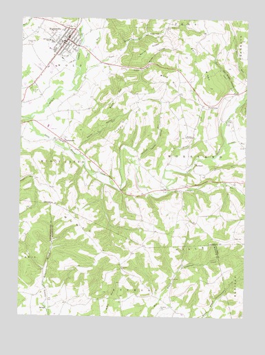
Hughesville, PA USGS Topographic Map
Click on map above to begin viewing in our Map Viewer.

This topographic map contains these locations and features:
Feature Name Type Latitude Longitude GNIS ID View Map
Ball RidgeRidgeN41.2320°W76.6488°1168664View Map
Ball Ridge HollowValleyN41.2191°W76.6305°1168665View Map
Borough of HughesvilleCivilN41.2390°W76.7254°1215420View Map
Broad RunStreamN41.1867°W76.6686°1170290View Map
Buck HillSummitN41.2140°W76.6977°1170514View Map
Clark School (historical)SchoolN41.1293°W76.6650°1197419View Map
ClarkstownPopulated PlaceN41.1987°W76.7255°1171934View Map
Clayhole SchoolSchoolN41.2256°W76.7147°1197418View Map
Cox RunStreamN41.1926°W76.7183°1172564View Map
East Lycoming High SchoolSchoolN41.2404°W76.7322°1173838View Map
Fairview ChurchChurchN41.1454°W76.6925°1174524View Map
Frazier BridgeBridgeN41.2072°W76.6358°1175185View Map
FrenchtownPopulated PlaceN41.2142°W76.6458°1203631View Map
Frenchtown SchoolSchoolN41.2129°W76.6466°1197417View Map
German RunStreamN41.1920°W76.6422°1175553View Map
Green ValleyValleyN41.2338°W76.6991°1176125View Map
Green Valley CemeteryCemeteryN41.2462°W76.6698°1176126View Map
Gregs RunStreamN41.2215°W76.7188°1192561View Map
HughesvillePopulated PlaceN41.2412°W76.7238°1213971View Map
Hughesville Borough Police DepartmentBuildingN41.2359°W76.7212°2780553View Map
Hughesville Post OfficePost OfficeN41.2417°W76.7235°2772751View Map
Hughesville Volunteer Fire DepartmentBuildingN41.2419°W76.7261°2652603View Map
Jakes RunStreamN41.2095°W76.6333°1177972View Map
Laurel RunStreamN41.1773°W76.6661°1179018View Map
Little Muncy CreekStreamN41.2073°W76.7455°1179619View Map
Little Sugar RunStreamN41.2340°W76.6986°1179687View Map
Metler RidgeRidgeN41.2390°W76.6752°1180979View Map
Miller HollowValleyN41.2321°W76.6780°1181218View Map
MorelandPopulated PlaceN41.1892°W76.6522°1204208View Map
Moreland Community ChurchChurchN41.2006°W76.6577°1181540View Map
Muncy Creek Community Fire Company ClarkstownBuildingN41.1970°W76.7230°2652742View Map
Muncy HillsRangeN41.1534°W76.6813°1190984View Map
Neufer HollowValleyN41.1956°W76.7179°1182273View Map
OppLocaleN41.1784°W76.6694°1183010View Map
Pleasant Hill CemeteryCemeteryN41.2429°W76.7430°1184031View Map
Saint James CemeteryCemeteryN41.1287°W76.6708°1186007View Map
Shepman RunStreamN41.1904°W76.6863°1187470View Map
Sugar RunStreamN41.2284°W76.7136°1193494View Map
Tommy HillSummitN41.2067°W76.6916°1189641View Map
Tommy HollowValleyN41.1912°W76.6842°1189642View Map
Township of MorelandCivilN41.1946°W76.6558°1216762View Map
Warn HillSummitN41.2248°W76.6661°1190594View Map

Note: Coordinates in the location and feature list above are referenced to NAD83 datum.


Copyright (C) 2008-2025 Ryan Niemi / Sunset Dynamics ... All Rights Reserved