TopoQuest Logo
Do you find TopoQuest useful?
Help keep TopoQuest running and adding new maps/features by donating!
Bitcoin:  19c7KJd3qBynnjoSw5npx9KScwjBe4ifkT
Litecoin:  LXs6TkuXGGXo1vDsWCkWVdjQX94eUKd6ui
Home View Maps Find Maps Find Places Resources & Links


Hunters Hot Springs, Montana Topographic Map

USGS Map Title: Hunters Hot Springs, MT
USGS Map MRC: 45110G3
DRG (GeoTIFF) Download: o45110g3.tif


Neighboring USGS Topographic Map Quads:


  Ibex Mountain, MT  
45110H4
 

  Fairview Peak, MT  
45110H3
 

  Raspberry Butte, MT  
45110H2
 

  Grannis, MT  
45110G4
 

  Hunters Hot Springs, MT  
45110G3
 

  Kelly Hills, MT  
45110G2
 

  Mission, MT  
45110F4
 

  Elton, MT  
45110F3
 

  Springdale, MT  
45110F2


Map MRC Location:

N46°
W111°
N46°
W110°
H8 H7 H6 H5 H4 H3 H2 H1
G8 G7 G6 G5 G4 G3 G2 G1
F8 F7 F6 F5 F4 F3 F2 F1
E8 E7 E6 E5 E4 E3 E2 E1
D8 D7 D6 D5 D4 D3 D2 D1
C8 C7 C6 C5 C4 C3 C2 C1
B8 B7 B6 B5 B4 B3 B2 B1
A8 A7 A6 A5 A4 A3 A2 A1
N45°
W111°
N45°
W110°

Hunters Hot Springs, MT USGS 1:24K Topographic Map Preview:
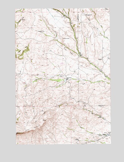
Hunters Hot Springs, MT USGS Topographic Map
Click on map above to begin viewing in our Map Viewer.

This topographic map contains these locations and features:
Feature Name Type Latitude Longitude GNIS ID View Map
01N11E01D___01 SpringSpringN45.8608°W110.2980°812828View Map
01N11E21D___01 SpringSpringN45.8174°W110.3594°812393View Map
01S11E01A___01 WellWellN45.7810°W110.3085°811962View Map
01S12E09CADD01 SpringSpringN45.7597°W110.2521°811747View Map
01S12E09CCAD01 SpringSpringN45.7572°W110.2580°811729View Map
Antelope ButteSummitN45.8360°W110.3660°768272View Map
Bishir RanchLocaleN45.8683°W110.3094°768901View Map
Carney RanchLocaleN45.8316°W110.2902°769609View Map
Choke-To-Death ButteSummitN45.8647°W110.3641°769856View Map
Green School (historical)SchoolN45.8277°W110.2613°771971View Map
Hole-In-The RockSummitN45.8472°W110.3110°772464View Map
Hole-In-The-Rock CreekStreamN45.8305°W110.2894°784932View Map
Hunters Hot SpringsSpringN45.7573°W110.2579°1743302View Map
Hunters Hot SpringsPopulated PlaceN45.7580°W110.2566°772639View Map
Hunters Hot Springs Post Office (historical)Post OfficeN45.7580°W110.2566°1743303View Map
Hunters School (historical)SchoolN45.7588°W110.2527°772642View Map
Krezelock RanchLocaleN45.7585°W110.2635°773137View Map
Long RidgeRidgeN45.8369°W110.3069°773655View Map
Martel HomesteadLocaleN45.7535°W110.2944°773894View Map
Murphy Sheep ShedsLocaleN45.7747°W110.2635°774511View Map
Prevost HomesteadLocaleN45.8541°W110.3377°775453View Map
Roebecker HomesteadLocaleN45.8685°W110.2833°775911View Map
Sheep MountainSummitN45.7608°W110.3746°776457View Map
Sheep Mountain RanchLocaleN45.8094°W110.3088°776458View Map
Spring CreekStreamN45.8474°W110.2552°791241View Map

Note: Coordinates in the location and feature list above are referenced to NAD83 datum.


Copyright (C) 2008-2025 Ryan Niemi / Sunset Dynamics ... All Rights Reserved