TopoQuest Logo
Do you find TopoQuest useful?
Help keep TopoQuest running and adding new maps/features by donating!
Bitcoin:  19c7KJd3qBynnjoSw5npx9KScwjBe4ifkT
Litecoin:  LXs6TkuXGGXo1vDsWCkWVdjQX94eUKd6ui
Home View Maps Find Maps Find Places Resources & Links


Kelly Hills, Montana Topographic Map

USGS Map Title: Kelly Hills, MT
USGS Map MRC: 45110G2
DRG (GeoTIFF) Download: o45110g2.tif


Neighboring USGS Topographic Map Quads:


  Fairview Peak, MT  
45110H3
 

  Raspberry Butte, MT  
45110H2
 

  Grosfield Ranch, MT  
45110H1
 

  Hunters Hot Springs, MT  
45110G3
 

  Kelly Hills, MT  
45110G2
 

  Carney, MT  
45110G1
 

  Elton, MT  
45110F3
 

  Springdale, MT  
45110F2
 

  McLeod, MT  
45110F1


Map MRC Location:

N46°
W111°
N46°
W110°
H8 H7 H6 H5 H4 H3 H2 H1
G8 G7 G6 G5 G4 G3 G2 G1
F8 F7 F6 F5 F4 F3 F2 F1
E8 E7 E6 E5 E4 E3 E2 E1
D8 D7 D6 D5 D4 D3 D2 D1
C8 C7 C6 C5 C4 C3 C2 C1
B8 B7 B6 B5 B4 B3 B2 B1
A8 A7 A6 A5 A4 A3 A2 A1
N45°
W111°
N45°
W110°

Kelly Hills, MT USGS 1:24K Topographic Map Preview:
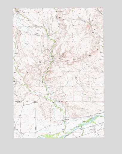
Kelly Hills, MT USGS Topographic Map
Click on map above to begin viewing in our Map Viewer.

This topographic map contains these locations and features:
Feature Name Type Latitude Longitude GNIS ID View Map
01N12E09C___01 SpringSpringN45.8463°W110.2460°812715View Map
01S13E08DCDA01 SpringSpringN45.7563°W110.1435°811709View Map
01S13E08DDBA01 WellWellN45.7580°W110.1407°811736View Map
01S13E09ABBB01 WellWellN45.7694°W110.1263°811835View Map
01S13E09BBCD01 WellWellN45.7669°W110.1360°811810View Map
01S13E17BBCA01 WellWellN45.7533°W110.1399°811680View Map
Alkali CreekStreamN45.8016°W110.2341°778949View Map
Bailey CreekStreamN45.8433°W110.1938°779254View Map
Boe RanchLocaleN45.8502°W110.2177°769133View Map
Carney RanchLocaleN45.7580°W110.1407°769608View Map
Chris Boe RanchLocaleN45.8049°W110.2463°770298View Map
Clark RanchLocaleN45.7919°W110.2024°769900View Map
Dog CreekStreamN45.7560°W110.2483°770698View Map
Duck CreekStreamN45.7558°W110.1763°770859View Map
Duck Creek School (historical)SchoolN45.7677°W110.1794°770875View Map
East Fork Duck CreekStreamN45.7880°W110.2032°782838View Map
Fetter RanchLocaleN45.8319°W110.2471°771329View Map
Fryer CreekStreamN45.7610°W110.1305°783779View Map
Gage Pioneer MemorialParkN45.7666°W110.1841°799318View Map
Gages Station (historical)LocaleN45.7527°W110.1896°1743398View Map
Hunters Hot Springs CanalCanalN45.7672°W110.1699°772640View Map
Jarrett CreekStreamN45.7616°W110.1580°772794View Map
Jarrett RanchLocaleN45.7838°W110.1949°772796View Map
Kelly HillsRidgeN45.8249°W110.1794°772971View Map
Laubach RanchLocaleN45.7583°W110.1810°773250View Map
Long Horn A RanchLocaleN45.7655°W110.1557°773646View Map
Lowell CreekStreamN45.8047°W110.2477°773723View Map
Old Kelly HomesteadLocaleN45.8283°W110.1982°774931View Map
Sioux CrossingPopulated PlaceN45.8713°W110.2444°776576View Map
West Fork Duck CreekStreamN45.7880°W110.2032°793016View Map

Note: Coordinates in the location and feature list above are referenced to NAD83 datum.


Copyright (C) 2008-2025 Ryan Niemi / Sunset Dynamics ... All Rights Reserved