TopoQuest Logo
Do you find TopoQuest useful?
Help keep TopoQuest running and adding new maps/features by donating!
Bitcoin:  19c7KJd3qBynnjoSw5npx9KScwjBe4ifkT
Litecoin:  LXs6TkuXGGXo1vDsWCkWVdjQX94eUKd6ui
Home View Maps Find Maps Find Places Resources & Links


Hurtsboro, Alabama Topographic Map

USGS Map Title: Hurtsboro, AL
USGS Map MRC: 32085B4
DRG (GeoTIFF) Download: o32085b4.tif


Neighboring USGS Topographic Map Quads:


  Warriorstand, AL  
32085C5
 

  Creek Stand, AL  
32085C4
 

  Hatchechubbee, AL  
32085C3
 

  Roba, AL  
32085B5
 

  Hurtsboro, AL  
32085B4
 

  Rutherford, AL  
32085B3
 

  Midway, AL  
32085A5
 

  Comer, AL  
32085A4
 

  Batesville, AL  
32085A3


Map MRC Location:

N33°
W86°
N33°
W85°
H8 H7 H6 H5 H4 H3 H2 H1
G8 G7 G6 G5 G4 G3 G2 G1
F8 F7 F6 F5 F4 F3 F2 F1
E8 E7 E6 E5 E4 E3 E2 E1
D8 D7 D6 D5 D4 D3 D2 D1
C8 C7 C6 C5 C4 C3 C2 C1
B8 B7 B6 B5 B4 B3 B2 B1
A8 A7 A6 A5 A4 A3 A2 A1
N32°
W86°
N32°
W85°

Hurtsboro, AL USGS 1:24K Topographic Map Preview:
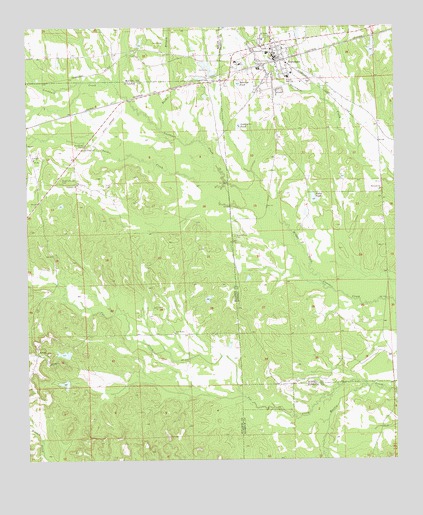
Hurtsboro, AL USGS Topographic Map
Click on map above to begin viewing in our Map Viewer.

This topographic map contains these locations and features:
Feature Name Type Latitude Longitude GNIS ID View Map
Beasleys PondReservoirN32.2339°W85.4279°113701View Map
Brown Road CemeteryCemeteryN32.1899°W85.4302°114998View Map
Browns Road ChurchChurchN32.1896°W85.4299°133218View Map
Calvary ChurchChurchN32.2049°W85.4833°115412View Map
Cowikee CreekStreamN32.2051°W85.4336°116761View Map
Cox CreekStreamN32.1463°W85.3852°116786View Map
Deep South Lake DamDamN32.2401°W85.3783°130330View Map
Dykes PondReservoirN32.2004°W85.4024°117715View Map
Dykes Pond DamDamN32.1985°W85.3983°130276View Map
Ebenezer ChurchChurchN32.2029°W85.3799°117821View Map
EnonPopulated PlaceN32.1554°W85.4966°117998View Map
Enon ChurchChurchN32.1507°W85.4986°149522View Map
Enon Junior High School (historical)SchoolN32.1549°W85.4972°154387View Map
Enon Lake Number OneReservoirN32.1471°W85.4873°130210View Map
Enon Lake Number TwoReservoirN32.1559°W85.4875°130216View Map
Enon Number 2 DamDamN32.1552°W85.4849°130215View Map
Enon Pond Number 1 DamDamN32.1468°W85.4849°130209View Map
First Baptist ChurchChurchN32.2438°W85.4127°133242View Map
First Methodist Episcopal ChurchChurchN32.2396°W85.4116°133245View Map
Glenford CemeteryCemeteryN32.2157°W85.4802°119037View Map
Goldsteins PondReservoirN32.2215°W85.4277°119096View Map
Guerryton Junior High School (historical)SchoolN32.2057°W85.4822°165603View Map
HurtsboroPopulated PlaceN32.2418°W85.4163°151840View Map
Hurtsboro CemeteryCemeteryN32.2443°W85.4180°138716View Map
Hurtsboro Police DepartmentBuildingN32.2399°W85.4145°2752017View Map
Hurtsboro Post OfficePost OfficeN32.2430°W85.4155°168701View Map
Hurtsboro Volunteer Fire DepartmentBuildingN32.2420°W85.4160°2691441View Map
Lockhart CreekStreamN32.2051°W85.4336°121948View Map
New Bethel ChurchChurchN32.1618°W85.4508°152602View Map
Noto Church (historical)ChurchN32.1254°W85.3927°1805345View Map
Provo CemeteryCemeteryN32.2049°W85.4744°125343View Map
Reeder BranchStreamN32.2207°W85.4555°125516View Map
Renfro Church (historical)ChurchN32.2396°W85.4699°134053View Map
Rogers ChapelChurchN32.2057°W85.4888°125903View Map
Rogers ChapelChurchN32.2057°W85.4883°149534View Map
Russell High SchoolSchoolN32.2357°W85.4119°126032View Map
Saint James Christian Methodist Episcopal ChurchChurchN32.1690°W85.4574°155915View Map
Saint Luke Baptist ChurchChurchN32.1529°W85.4924°155917View Map
Saint Marks ChurchChurchN32.2121°W85.4977°126159View Map
Saint Pauls CemeteryCemeteryN32.2474°W85.4183°126183View Map
Sehoy AirportAirportN32.2260°W85.4689°129423View Map
Town of HurtsboroCivilN32.2401°W85.4147°2405877View Map

Note: Coordinates in the location and feature list above are referenced to NAD83 datum.


Copyright (C) 2008-2025 Ryan Niemi / Sunset Dynamics ... All Rights Reserved