TopoQuest Logo
Do you find TopoQuest useful?
Help keep TopoQuest running and adding new maps/features by donating!
Bitcoin:  19c7KJd3qBynnjoSw5npx9KScwjBe4ifkT
Litecoin:  LXs6TkuXGGXo1vDsWCkWVdjQX94eUKd6ui
Home View Maps Find Maps Find Places Resources & Links


Warriorstand, Alabama Topographic Map

USGS Map Title: Warriorstand, AL
USGS Map MRC: 32085C5
DRG (GeoTIFF) Download: o32085c5.tif


Neighboring USGS Topographic Map Quads:


  Tuskegee, AL  
32085D6
 

  Little Texas, AL  
32085D5
 

  Society Hill, AL  
32085D4
 

  Davisville, AL  
32085C6
 

  Warriorstand, AL  
32085C5
 

  Creek Stand, AL  
32085C4
 

  Union Springs, AL  
32085B6
 

  Roba, AL  
32085B5
 

  Hurtsboro, AL  
32085B4


Map MRC Location:

N33°
W86°
N33°
W85°
H8 H7 H6 H5 H4 H3 H2 H1
G8 G7 G6 G5 G4 G3 G2 G1
F8 F7 F6 F5 F4 F3 F2 F1
E8 E7 E6 E5 E4 E3 E2 E1
D8 D7 D6 D5 D4 D3 D2 D1
C8 C7 C6 C5 C4 C3 C2 C1
B8 B7 B6 B5 B4 B3 B2 B1
A8 A7 A6 A5 A4 A3 A2 A1
N32°
W86°
N32°
W85°

Warriorstand, AL USGS 1:24K Topographic Map Preview:
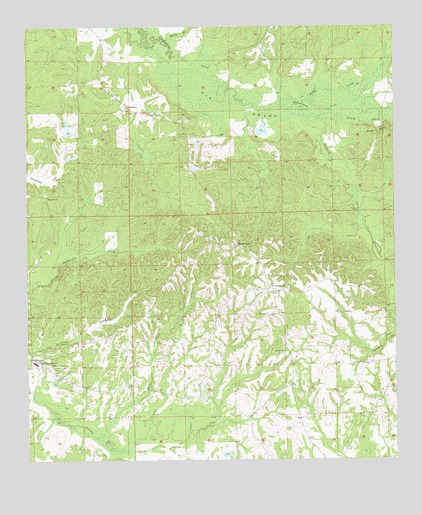
Warriorstand, AL USGS Topographic Map
Click on map above to begin viewing in our Map Viewer.

This topographic map contains these locations and features:
Feature Name Type Latitude Longitude GNIS ID View Map
Antioch CemeteryCemeteryN32.2807°W85.5380°154811View Map
Antioch ChurchChurchN32.2813°W85.5380°113142View Map
Big SwampSwampN32.3575°W85.5172°114331View Map
Chapple CemeteryCemeteryN32.2985°W85.5419°115967View Map
Coopers ChapelChurchN32.3001°W85.5416°155038View Map
Crossroads (historical)LocaleN32.2785°W85.6211°134008View Map
Dixie CreekStreamN32.2568°W85.6019°117310View Map
H A Vaughan Junior DamDamN32.3535°W85.6083°130474View Map
Hernando (historical)LocaleN32.3149°W85.5097°134025View Map
Kelly CreekStreamN32.3526°W85.5413°151945View Map
Magnolia CemeteryCemeteryN32.3515°W85.5908°154813View Map
Magnolia ChurchChurchN32.3521°W85.5908°122213View Map
Magnolia School (historical)SchoolN32.3524°W85.5916°134033View Map
New Hog Wallow LakeReservoirN32.3535°W85.6083°130475View Map
Sanford Johnson DamDamN32.3118°W85.5633°130412View Map
Sanford Johnson LakeReservoirN32.3118°W85.5633°130411View Map
Shady Hill ChurchChurchN32.3263°W85.6180°126620View Map
South Macon High SchoolSchoolN32.2785°W85.6224°127129View Map
Spring BranchStreamN32.3710°W85.5780°127219View Map
Swanson School (historical)SchoolN32.2696°W85.5813°134061View Map
Sweet Pilgrim CemeteryCemeteryN32.2774°W85.6166°127584View Map
Sweet Pilgrim ChurchChurchN32.2788°W85.6238°127585View Map
Tanyard CreekStreamN32.3493°W85.5252°127686View Map
Tuskegee Institute Farm (historical)LocaleN32.3432°W85.5486°134065View Map
Warrior Stand CemeteryCemeteryN32.3029°W85.5388°137129View Map
WarriorstandPopulated PlaceN32.3118°W85.5533°128603View Map
Warriorstand SchoolSchoolN32.2924°W85.5394°134068View Map
Warriorstand Volunteer Fire DepartmentBuildingN32.2987°W85.5402°2691132View Map
Warriorstand-Creek Stand DivisionCivilN32.3083°W85.5567°165863View Map

Note: Coordinates in the location and feature list above are referenced to NAD83 datum.


Copyright (C) 2008-2025 Ryan Niemi / Sunset Dynamics ... All Rights Reserved