TopoQuest Logo
Do you find TopoQuest useful?
Help keep TopoQuest running and adding new maps/features by donating!
Bitcoin:  19c7KJd3qBynnjoSw5npx9KScwjBe4ifkT
Litecoin:  LXs6TkuXGGXo1vDsWCkWVdjQX94eUKd6ui
Home View Maps Find Maps Find Places Resources & Links


Comer, Alabama Topographic Map

USGS Map Title: Comer, AL
USGS Map MRC: 32085A4
DRG (GeoTIFF) Download: o32085a4.tif


Neighboring USGS Topographic Map Quads:


  Roba, AL  
32085B5
 

  Hurtsboro, AL  
32085B4
 

  Rutherford, AL  
32085B3
 

  Midway, AL  
32085A5
 

  Comer, AL  
32085A4
 

  Batesville, AL  
32085A3
 

  Mount Andrew, AL  
31085H5
 

  Clayton North, AL  
31085H4
 

  White Oak, AL  
31085H3


Map MRC Location:

N33°
W86°
N33°
W85°
H8 H7 H6 H5 H4 H3 H2 H1
G8 G7 G6 G5 G4 G3 G2 G1
F8 F7 F6 F5 F4 F3 F2 F1
E8 E7 E6 E5 E4 E3 E2 E1
D8 D7 D6 D5 D4 D3 D2 D1
C8 C7 C6 C5 C4 C3 C2 C1
B8 B7 B6 B5 B4 B3 B2 B1
A8 A7 A6 A5 A4 A3 A2 A1
N32°
W86°
N32°
W85°

Comer, AL USGS 1:24K Topographic Map Preview:
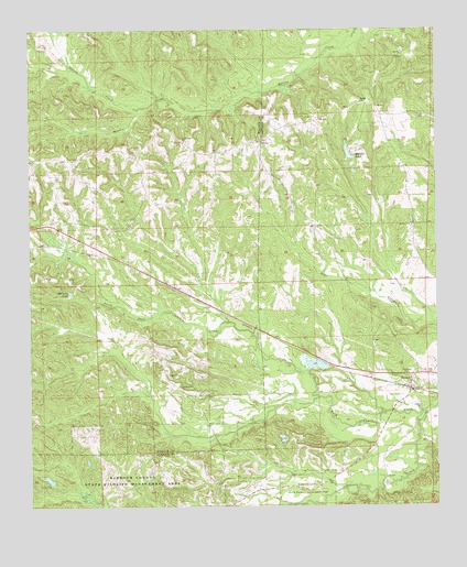
Comer, AL USGS Topographic Map
Click on map above to begin viewing in our Map Viewer.

This topographic map contains these locations and features:
Feature Name Type Latitude Longitude GNIS ID View Map
Barbour County State Wildlife Management AreaParkN32.0071°W85.4694°112831View Map
ComerPopulated PlaceN32.0329°W85.3833°116466View Map
Comer United Methodist ChurchChurchN32.0313°W85.3852°155837View Map
Galilee ChurchChurchN32.0265°W85.3797°164055View Map
Galilee Comer Elementary School (historical)SchoolN32.0349°W85.3952°154382View Map
Grants Duck PondReservoirN32.0329°W85.4028°130068View Map
Grants Duck Pond DamDamN32.0318°W85.4016°130069View Map
Great Hope African Methodist Epsicopal ChurchChurchN32.0960°W85.4538°155872View Map
Great Hope Junior High School (historical)SchoolN32.0963°W85.4622°165602View Map
Johnson CreekStreamN32.0249°W85.3788°120949View Map
Mc Calls Lake DamDamN32.0902°W85.4016°130118View Map
McCains LakeReservoirN32.0563°W85.4876°122457View Map
McCalls PondReservoirN32.0926°W85.4017°152262View Map
Mount Olive ChurchChurchN32.0735°W85.3827°123295View Map
Nero ChurchChurchN32.1190°W85.3858°123703View Map
Norton CreekStreamN32.1046°W85.4677°124028View Map
Pleasant Hill ChurchChurchN32.0313°W85.4541°124989View Map
Ramah CemeteryCemeteryN32.1064°W85.3983°2576432View Map
Ramah ChurchChurchN32.1060°W85.3986°125423View Map
Seay CemeteryCemeteryN32.0346°W85.4577°126513View Map
Taylors Store (historical)LocaleN32.1049°W85.3930°1805356View Map
Wehle LakeReservoirN32.0402°W85.4766°130074View Map
Wehle Lake DamDamN32.0402°W85.4766°130075View Map

Note: Coordinates in the location and feature list above are referenced to NAD83 datum.


Copyright (C) 2008-2025 Ryan Niemi / Sunset Dynamics ... All Rights Reserved