TopoQuest Logo
Do you find TopoQuest useful?
Help keep TopoQuest running and adding new maps/features by donating!
Bitcoin:  19c7KJd3qBynnjoSw5npx9KScwjBe4ifkT
Litecoin:  LXs6TkuXGGXo1vDsWCkWVdjQX94eUKd6ui
Home View Maps Find Maps Find Places Resources & Links


Husser, Louisiana Topographic Map

USGS Map Title: Husser, LA
USGS Map MRC: 30090F3
DRG (GeoTIFF) Download: o30090f3.tif


Neighboring USGS Topographic Map Quads:


  Chesbrough, LA  
30090G4
 

  Wilmer, LA  
30090G3
 

  Franklinton, LA  
30090G2
 

  Loranger, LA  
30090F4
 

  Husser, LA  
30090F3
 

  Folsom, LA  
30090F2
 

  Hammond, LA  
30090E4
 

  Robert, LA  
30090E3
 

  Martinville, LA  
30090E2


Map MRC Location:

N31°
W91°
N31°
W90°
H8 H7 H6 H5 H4 H3 H2 H1
G8 G7 G6 G5 G4 G3 G2 G1
F8 F7 F6 F5 F4 F3 F2 F1
E8 E7 E6 E5 E4 E3 E2 E1
D8 D7 D6 D5 D4 D3 D2 D1
C8 C7 C6 C5 C4 C3 C2 C1
B8 B7 B6 B5 B4 B3 B2 B1
A8 A7 A6 A5 A4 A3 A2 A1
N30°
W91°
N30°
W90°

Husser, LA USGS 1:24K Topographic Map Preview:
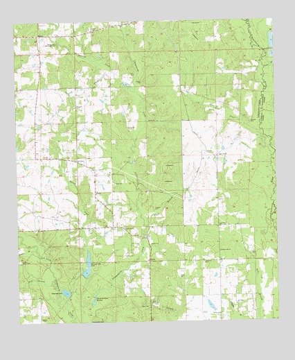
Husser, LA USGS Topographic Map
Click on map above to begin viewing in our Map Viewer.

This topographic map contains these locations and features:
Feature Name Type Latitude Longitude GNIS ID View Map
Bahm CemeteryCemeteryN30.6524°W90.3195°532274View Map
Bailey CemeteryCemeteryN30.6282°W90.2781°532280View Map
Baldwin ChapelChurchN30.6266°W90.3643°532288View Map
Bell CemeteryCemeteryN30.7282°W90.3192°532909View Map
Bezue CemeteryCemeteryN30.6442°W90.2973°533006View Map
Black BranchStreamN30.6646°W90.3120°533174View Map
Brown CemeteryCemeteryN30.6577°W90.3109°533434View Map
Buzzards Roost SwampLakeN30.6329°W90.3389°533601View Map
Carrier CemeteryCemeteryN30.7463°W90.3381°533779View Map
Catca CreekStreamN30.7299°W90.2548°553926View Map
Clark BranchStreamN30.6774°W90.2512°560435View Map
Dick BranchStreamN30.6405°W90.3581°554239View Map
Dogwood LakeLakeN30.6376°W90.3523°554253View Map
Edwards CemeteryCemeteryN30.7088°W90.2617°534774View Map
Epney (historical)Populated PlaceN30.7102°W90.3212°549647View Map
Goose LandingAirportN30.6364°W90.3106°2770268View Map
Henry City (historical)Populated PlaceN30.7224°W90.3640°549679View Map
Hillcrest School (historical)SchoolN30.6691°W90.2948°542184View Map
HoltonPopulated PlaceN30.7444°W90.3643°543308View Map
Holton Church (historical)ChurchN30.6932°W90.3631°542185View Map
Hughes CemeteryCemeteryN30.7149°W90.3454°535851View Map
Hughes CemeteryCemeteryN30.7249°W90.3140°535852View Map
HusserPopulated PlaceN30.6794°W90.3373°541113View Map
Husser Post OfficePost OfficeN30.6785°W90.3370°1631302View Map
Husser Volunteer Fire Department Station 1BuildingN30.6724°W90.3310°2332362View Map
Lamaux RanchLocaleN30.6938°W90.2779°554989View Map
Lee Valley Baptist ChurchChurchN30.6655°W90.2776°555012View Map
Loranger Lookout TowerTowerN30.6505°W90.3740°558799View Map
Mary BranchStreamN30.6977°W90.2523°1627619View Map
Morgan BranchStreamN30.6549°W90.3662°537203View Map
Mount Zion ChurchChurchN30.7088°W90.3079°537435View Map
Neal CemeteryCemeteryN30.6332°W90.3109°537529View Map
New Hope Baptist ChurchChurchN30.6324°W90.2701°555472View Map
New Sharon Baptist ChurchChurchN30.6924°W90.3459°555487View Map
Noah CemeteryCemeteryN30.6535°W90.2626°537690View Map
Olliphant CemeteryCemeteryN30.7057°W90.3204°537878View Map
OsceolaPopulated PlaceN30.6507°W90.3115°555570View Map
Parish Governing Authority District 2CivilN30.6360°W90.3405°1929919View Map
Pleasant Valley ChurchChurchN30.6544°W90.2779°538266View Map
Reed CemeteryCemeteryN30.6830°W90.3276°538552View Map
Saint Dominic ChurchChurchN30.6641°W90.3229°538832View Map
Saint Rock CemeteryCemeteryN30.6724°W90.3090°539072View Map
Snow CreekStreamN30.6935°W90.2518°539463View Map
Spring CreekStreamN30.6321°W90.3445°539581View Map
Spring Creek LakeReservoirN30.6467°W90.3422°556813View Map
Spring Creek Lake DamDamN30.6452°W90.3451°556812View Map
Squirrel CreekStreamN30.7174°W90.3134°556132View Map
Stevens CemeteryCemeteryN30.7413°W90.3548°539662View Map
Sycamore AirportAirportN30.7165°W90.3572°2676797View Map
Tung Oil Lake Number One DamDamN30.6919°W90.2734°556961View Map
Tung Oil Lake Number Two DamDamN30.6969°W90.2768°556962View Map
Union Training School (historical)SchoolN30.6482°W90.2856°542188View Map
Viola (historical)Populated PlaceN30.6552°W90.2945°551128View Map
Wainwright CemeteryCemeteryN30.7407°W90.3548°540189View Map

Note: Coordinates in the location and feature list above are referenced to NAD83 datum.


Copyright (C) 2008-2024 Ryan Niemi / Sunset Dynamics ... All Rights Reserved