TopoQuest Logo
Do you find TopoQuest useful?
Help keep TopoQuest running and adding new maps/features by donating!
Bitcoin:  19c7KJd3qBynnjoSw5npx9KScwjBe4ifkT
Litecoin:  LXs6TkuXGGXo1vDsWCkWVdjQX94eUKd6ui
Home View Maps Find Maps Find Places Resources & Links


Wilmer, Louisiana Topographic Map

USGS Map Title: Wilmer, LA
USGS Map MRC: 30090G3
DRG (GeoTIFF) Download: o30090g3.tif


Neighboring USGS Topographic Map Quads:


  Spring Creek, LA  
30090H4
 

  Mount Hermon, LA  
30090H3
 

  Clifton, LA  
30090H2
 

  Chesbrough, LA  
30090G4
 

  Wilmer, LA  
30090G3
 

  Franklinton, LA  
30090G2
 

  Loranger, LA  
30090F4
 

  Husser, LA  
30090F3
 

  Folsom, LA  
30090F2


Map MRC Location:

N31°
W91°
N31°
W90°
H8 H7 H6 H5 H4 H3 H2 H1
G8 G7 G6 G5 G4 G3 G2 G1
F8 F7 F6 F5 F4 F3 F2 F1
E8 E7 E6 E5 E4 E3 E2 E1
D8 D7 D6 D5 D4 D3 D2 D1
C8 C7 C6 C5 C4 C3 C2 C1
B8 B7 B6 B5 B4 B3 B2 B1
A8 A7 A6 A5 A4 A3 A2 A1
N30°
W91°
N30°
W90°

Wilmer, LA USGS 1:24K Topographic Map Preview:
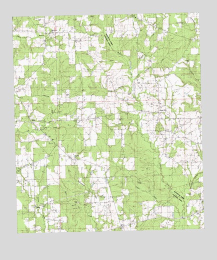
Wilmer, LA USGS Topographic Map
Click on map above to begin viewing in our Map Viewer.

This topographic map contains these locations and features:
Feature Name Type Latitude Longitude GNIS ID View Map
Bickham CemeteryCemeteryN30.8477°W90.2562°533012View Map
Black BranchStreamN30.8099°W90.2937°533176View Map
Bond CemeteryCemeteryN30.8355°W90.2926°533312View Map
Brumfield CemeteryCemeteryN30.8635°W90.3201°533445View Map
Brushy HollowValleyN30.8467°W90.3004°533483View Map
Bullock CemeteryCemeteryN30.8018°W90.2756°533541View Map
Buras Pond DamDamN30.7669°W90.3534°556824View Map
Carson CemeteryCemeteryN30.8488°W90.2837°533788View Map
Casper-Lea CemeteryCemeteryN30.8146°W90.3056°542031View Map
Crystal Springs ChurchChurchN30.8696°W90.2601°534297View Map
Davis BranchStreamN30.7627°W90.3306°534403View Map
Dyson CemeteryCemeteryN30.8741°W90.3573°534680View Map
Friendship Baptist ChurchChurchN30.7657°W90.3612°554484View Map
Gorman CreekStreamN30.7657°W90.2626°535294View Map
Graham CemeteryCemeteryN30.8302°W90.2993°535302View Map
Hennesy CemeteryCemeteryN30.7782°W90.2923°535628View Map
Hughes CemeteryCemeteryN30.7521°W90.2759°535853View Map
Lea CemeteryCemeteryN30.8238°W90.2831°536378View Map
Lowery CemeteryCemeteryN30.7660°W90.3581°536773View Map
McDaniel CemeteryCemeteryN30.8443°W90.3156°536977View Map
New Jerusalem ChurchChurchN30.8660°W90.3484°555478View Map
North Carson CreekStreamN30.8435°W90.2970°555505View Map
Parker CemeteryCemeteryN30.8652°W90.3098°537974View Map
Parkers CemeteryCemeteryN30.8146°W90.3593°542044View Map
Pasman CemeteryCemeteryN30.7705°W90.2579°537988View Map
Reedy BranchStreamN30.8332°W90.2968°538557View Map
Reedy PondReservoirN30.8287°W90.2600°556826View Map
Reedy Pond DamDamN30.8269°W90.2601°556825View Map
Sharon ChurchChurchN30.7521°W90.3051°539299View Map
Sharp CemeteryCemeteryN30.7593°W90.2554°542087View Map
Sharp ChurchChurchN30.7588°W90.2554°539302View Map
South Carson CreekStreamN30.8377°W90.2959°556085View Map
Statham CemeteryCemeteryN30.7932°W90.3348°539641View Map
Stoney PointPopulated PlaceN30.8182°W90.2787°542094View Map
Stoney Point Baptist ChurchChurchN30.8177°W90.2784°559718View Map
Stony Point School (historical)SchoolN30.8205°W90.2790°543964View Map
Sylvest CemeteryCemeteryN30.7668°W90.3337°539775View Map
Taylor CreekStreamN30.7577°W90.2654°556209View Map
Walker CemeteryCemeteryN30.8291°W90.3398°540193View Map
WilmerPopulated PlaceN30.8141°W90.3626°556445View Map
Wilmer ChurchChurchN30.8032°W90.3518°540475View Map
Wilmer Volunteer Fire Department Station 1BuildingN30.8148°W90.3596°2332545View Map

Note: Coordinates in the location and feature list above are referenced to NAD83 datum.


Copyright (C) 2008-2024 Ryan Niemi / Sunset Dynamics ... All Rights Reserved