TopoQuest Logo
Do you find TopoQuest useful?
Help keep TopoQuest running and adding new maps/features by donating!
Bitcoin:  19c7KJd3qBynnjoSw5npx9KScwjBe4ifkT
Litecoin:  LXs6TkuXGGXo1vDsWCkWVdjQX94eUKd6ui
Home View Maps Find Maps Find Places Resources & Links


Baker, Florida Topographic Map

USGS Map Title: Baker, FL
USGS Map MRC: 30086G6
DRG (GeoTIFF) Download: o30086g6.tif


Neighboring USGS Topographic Map Quads:


  Hurricane Lake, FL  
30086H7
 

  Blackman, FL  
30086H6
 

  Oak Grove, FL  
30086H5
 

  Munson, FL  
30086G7
 

  Baker, FL  
30086G6
 

  Crestview North, FL  
30086G5
 

  Floridale, FL  
30086F7
 

  Holt, FL  
30086F6
 

  Crestview South, FL  
30086F5


Map MRC Location:

N31°
W87°
N31°
W86°
H8 H7 H6 H5 H4 H3 H2 H1
G8 G7 G6 G5 G4 G3 G2 G1
F8 F7 F6 F5 F4 F3 F2 F1
E8 E7 E6 E5 E4 E3 E2 E1
D8 D7 D6 D5 D4 D3 D2 D1
C8 C7 C6 C5 C4 C3 C2 C1
B8 B7 B6 B5 B4 B3 B2 B1
A8 A7 A6 A5 A4 A3 A2 A1
N30°
W87°
N30°
W86°

Baker, FL USGS 1:24K Topographic Map Preview:
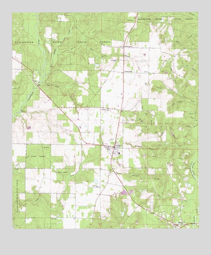
Baker, FL USGS Topographic Map
Click on map above to begin viewing in our Map Viewer.

This topographic map contains these locations and features:
Feature Name Type Latitude Longitude GNIS ID View Map
A A Hilton PondLakeN30.7605°W86.6850°298249View Map
BakerPopulated PlaceN30.7971°W86.6813°278045View Map
Baker DivisionCivilN30.8481°W86.6921°1935689View Map
Baker Fire DistrictBuildingN30.8011°W86.6798°2644289View Map
Baker Post OfficePost OfficeN30.7901°W86.6841°2759154View Map
Baker SchoolSchoolN30.7934°W86.6788°298323View Map
Bear CreekStreamN30.8282°W86.6380°278304View Map
Bluff LandingLocaleN30.8182°W86.7444°295142View Map
Cannon TownPopulated PlaceN30.8549°W86.6741°294704View Map
Cobb CemeteryCemeteryN30.8166°W86.6283°280595View Map
Cotton BridgeBridgeN30.8335°W86.7338°280878View Map
Deer HeadValleyN30.8241°W86.6330°281438View Map
Dotson AirportAirportN30.8183°W86.6859°309253View Map
Golan ChurchChurchN30.8557°W86.6747°283141View Map
Griffith CemeteryCemeteryN30.7913°W86.6361°283452View Map
Griffith Ferry StretchChannelN30.7835°W86.6294°283453View Map
Gum Springs BranchStreamN30.8074°W86.6563°283554View Map
Gunn CreekStreamN30.7935°W86.6258°283566View Map
Henderson BranchStreamN30.7991°W86.6483°283892View Map
Hester ChurchChurchN30.8405°W86.6583°283927View Map
Hog Pen BranchStreamN30.8066°W86.6552°284096View Map
Island BranchStreamN30.8030°W86.6500°284608View Map
Light House ChurchChurchN30.7563°W86.7205°285500View Map
Lighthouse ChurchChurchN30.8363°W86.7080°300901View Map
Lonesome Pines Airport (historical)AirportN30.8010°W86.6841°309251View Map
Long BranchStreamN30.7988°W86.6400°285963View Map
Meritt LandingLocaleN30.7852°W86.6302°295445View Map
Mill CreekStreamN30.7621°W86.6255°286873View Map
MilliganPopulated PlaceN30.7524°W86.6408°286927View Map
Narrows CreekStreamN30.8507°W86.7211°287540View Map
North Okaloosa Fire Department Station 83BuildingN30.7546°W86.6449°2644098View Map
Nubbin RidgePopulated PlaceN30.8405°W86.6747°294868View Map
Okaloosa County Emergency Medical Services Station 5BuildingN30.7973°W86.6790°2661816View Map
Panther CreekStreamN30.8391°W86.7277°306199View Map
Pilgrims Rest ChurchChurchN30.7824°W86.6797°288816View Map
Pyron Spring BranchStreamN30.8560°W86.7044°289391View Map
Pyron Spring ChapelChurchN30.8477°W86.6791°289392View Map
Red Wash BranchStreamN30.8352°W86.7300°289554View Map
Shady Grove ChurchChurchN30.7744°W86.6925°290907View Map
Skypark Estates Owners Association AirportAirportN30.8534°W86.6665°309252View Map
Surveyor CreekStreamN30.8282°W86.6383°291895View Map
Tan Vat BranchStreamN30.7894°W86.6272°292010View Map
Threemile BranchStreamN30.7680°W86.6494°292254View Map
WJUS-FM (Fort Walton Beach)TowerN30.7513°W86.7105°308990View Map
WJUS-FM (Fort Walton Beach)TowerN30.7585°W86.7216°308991View Map
WTJT-FM (Baker)TowerN30.8227°W86.7113°308949View Map
WTJT-FM (Crestview)TowerN30.8227°W86.7113°308968View Map

Note: Coordinates in the location and feature list above are referenced to NAD83 datum.


Copyright (C) 2008-2025 Ryan Niemi / Sunset Dynamics ... All Rights Reserved