TopoQuest Logo
Do you find TopoQuest useful?
Help keep TopoQuest running and adding new maps/features by donating!
Bitcoin:  19c7KJd3qBynnjoSw5npx9KScwjBe4ifkT
Litecoin:  LXs6TkuXGGXo1vDsWCkWVdjQX94eUKd6ui
Home View Maps Find Maps Find Places Resources & Links


Munson, Florida Topographic Map

USGS Map Title: Munson, FL
USGS Map MRC: 30086G7
DRG (GeoTIFF) Download: o30086g7.tif


Neighboring USGS Topographic Map Quads:


  McLellan, FL  
30086H8
 

  Hurricane Lake, FL  
30086H7
 

  Blackman, FL  
30086H6
 

  Spring Hill, FL  
30086G8
 

  Munson, FL  
30086G7
 

  Baker, FL  
30086G6
 

  Harold, FL  
30086F8
 

  Floridale, FL  
30086F7
 

  Holt, FL  
30086F6


Map MRC Location:

N31°
W87°
N31°
W86°
H8 H7 H6 H5 H4 H3 H2 H1
G8 G7 G6 G5 G4 G3 G2 G1
F8 F7 F6 F5 F4 F3 F2 F1
E8 E7 E6 E5 E4 E3 E2 E1
D8 D7 D6 D5 D4 D3 D2 D1
C8 C7 C6 C5 C4 C3 C2 C1
B8 B7 B6 B5 B4 B3 B2 B1
A8 A7 A6 A5 A4 A3 A2 A1
N30°
W87°
N30°
W86°

Munson, FL USGS 1:24K Topographic Map Preview:
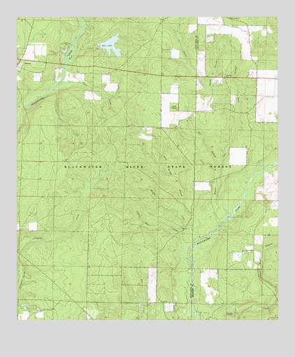
Munson, FL USGS Topographic Map
Click on map above to begin viewing in our Map Viewer.

This topographic map contains these locations and features:
Feature Name Type Latitude Longitude GNIS ID View Map
Ates CemeteryCemeteryN30.8232°W86.8450°277974View Map
Bear CreekStreamN30.8566°W86.8513°278305View Map
Bear LakeReservoirN30.8632°W86.8295°278336View Map
Beaver CreekStreamN30.7902°W86.7772°305262View Map
Beaver Creek ChurchChurchN30.8749°W86.7725°278364View Map
Big Branch Beaver CreekStreamN30.8144°W86.7775°278645View Map
Blackwater Wildlife Management AreaParkN30.8335°W86.8333°306975View Map
Blue CreekStreamN30.8477°W86.8538°279014View Map
Good Hope ChurchChurchN30.8507°W86.7750°283172View Map
Kelly Spring BranchStreamN30.7966°W86.7969°285045View Map
Lake MunsonLakeN30.8609°W86.8520°298123View Map
Lighter Knot CreekStreamN30.7699°W86.7908°285502View Map
Little Branch Beaver CreekStreamN30.8116°W86.7780°285623View Map
Long BranchStreamN30.8335°W86.7705°285965View Map
Martins Mill PondLakeN30.8482°W86.7769°300910View Map
Middle CreekStreamN30.7841°W86.7872°286785View Map
Muddy BranchStreamN30.8432°W86.7800°287435View Map
MunsonPopulated PlaceN30.8577°W86.8730°294860View Map
Munson Recreation AreaParkN30.8624°W86.8519°287472View Map
Munson Volunteer Fire Department District 19 Station 1BuildingN30.8564°W86.8736°2644069View Map
New Bethany ChurchChurchN30.7782°W86.7655°287597View Map
Poplar Head BranchStreamN30.7621°W86.7505°289204View Map

Note: Coordinates in the location and feature list above are referenced to NAD83 datum.


Copyright (C) 2008-2025 Ryan Niemi / Sunset Dynamics ... All Rights Reserved