TopoQuest Logo
Do you find TopoQuest useful?
Help keep TopoQuest running and adding new maps/features by donating!
Bitcoin:  19c7KJd3qBynnjoSw5npx9KScwjBe4ifkT
Litecoin:  LXs6TkuXGGXo1vDsWCkWVdjQX94eUKd6ui
Home View Maps Find Maps Find Places Resources & Links


Idaho City, Idaho Topographic Map

USGS Map Title: Idaho City, ID
USGS Map MRC: 43115G7
DRG (GeoTIFF) Download: o43115g7.tif


Neighboring USGS Topographic Map Quads:


  Placerville, ID  
43115H8
 

  Pioneerville, ID  
43115H7
 

  Sunset Mountain, ID  
43115H6
 

  Warm Springs Point, ID  
43115G8
 

  Idaho City, ID  
43115G7
 

  Rabbit Creek Summit, ID  
43115G6
 

  Dunnigan Creek, ID  
43115F8
 

  Arrowrock Reservoir NE, ID  
43115F7
 

  Twin Springs, ID  
43115F6


Map MRC Location:

N44°
W116°
N44°
W115°
H8 H7 H6 H5 H4 H3 H2 H1
G8 G7 G6 G5 G4 G3 G2 G1
F8 F7 F6 F5 F4 F3 F2 F1
E8 E7 E6 E5 E4 E3 E2 E1
D8 D7 D6 D5 D4 D3 D2 D1
C8 C7 C6 C5 C4 C3 C2 C1
B8 B7 B6 B5 B4 B3 B2 B1
A8 A7 A6 A5 A4 A3 A2 A1
N43°
W116°
N43°
W115°

Idaho City, ID USGS 1:24K Topographic Map Preview:
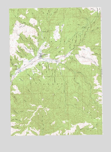
Idaho City, ID USGS Topographic Map
Click on map above to begin viewing in our Map Viewer.

This topographic map contains these locations and features:
Feature Name Type Latitude Longitude GNIS ID View Map
Bairds GulchValleyN43.8207°W115.8179°376856View Map
Bannock CreekStreamN43.8218°W115.8090°399770View Map
Basin Elementary-Junior High SchoolSchoolN43.8310°W115.8326°401308View Map
Bear RunStreamN43.8321°W115.8373°399776View Map
Bear Run GulchValleyN43.8310°W115.8315°399369View Map
Boise Basin Experiment StationLocaleN43.8346°W115.8426°378002View Map
Boise County Sheriff's OfficeBuildingN43.8229°W115.8396°2722400View Map
Boulder CreekStreamN43.8513°W115.7704°378084View Map
Brockmiller GulchValleyN43.8271°W115.7957°378241View Map
California GulchValleyN43.8154°W115.8462°378721View Map
Campbell GulchValleyN43.8210°W115.8229°378827View Map
Char GulchValleyN43.8191°W115.8423°379191View Map
Charcoal GulchValleyN43.8238°W115.8523°379197View Map
Chinee GulchValleyN43.8693°W115.7512°379307View Map
City of Idaho CityCivilN43.8281°W115.8306°2410090View Map
Coalpit GulchValleyN43.8268°W115.8426°379476View Map
Deer CreekStreamN43.8621°W115.8234°380436View Map
Dry CreekStreamN43.7999°W115.8023°380807View Map
East Boise County AmbulanceBuildingN43.8281°W115.8349°2642790View Map
Eldorado GulchValleyN43.8699°W115.8165°381309View Map
Elk CreekStreamN43.8107°W115.8665°381345View Map
Farrell GulchValleyN43.8193°W115.8626°381606View Map
Franer CanalCanalN43.8502°W115.7840°382009View Map
Franer GulchValleyN43.8541°W115.7696°382010View Map
Gambrinus GulchValleyN43.8696°W115.7557°382156View Map
Gold Hill MineMineN43.8368°W115.8296°382381View Map
Granite CreekStreamN43.8302°W115.7937°382526View Map
Granite Creek Recreation SiteLocaleN43.8229°W115.7832°394073View Map
Grayback GulchValleyN43.8079°W115.8668°382608View Map
Grayback Gulch CampgroundLocaleN43.8071°W115.8618°394072View Map
Hoodoo CreekStreamN43.8354°W115.7862°383297View Map
Humbug GulchValleyN43.8279°W115.7937°383537View Map
Idaho CityPopulated PlaceN43.8285°W115.8346°383600View Map
Idaho City DivisionCivilN43.8002°W115.8346°1936737View Map
Idaho City Pioneer CemeteryCemeteryN43.8321°W115.8421°2019056View Map
Idaho City Police DepartmentBuildingN43.8296°W115.8328°2722452View Map
Idaho City Post OfficePost OfficeN43.8243°W115.8385°2781750View Map
Idaho City Ranger StationLocaleN43.8229°W115.8390°398478View Map
Idaho City Ski AreaLocaleN43.8291°W115.8226°394074View Map
Idaho City USFS AirportAirportN43.8236°W115.8448°400839View Map
Idaho City Volunteer Fire DepartmentBuildingN43.8235°W115.8386°2619079View Map
Idaho State Highway Maintenance StationLocaleN43.8252°W115.8334°398477View Map
Illinois GulchValleyN43.8554°W115.7671°383624View Map
Ivydale Organization CampLocaleN43.8052°W115.8462°394080View Map
Laraway GulchValleyN43.8224°W115.8279°384433View Map
Little California GulchValleyN43.8121°W115.8446°384758View Map
Little Hoodoo CreekStreamN43.8324°W115.7687°384860View Map
Lykow FlatFlatN43.8571°W115.8032°386303View Map
McIntyre GulchValleyN43.8218°W115.8582°386632View Map
Mine DitchCanalN43.8549°W115.8121°386987View Map
Noble GulchValleyN43.8227°W115.8337°387601View Map
Old Pioneer CemeteryCemeteryN43.8319°W115.8416°378031View Map
Pine CreekStreamN43.8216°W115.8109°400040View Map
Rocker GulchValleyN43.8416°W115.7790°389531View Map
Russells GulchValleyN43.8385°W115.7859°389741View Map
Sawmill CreekStreamN43.8093°W115.8723°389965View Map
Shaws GulchValleyN43.8149°W115.8548°390168View Map
Slaughterhouse GulchValleyN43.8321°W115.8387°390581View Map
Spanish ForkStreamN43.8418°W115.8290°391093View Map
Steamboat GulchValleyN43.8177°W115.8129°391389View Map
Thomas GulchValleyN43.8252°W115.8159°392025View Map
Tollgate GulchValleyN43.8082°W115.8737°392210View Map
Tuttls GulchValleyN43.8216°W115.8365°392474View Map
Walla Walla GulchValleyN43.8329°W115.7934°392795View Map
Warm Springs GulchValleyN43.8157°W115.8643°376448View Map
Warm Springs GulchValleyN43.8166°W115.8634°399605View Map
Washington GulchValleyN43.8652°W115.7540°392920View Map
Wentworth GulchValleyN43.8591°W115.8537°393003View Map
West Fork Bannock CreekStreamN43.8113°W115.7876°393041View Map
Wet GulchValleyN43.8491°W115.8321°393266View Map
Wolf CreekStreamN43.8674°W115.8251°393624View Map

Note: Coordinates in the location and feature list above are referenced to NAD83 datum.


Copyright (C) 2008-2025 Ryan Niemi / Sunset Dynamics ... All Rights Reserved