TopoQuest Logo
Do you find TopoQuest useful?
Help keep TopoQuest running and adding new maps/features by donating!
Bitcoin:  19c7KJd3qBynnjoSw5npx9KScwjBe4ifkT
Litecoin:  LXs6TkuXGGXo1vDsWCkWVdjQX94eUKd6ui
Home View Maps Find Maps Find Places Resources & Links


Warm Springs Point, Idaho Topographic Map

USGS Map Title: Warm Springs Point, ID
USGS Map MRC: 43115G8
DRG (GeoTIFF) Download: o43115g8.tif


Neighboring USGS Topographic Map Quads:


  Harris Creek Summit, ID  
43116H1
 

  Placerville, ID  
43115H8
 

  Pioneerville, ID  
43115H7
 

  Shafer Butte, ID  
43116G1
 

  Warm Springs Point, ID  
43115G8
 

  Idaho City, ID  
43115G7
 

  Robie Creek, ID  
43116F1
 

  Dunnigan Creek, ID  
43115F8
 

  Arrowrock Reservoir NE, ID  
43115F7


Map MRC Location:

N44°
W116°
N44°
W115°
H8 H7 H6 H5 H4 H3 H2 H1
G8 G7 G6 G5 G4 G3 G2 G1
F8 F7 F6 F5 F4 F3 F2 F1
E8 E7 E6 E5 E4 E3 E2 E1
D8 D7 D6 D5 D4 D3 D2 D1
C8 C7 C6 C5 C4 C3 C2 C1
B8 B7 B6 B5 B4 B3 B2 B1
A8 A7 A6 A5 A4 A3 A2 A1
N43°
W116°
N43°
W115°

Warm Springs Point, ID USGS 1:24K Topographic Map Preview:
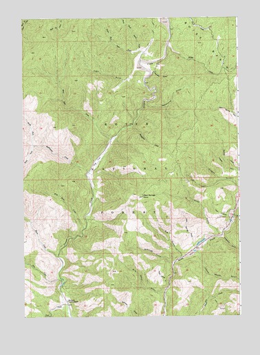
Warm Springs Point, ID USGS Topographic Map
Click on map above to begin viewing in our Map Viewer.

This topographic map contains these locations and features:
Feature Name Type Latitude Longitude GNIS ID View Map
Big GulchValleyN43.7749°W115.9093°377536View Map
Casner MountainSummitN43.7638°W115.9501°394051View Map
Clear CreekStreamN43.7516°W115.9748°379395View Map
Cold Springs GulchValleyN43.7810°W115.9023°379560View Map
Deadhorse GulchValleyN43.8399°W115.9287°380319View Map
Granite CreekStreamN43.8729°W115.9204°399898View Map
Greenland GulchValleyN43.7827°W115.8848°382662View Map
Gregory GulchValleyN43.8046°W115.8762°382669View Map
Hahn GulchValleyN43.8529°W115.9365°382799View Map
Holcomb Guard StationLocaleN43.7563°W115.9754°383248View Map
Horse Spring GulchValleyN43.7641°W115.9165°383404View Map
Johnny Woods GulchValleyN43.7766°W115.8993°383963View Map
Lass GulchValleyN43.7918°W115.8821°384450View Map
Macks CreekStreamN43.7754°W115.9809°386343View Map
Manhattan CreekStreamN43.8299°W115.9384°397889View Map
McKinley GulchValleyN43.7724°W115.9151°386640View Map
Milk Ranch GulchValleyN43.7602°W115.9193°386911View Map
Monazite GulchValleyN43.8524°W115.9259°387082View Map
New York GulchValleyN43.7924°W115.8782°387537View Map
North Fork Rattlesnake CreekStreamN43.8218°W115.9934°387761View Map
North Fork Sugar CreekStreamN43.8610°W115.9334°387798View Map
Pine CreekStreamN43.7660°W115.9796°388491View Map
Rattlesnake CreekStreamN43.8102°W115.9626°389137View Map
Rocky GulchValleyN43.7849°W115.8868°389555View Map
Rye FlatFlatN43.8149°W115.9582°389755View Map
South Fork Rattlesnake CreekStreamN43.8218°W115.9934°391001View Map
South Fork Sugar CreekStreamN43.8610°W115.9334°391040View Map
Sugar CreekStreamN43.8568°W115.9332°391581View Map
Valley of the Pines Volunteer Fire DepartmentBuildingN43.7501°W115.9207°2619087View Map
Valley of the Pines Volunteer Fire DepartmentBuildingN43.7503°W115.9206°2619088View Map
Warm Springs PointSummitN43.8002°W115.9318°392896View Map
Wild Goat CreekStreamN43.8241°W115.9498°393417View Map
Wild Horse CreekStreamN43.7866°W115.9657°393423View Map
Willow CreekStreamN43.8632°W115.9171°393503View Map

Note: Coordinates in the location and feature list above are referenced to NAD83 datum.


Copyright (C) 2008-2025 Ryan Niemi / Sunset Dynamics ... All Rights Reserved