TopoQuest Logo
Do you find TopoQuest useful?
Help keep TopoQuest running and adding new maps/features by donating!
Bitcoin:  19c7KJd3qBynnjoSw5npx9KScwjBe4ifkT
Litecoin:  LXs6TkuXGGXo1vDsWCkWVdjQX94eUKd6ui
Home View Maps Find Maps Find Places Resources & Links


Dunnigan Creek, Idaho Topographic Map

USGS Map Title: Dunnigan Creek, ID
USGS Map MRC: 43115F8
DRG (GeoTIFF) Download: o43115f8.tif


Neighboring USGS Topographic Map Quads:


  Shafer Butte, ID  
43116G1
 

  Warm Springs Point, ID  
43115G8
 

  Idaho City, ID  
43115G7
 

  Robie Creek, ID  
43116F1
 

  Dunnigan Creek, ID  
43115F8
 

  Arrowrock Reservoir NE, ID  
43115F7
 

  Lucky Peak, ID  
43116E1
 

  Arrowrock Dam, ID  
43115E8
 

  Grape Mountain, ID  
43115E7


Map MRC Location:

N44°
W116°
N44°
W115°
H8 H7 H6 H5 H4 H3 H2 H1
G8 G7 G6 G5 G4 G3 G2 G1
F8 F7 F6 F5 F4 F3 F2 F1
E8 E7 E6 E5 E4 E3 E2 E1
D8 D7 D6 D5 D4 D3 D2 D1
C8 C7 C6 C5 C4 C3 C2 C1
B8 B7 B6 B5 B4 B3 B2 B1
A8 A7 A6 A5 A4 A3 A2 A1
N43°
W116°
N43°
W115°

Dunnigan Creek, ID USGS 1:24K Topographic Map Preview:
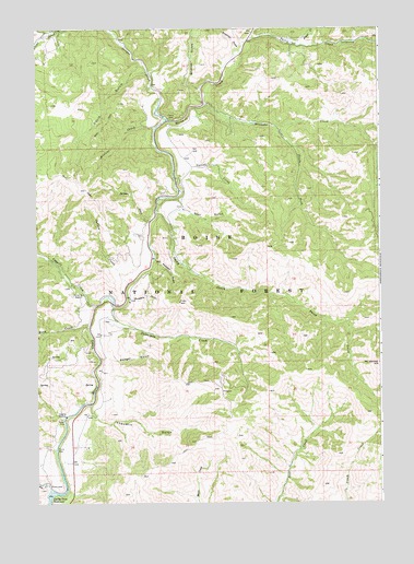
Dunnigan Creek, ID USGS Topographic Map
Click on map above to begin viewing in our Map Viewer.

This topographic map contains these locations and features:
Feature Name Type Latitude Longitude GNIS ID View Map
Avelene CreekStreamN43.7235°W115.9568°397397View Map
Badger GulchValleyN43.6629°W115.9768°376832View Map
Corral CreekStreamN43.7107°W115.9501°379774View Map
Daggett CreekStreamN43.6768°W115.9793°380206View Map
Davis GulchValleyN43.7388°W115.9596°380281View Map
Dunnigan CreekStreamN43.6768°W115.9721°380942View Map
Grimes CreekStreamN43.7260°W115.9521°399902View Map
Indian CreekStreamN43.6827°W115.9665°383643View Map
Jackson CreekStreamN43.6993°W115.9587°383830View Map
Minneha CreekStreamN43.7299°W115.9390°387026View Map
Mount HeinenSummitN43.6616°W115.8759°383050View Map
Mudders GulchValleyN43.6791°W115.9659°387363View Map
Placer CreekStreamN43.7457°W115.9032°388588View Map
Robbers GulchValleyN43.6891°W115.9573°389432View Map
Robie CreekStreamN43.6293°W115.9962°389445View Map
Rush CreekStreamN43.6721°W115.9809°389729View Map
Smith CreekStreamN43.7013°W115.9565°390660View Map
South Fork Minneha CreekStreamN43.7238°W115.9118°390977View Map
Star GulchValleyN43.7024°W115.9451°391352View Map
Stierman GulchValleyN43.7443°W115.9259°391459View Map
Thorn CreekStreamN43.7471°W115.9212°392052View Map
Thorn Creek CampgroundLocaleN43.7457°W115.8843°398479View Map
Voquelin GulchValleyN43.6507°W115.9812°400158View Map
Wildcat GulchValleyN43.7343°W115.9409°393437View Map
Wilderness Ranch Fire Protection DistrictBuildingN43.6757°W115.9854°2619061View Map

Note: Coordinates in the location and feature list above are referenced to NAD83 datum.


Copyright (C) 2008-2024 Ryan Niemi / Sunset Dynamics ... All Rights Reserved