TopoQuest Logo
Do you find TopoQuest useful?
Help keep TopoQuest running and adding new maps/features by donating!
Bitcoin:  19c7KJd3qBynnjoSw5npx9KScwjBe4ifkT
Litecoin:  LXs6TkuXGGXo1vDsWCkWVdjQX94eUKd6ui
Home View Maps Find Maps Find Places Resources & Links


Indian Camp Branch, South Carolina Topographic Map

USGS Map Title: Indian Camp Branch, SC
USGS Map MRC: 33080D6
DRG (GeoTIFF) Download: o33080d6.tif


Neighboring USGS Topographic Map Quads:


  Orangeburg North, SC  
33080E7
 

  Cameron, SC  
33080E6
 

  Elloree, SC  
33080E5
 

  Orangeburg South, SC  
33080D7
 

  Indian Camp Branch, SC  
33080D6
 

  Felderville, SC  
33080D5
 

  Branchville North, SC  
33080C7
 

  Bowman, SC  
33080C6
 

  Wadboo Swamp, SC  
33080C5


Map MRC Location:

N34°
W81°
N34°
W80°
H8 H7 H6 H5 H4 H3 H2 H1
G8 G7 G6 G5 G4 G3 G2 G1
F8 F7 F6 F5 F4 F3 F2 F1
E8 E7 E6 E5 E4 E3 E2 E1
D8 D7 D6 D5 D4 D3 D2 D1
C8 C7 C6 C5 C4 C3 C2 C1
B8 B7 B6 B5 B4 B3 B2 B1
A8 A7 A6 A5 A4 A3 A2 A1
N33°
W81°
N33°
W80°

Indian Camp Branch, SC USGS 1:24K Topographic Map Preview:
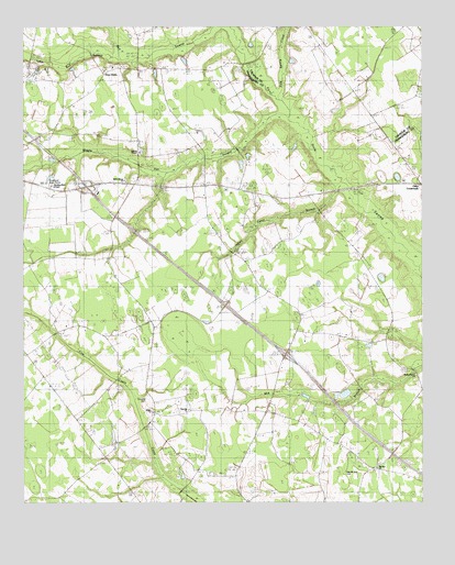
Indian Camp Branch, SC USGS Topographic Map
Click on map above to begin viewing in our Map Viewer.

This topographic map contains these locations and features:
Feature Name Type Latitude Longitude GNIS ID View Map
Andrew ChapelChurchN33.4671°W80.7131°1242506View Map
Andrews ChapelChurchN33.4799°W80.7056°1244884View Map
Bowman Fire DepartmentBuildingN33.4096°W80.6694°2578848View Map
Brookland Boys HomeBuildingN33.4582°W80.7404°1242537View Map
Brunson PondReservoirN33.4030°W80.6616°1238121View Map
Cotton Lane FarmsLocaleN33.4819°W80.6256°2710696View Map
East Middle SchoolSchoolN33.4327°W80.6754°1222190View Map
Fair School (historical)SchoolN33.4249°W80.6634°1242614View Map
Four Hole Baptist ChurchChurchN33.4896°W80.7215°1242630View Map
Four Hole SchoolSchoolN33.4902°W80.7190°1222515View Map
Four Holes Baptist Church CemeteryCemeteryN33.4896°W80.7220°2681203View Map
Indian Camp BranchStreamN33.4568°W80.6490°1223432View Map
Indian Camp SchoolSchoolN33.4402°W80.6706°1223434View Map
Interchange 154CrossingN33.4582°W80.7301°1228216View Map
Interchange 159CrossingN33.4140°W80.6676°1228217View Map
Jericho ChurchChurchN33.4213°W80.6620°1246163View Map
Little Bull SwampSwampN33.4554°W80.6527°1246390View Map
Livingston Mill SchoolSchoolN33.4057°W80.6584°1224088View Map
McKeowen FarmsLocaleN33.4964°W80.7486°2710697View Map
Middle Pen SwampStreamN33.4774°W80.6668°1246631View Map
Moorers Mill (historical)LocaleN33.4015°W80.6609°1242703View Map
Mount Zion ChurchChurchN33.3843°W80.6373°1224820View Map
New Mount Zion CemeteryCemeteryN33.3827°W80.6493°1242726View Map
Orangeburg County Fire Department Maintenance BuildingBuildingN33.4559°W80.7217°2578851View Map
Pineville CemeteryCemeteryN33.4029°W80.7109°1242774View Map
Pineville ChurchChurchN33.3993°W80.6981°1242775View Map
Pineville SchoolSchoolN33.3996°W80.6973°1225482View Map
Pitthan V CemeteryCemeteryN33.4429°W80.6426°2681235View Map
Polk Spring CreekStreamN33.4827°W80.6662°1250205View Map
Shamrock Commercial CenterLocaleN33.4599°W80.7142°2489504View Map
Shiloh CemeteryCemeteryN33.3983°W80.7088°2681243View Map
Shiloh ChurchChurchN33.3985°W80.7087°1226570View Map
Shiloh Church (historical)ChurchN33.3882°W80.6331°1242848View Map
South Carolina Noname 38015 D-3773 DamDamN33.4035°W80.6615°1238120View Map
Walnut Grove Baptist ChurchChurchN33.4082°W80.6251°1251315View Map
Walnut Grove CemeteryCemeteryN33.4087°W80.6267°2681247View Map
Wentling Memorial ChapelChurchN33.4582°W80.7409°1242889View Map
West Middle Fire DepartmentBuildingN33.4563°W80.7221°2578855View Map
West Middle Fire Department Station 2BuildingN33.4131°W80.7488°2578489View Map
West Middle SchoolSchoolN33.4138°W80.7487°1227495View Map
White House ChurchChurchN33.4596°W80.7179°1242893View Map

Note: Coordinates in the location and feature list above are referenced to NAD83 datum.


Copyright (C) 2008-2025 Ryan Niemi / Sunset Dynamics ... All Rights Reserved