TopoQuest Logo
Do you find TopoQuest useful?
Help keep TopoQuest running and adding new maps/features by donating!
Bitcoin:  19c7KJd3qBynnjoSw5npx9KScwjBe4ifkT
Litecoin:  LXs6TkuXGGXo1vDsWCkWVdjQX94eUKd6ui
Home View Maps Find Maps Find Places Resources & Links


Branchville North, South Carolina Topographic Map

USGS Map Title: Branchville North, SC
USGS Map MRC: 33080C7
DRG (GeoTIFF) Download: o33080c7.tif


Neighboring USGS Topographic Map Quads:


  Cordova, SC  
33080D8
 

  Orangeburg South, SC  
33080D7
 

  Indian Camp Branch, SC  
33080D6
 

  Midway, SC  
33080C8
 

  Branchville North, SC  
33080C7
 

  Bowman, SC  
33080C6
 

  Tony Hill Bay, SC  
33080B8
 

  Branchville South, SC  
33080B7
 

  Reevesville, SC  
33080B6


Map MRC Location:

N34°
W81°
N34°
W80°
H8 H7 H6 H5 H4 H3 H2 H1
G8 G7 G6 G5 G4 G3 G2 G1
F8 F7 F6 F5 F4 F3 F2 F1
E8 E7 E6 E5 E4 E3 E2 E1
D8 D7 D6 D5 D4 D3 D2 D1
C8 C7 C6 C5 C4 C3 C2 C1
B8 B7 B6 B5 B4 B3 B2 B1
A8 A7 A6 A5 A4 A3 A2 A1
N33°
W81°
N33°
W80°

Branchville North, SC USGS 1:24K Topographic Map Preview:
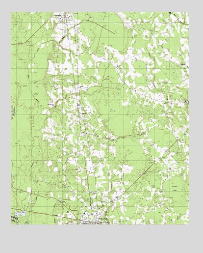
Branchville North, SC USGS Topographic Map
Click on map above to begin viewing in our Map Viewer.

This topographic map contains these locations and features:
Feature Name Type Latitude Longitude GNIS ID View Map
Bethel ChurchChurchN33.2504°W80.8209°1242516View Map
BranchvillePopulated PlaceN33.2513°W80.8157°1220931View Map
Branchville Baptist ChurchChurchN33.2558°W80.8131°2489994View Map
Branchville Christian ChurchChurchN33.2607°W80.8136°2489995View Map
Branchville DivisionCivilN33.2713°W80.8037°1938210View Map
Branchville Elementary SchoolSchoolN33.2565°W80.8234°1242529View Map
Branchville Post OfficePost OfficeN33.2503°W80.8172°1252272View Map
Branchville United Methodist ChurchChurchN33.2532°W80.8226°1242531View Map
Byrd CemeteryCemeteryN33.2574°W80.8334°1242544View Map
Camp EdistoLocaleN33.2638°W80.8095°1242550View Map
Canaan Baptist Church CemeteryCemeteryN33.2518°W80.8084°2681193View Map
Canaan ChurchChurchN33.2515°W80.8087°1242553View Map
Cattle Creek CampgroundLocaleN33.3221°W80.7509°1242559View Map
Cattle Creek CemeteryCemeteryN33.3224°W80.7511°1242560View Map
Cattle Creek ChurchChurchN33.3229°W80.7520°1247192View Map
Cattle Creek Fire DepartmentBuildingN33.3491°W80.8150°2368236View Map
Collier SchoolSchoolN33.3018°W80.8348°1221685View Map
Duke SchoolSchoolN33.3360°W80.7990°1222141View Map
Durbin BayBasinN33.2713°W80.7595°1242600View Map
East Branchville School (historical)SchoolN33.3054°W80.7626°1247595View Map
Mays ChapelChurchN33.3210°W80.8268°1242690View Map
Mill BranchStreamN33.3199°W80.8554°1242699View Map
Mill Branch SchoolSchoolN33.3204°W80.8270°1224525View Map
Ott CemeteryCemeteryN33.2507°W80.8337°1242761View Map
Peter Bowman CemeteryCemeteryN33.3190°W80.8456°1242765View Map
Prospect ChurchChurchN33.3452°W80.7565°1225690View Map
Prospect School (historical)SchoolN33.3435°W80.7568°1242787View Map
Robinsons BayBasinN33.3663°W80.8051°1242805View Map
RowesvillePopulated PlaceN33.3699°W80.8370°1250479View Map
Rowesville Fire DepartmentBuildingN33.3732°W80.8315°2578522View Map
Rowesville Post OfficePost OfficeN33.3711°W80.8356°2489882View Map
Rowesville School (historical)SchoolN33.3677°W80.8298°1242812View Map
Saint James ChurchChurchN33.3304°W80.8257°1242815View Map
Saint James School (historical)SchoolN33.2913°W80.7754°1242817View Map
Saint Lukes ChurchChurchN33.3452°W80.8068°1226174View Map
Saint Lukes School (historical)SchoolN33.3454°W80.8056°1242826View Map
Saint Stephens ChurchChurchN33.3154°W80.8254°1242833View Map
Sardis CemeteryCemeteryN33.2688°W80.8176°1242838View Map
Sardis ChurchChurchN33.2688°W80.8173°1242839View Map
Sardis SchoolSchoolN33.2677°W80.8173°1226403View Map
Sixty SixPopulated PlaceN33.3057°W80.8262°1250918View Map
Staley BranchStreamN33.3465°W80.8612°1242862View Map
Summers CemeteryCemeteryN33.3188°W80.7504°1242866View Map
Town of BranchvilleCivilN33.2516°W80.8161°2405313View Map
Town of RowesvilleCivilN33.3722°W80.8361°2407251View Map
Wilson ChapelChurchN33.2560°W80.8026°1242899View Map

Note: Coordinates in the location and feature list above are referenced to NAD83 datum.


Copyright (C) 2008-2025 Ryan Niemi / Sunset Dynamics ... All Rights Reserved