TopoQuest Logo
Do you find TopoQuest useful?
Help keep TopoQuest running and adding new maps/features by donating!
Bitcoin:  19c7KJd3qBynnjoSw5npx9KScwjBe4ifkT
Litecoin:  LXs6TkuXGGXo1vDsWCkWVdjQX94eUKd6ui
Home View Maps Find Maps Find Places Resources & Links


Westwood, Louisiana Topographic Map

USGS Map Title: Westwood, LA
USGS Map MRC: 32091B3
DRG (GeoTIFF) Download: o32091b3.tif


Neighboring USGS Topographic Map Quads:


  Indian Lake, LA  
32091C4
 

  Waverly SE, LA  
32091C3
 

  Fortune Fork, LA  
32091C2
 

  Tensas Bluff, LA  
32091B4
 

  Westwood, LA  
32091B3
 

  Somerset, LA  
32091B2
 

  Newlight, LA  
32091A4
 

  Saranac, LA  
32091A3
 

  Newellton, LA  
32091A2


Map MRC Location:

N33°
W92°
N33°
W91°
H8 H7 H6 H5 H4 H3 H2 H1
G8 G7 G6 G5 G4 G3 G2 G1
F8 F7 F6 F5 F4 F3 F2 F1
E8 E7 E6 E5 E4 E3 E2 E1
D8 D7 D6 D5 D4 D3 D2 D1
C8 C7 C6 C5 C4 C3 C2 C1
B8 B7 B6 B5 B4 B3 B2 B1
A8 A7 A6 A5 A4 A3 A2 A1
N32°
W92°
N32°
W91°

Westwood, LA USGS 1:24K Topographic Map Preview:
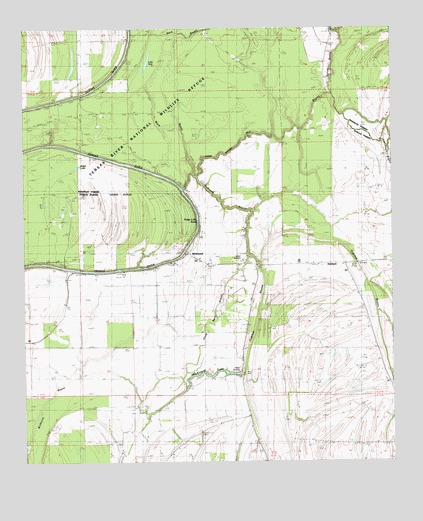
Westwood, LA USGS Topographic Map
Click on map above to begin viewing in our Map Viewer.

This topographic map contains these locations and features:
Feature Name Type Latitude Longitude GNIS ID View Map
Cypress BayouGutN32.1729°W91.2943°554157View Map
DearbornPopulated PlaceN32.1821°W91.2787°543135View Map
Du Rosset BayouGutN32.1985°W91.3068°554279View Map
Flowers FerryLocaleN32.1829°W91.3237°535015View Map
Lake NickLakeN32.2402°W91.3328°555499View Map
Mill BayouGutN32.2190°W91.2868°537092View Map
Newells RidgeRidgeN32.1257°W91.2723°549340View Map
Parish Governing Authority District 1CivilN32.1278°W91.3297°1929763View Map
Ridge LakeLakeN32.2101°W91.3572°555801View Map
Ridge Lake BendBendN32.1935°W91.3168°538600View Map
Saint Peter ChurchChurchN32.1590°W91.2565°539050View Map
Shackleford ChurchChurchN32.1402°W91.3284°539267View Map
Shackleford ChurchChurchN32.1638°W91.3004°539268View Map
Shackleford LakeLakeN32.1502°W91.3108°556004View Map
Steep Bank BayouGutN32.1702°W91.3101°539645View Map
Tensas River National Wildlife RefugeParkN32.2082°W91.3452°553973View Map
The GladeAreaN32.1571°W91.3584°549517View Map
Ward OneCivilN32.1318°W91.3543°545212View Map
WestwoodPopulated PlaceN32.1852°W91.3201°543782View Map
WildcatPopulated PlaceN32.1388°W91.3623°543783View Map
Wildhorse BayouGutN32.1363°W91.3726°540408View Map

Note: Coordinates in the location and feature list above are referenced to NAD83 datum.


Copyright (C) 2008-2024 Ryan Niemi / Sunset Dynamics ... All Rights Reserved