TopoQuest Logo
Do you find TopoQuest useful?
Help keep TopoQuest running and adding new maps/features by donating!
Bitcoin:  19c7KJd3qBynnjoSw5npx9KScwjBe4ifkT
Litecoin:  LXs6TkuXGGXo1vDsWCkWVdjQX94eUKd6ui
Home View Maps Find Maps Find Places Resources & Links


Ironside Mountain, California Topographic Map

USGS Map Title: Ironside Mountain, CA
USGS Map MRC: 40123G4
DRG (GeoTIFF) Download: o40123g4.tif


Neighboring USGS Topographic Map Quads:


  Salyer, CA  
40123H5
 

  Denny, CA  
40123H4
 

  Jim Jam Ridge, CA  
40123H3
 

  Hennessy Peak, CA  
40123G5
 

  Ironside Mountain, CA  
40123G4
 

  Del Loma, CA  
40123G3
 

  Sims Mountain, CA  
40123F5
 

  Hyampom Mountain, CA  
40123F4
 

  Big Bar, CA  
40123F3


Map MRC Location:

N41°
W124°
N41°
W123°
H8 H7 H6 H5 H4 H3 H2 H1
G8 G7 G6 G5 G4 G3 G2 G1
F8 F7 F6 F5 F4 F3 F2 F1
E8 E7 E6 E5 E4 E3 E2 E1
D8 D7 D6 D5 D4 D3 D2 D1
C8 C7 C6 C5 C4 C3 C2 C1
B8 B7 B6 B5 B4 B3 B2 B1
A8 A7 A6 A5 A4 A3 A2 A1
N40°
W124°
N40°
W123°

Ironside Mountain, CA USGS 1:24K Topographic Map Preview:
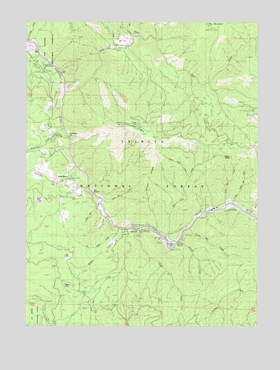
Ironside Mountain, CA USGS Topographic Map
Click on map above to begin viewing in our Map Viewer.

This topographic map contains these locations and features:
Feature Name Type Latitude Longitude GNIS ID View Map
Bell CreekStreamN40.8693°W123.4442°256802View Map
Bell FlatFlatN40.8685°W123.4495°1665314View Map
Bidden CreekStreamN40.7901°W123.4500°256866View Map
Big CreekStreamN40.8676°W123.4306°256914View Map
Big LakeLakeN40.7782°W123.4770°256952View Map
Box CanyonValleyN40.8074°W123.4670°257407View Map
Burnt RanchPopulated PlaceN40.8090°W123.4742°257728View Map
Burnt Ranch CampgroundLocaleN40.8276°W123.4820°276145View Map
Burnt Ranch Elementary SchoolSchoolN40.8089°W123.4797°1683077View Map
Burnt Ranch FallsFallsN40.8262°W123.4762°257730View Map
Burnt Ranch Post OfficePost OfficeN40.8225°W123.4833°2789117View Map
Burnt Ranch SchoolSchoolN40.8335°W123.4884°257731View Map
Burnt Ranch StationLocaleN40.8104°W123.4784°276149View Map
Cedar FlatFlatN40.7879°W123.4456°258127View Map
Cedar Flat CreekStreamN40.7893°W123.4403°258129View Map
Cedar Flat Picnic AreaLocaleN40.7890°W123.4525°276148View Map
China SlideSlopeN40.7946°W123.4598°258318View Map
Collins Bar CreekStreamN40.8007°W123.4614°258594View Map
Dixon Bar CreekStreamN40.7996°W123.4592°259408View Map
Don Juan CreekStreamN40.7865°W123.4253°259465View Map
Don Juan PointCapeN40.7849°W123.4203°259604View Map
Dyer CreekStreamN40.8640°W123.4528°259645View Map
Gray FallsFallsN40.8547°W123.4837°1665358View Map
Gray Falls CampgroundLocaleN40.8571°W123.4917°1665359View Map
Gray RanchLocaleN40.8632°W123.4987°260831View Map
Halsey RidgeRidgeN40.8124°W123.4373°261030View Map
Hennessy CreekStreamN40.8310°W123.4812°266339View Map
Hidden LakeLakeN40.7673°W123.4803°261304View Map
Ironside MountainSummitN40.8324°W123.4506°261819View Map
Little Bidden CreekStreamN40.7907°W123.4512°262540View Map
Little Sandy Bar CreekStreamN40.8001°W123.3889°262714View Map
Luccock BarBarN40.7993°W123.3900°263055View Map
McDonald CreekStreamN40.8154°W123.4739°263338View Map
Mill CreekStreamN40.7901°W123.4456°263611View Map
Misery SpringSpringN40.8201°W123.3942°1665396View Map
New RiverStreamN40.8460°W123.4800°264060View Map
New York BarBarN40.7860°W123.4273°264062View Map
Rowdy Bar CreekStreamN40.7896°W123.4117°265632View Map
Sandy Bar CreekStreamN40.7990°W123.3925°265819View Map
Smoky Camp CreekStreamN40.8112°W123.4114°267279View Map
Stetson CreekStreamN40.7840°W123.4175°267725View Map
Vance GulchValleyN40.7968°W123.3800°268673View Map
Zeigler SpringSpringN40.8324°W123.4406°269392View Map

Note: Coordinates in the location and feature list above are referenced to NAD83 datum.


Copyright (C) 2008-2025 Ryan Niemi / Sunset Dynamics ... All Rights Reserved