TopoQuest Logo
Do you find TopoQuest useful?
Help keep TopoQuest running and adding new maps/features by donating!
Bitcoin:  19c7KJd3qBynnjoSw5npx9KScwjBe4ifkT
Litecoin:  LXs6TkuXGGXo1vDsWCkWVdjQX94eUKd6ui
Home View Maps Find Maps Find Places Resources & Links


Del Loma, California Topographic Map

USGS Map Title: Del Loma, CA
USGS Map MRC: 40123G3
DRG (GeoTIFF) Download: o40123g3.tif


Neighboring USGS Topographic Map Quads:


  Denny, CA  
40123H4
 

  Jim Jam Ridge, CA  
40123H3
 

  Thurston Peaks, CA  
40123H2
 

  Ironside Mountain, CA  
40123G4
 

  Del Loma, CA  
40123G3
 

  Helena, CA  
40123G2
 

  Hyampom Mountain, CA  
40123F4
 

  Big Bar, CA  
40123F3
 

  Hayfork Bally, CA  
40123F2


Map MRC Location:

N41°
W124°
N41°
W123°
H8 H7 H6 H5 H4 H3 H2 H1
G8 G7 G6 G5 G4 G3 G2 G1
F8 F7 F6 F5 F4 F3 F2 F1
E8 E7 E6 E5 E4 E3 E2 E1
D8 D7 D6 D5 D4 D3 D2 D1
C8 C7 C6 C5 C4 C3 C2 C1
B8 B7 B6 B5 B4 B3 B2 B1
A8 A7 A6 A5 A4 A3 A2 A1
N40°
W124°
N40°
W123°

Del Loma, CA USGS 1:24K Topographic Map Preview:
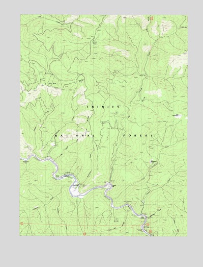
Del Loma, CA USGS Topographic Map
Click on map above to begin viewing in our Map Viewer.

This topographic map contains these locations and features:
Feature Name Type Latitude Longitude GNIS ID View Map
Barnum RidgeRidgeN40.8138°W123.3236°218692View Map
Big French CreekStreamN40.7793°W123.3084°256932View Map
Brooks RanchLocaleN40.8196°W123.3039°1665319View Map
Buckhorn CampLocaleN40.8585°W123.3214°257610View Map
Canadian BarBarN40.7829°W123.3392°257927View Map
Canadian CreekStreamN40.7776°W123.3381°266530View Map
Cherry FlatFlatN40.8396°W123.2867°258245View Map
Del LomaPopulated PlaceN40.7785°W123.3323°1655962View Map
Denny CreekStreamN40.7504°W123.2592°254333View Map
East Fork Big French CreekStreamN40.8676°W123.2570°259712View Map
French BarBarN40.7779°W123.3061°260367View Map
Green Mountain Trailhead ParkingLocaleN40.8674°W123.3150°276937View Map
Hayden Flat CampgroundLocaleN40.7840°W123.3434°1665361View Map
Hayden Flat Guard StationLocaleN40.7851°W123.3411°261170View Map
Italian CreekStreamN40.7951°W123.3634°261837View Map
Little French CreekStreamN40.7701°W123.3053°262601View Map
Little PrairieAreaN40.7582°W123.2856°262692View Map
Little Swede CreekStreamN40.7913°W123.3500°262737View Map
Lower Waldorff RanchLocaleN40.7918°W123.2770°263052View Map
New River Divide TrailTrailN40.8637°W123.3192°267059View Map
Oak FlatFlatN40.8274°W123.2834°264282View Map
Panther CreekStreamN40.7729°W123.3470°267107View Map
Pelletreau CreekStreamN40.7801°W123.3328°264626View Map
Prairie CreekStreamN40.7621°W123.2848°265021View Map
Rock Bar CreekStreamN40.7660°W123.2986°265470View Map
Salt Log SpringSpringN40.8371°W123.3345°265787View Map
Schneiders BarBarN40.7926°W123.3723°265915View Map
Smitty SpringSpringN40.8360°W123.3553°1665430View Map
Swede CreekStreamN40.7929°W123.3559°268017View Map
Taylors FlatFlatN40.7831°W123.3094°2556778View Map
Tonys PointCapeN40.7846°W123.3461°268354View Map
Upper Waldorff RanchLocaleN40.8179°W123.2578°268646View Map
Whites Bar CreekStreamN40.7604°W123.2806°269029View Map
Whites Bar Picnic AreaLocaleN40.7546°W123.2839°276938View Map
Willow GulchValleyN40.8604°W123.2756°269174View Map

Note: Coordinates in the location and feature list above are referenced to NAD83 datum.


Copyright (C) 2008-2025 Ryan Niemi / Sunset Dynamics ... All Rights Reserved