TopoQuest Logo
Do you find TopoQuest useful?
Help keep TopoQuest running and adding new maps/features by donating!
Bitcoin:  19c7KJd3qBynnjoSw5npx9KScwjBe4ifkT
Litecoin:  LXs6TkuXGGXo1vDsWCkWVdjQX94eUKd6ui
Home View Maps Find Maps Find Places Resources & Links


Big Bar, California Topographic Map

USGS Map Title: Big Bar, CA
USGS Map MRC: 40123F3
DRG (GeoTIFF) Download: o40123f3.tif


Neighboring USGS Topographic Map Quads:


  Ironside Mountain, CA  
40123G4
 

  Del Loma, CA  
40123G3
 

  Helena, CA  
40123G2
 

  Hyampom Mountain, CA  
40123F4
 

  Big Bar, CA  
40123F3
 

  Hayfork Bally, CA  
40123F2
 

  Hyampom, CA  
40123E4
 

  Halfway Ridge, CA  
40123E3
 

  Hayfork, CA  
40123E2


Map MRC Location:

N41°
W124°
N41°
W123°
H8 H7 H6 H5 H4 H3 H2 H1
G8 G7 G6 G5 G4 G3 G2 G1
F8 F7 F6 F5 F4 F3 F2 F1
E8 E7 E6 E5 E4 E3 E2 E1
D8 D7 D6 D5 D4 D3 D2 D1
C8 C7 C6 C5 C4 C3 C2 C1
B8 B7 B6 B5 B4 B3 B2 B1
A8 A7 A6 A5 A4 A3 A2 A1
N40°
W124°
N40°
W123°

Big Bar, CA USGS 1:24K Topographic Map Preview:
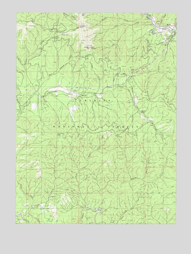
Big Bar, CA USGS Topographic Map
Click on map above to begin viewing in our Map Viewer.

This topographic map contains these locations and features:
Feature Name Type Latitude Longitude GNIS ID View Map
Bidden CreekStreamN40.7021°W123.3167°256865View Map
Big BarPopulated PlaceN40.7410°W123.2559°1658047View Map
Big Bar District Ranger OfficeLocaleN40.7401°W123.2520°276955View Map
Big Bar Post OfficePost OfficeN40.7435°W123.2672°1683020View Map
Big Bar Recreation SiteLocaleN40.7363°W123.2545°276956View Map
Corral BottomBendN40.7010°W123.3309°258728View Map
Cox Bar SchoolSchoolN40.7357°W123.2592°258821View Map
Deer CreekStreamN40.7443°W123.2714°259212View Map
Eagle RockPillarN40.7490°W123.3273°259676View Map
East Hayshed CreekStreamN40.7029°W123.3634°259761View Map
Gates CreekStreamN40.6343°W123.3648°260507View Map
Gates MountainSummitN40.6557°W123.3569°1665353View Map
Hawk CreekStreamN40.7043°W123.3011°261158View Map
Haypress MeadowFlatN40.6943°W123.2775°261181View Map
Hayshed CreekStreamN40.7024°W123.3642°261186View Map
Hyampom CreekStreamN40.6910°W123.3745°266844View Map
Knowles GulchValleyN40.6521°W123.2761°262227View Map
Miners CreekStreamN40.6346°W123.3225°263676View Map
Monkey CreekStreamN40.7488°W123.2775°263741View Map
Monument PeakSummitN40.7290°W123.3203°263778View Map
Mud SpringSpringN40.7133°W123.2905°263939View Map
Pasture GulchValleyN40.6254°W123.2975°264542View Map
Pattison PeakSummitN40.6771°W123.3459°264566View Map
Price CreekStreamN40.7385°W123.2511°265035View Map
Treloar CreekStreamN40.7390°W123.2525°268395View Map
West Fork Miners CreekStreamN40.6388°W123.3234°268909View Map
West Hayshed CreekStreamN40.7171°W123.3723°268922View Map

Note: Coordinates in the location and feature list above are referenced to NAD83 datum.


Copyright (C) 2008-2025 Ryan Niemi / Sunset Dynamics ... All Rights Reserved