TopoQuest Logo
Do you find TopoQuest useful?
Help keep TopoQuest running and adding new maps/features by donating!
Bitcoin:  19c7KJd3qBynnjoSw5npx9KScwjBe4ifkT
Litecoin:  LXs6TkuXGGXo1vDsWCkWVdjQX94eUKd6ui
Home View Maps Find Maps Find Places Resources & Links


Irwinton, Georgia Topographic Map

USGS Map Title: Irwinton, GA
USGS Map MRC: 32083G2
DRG (GeoTIFF) Download: o32083g2.tif


Neighboring USGS Topographic Map Quads:


  Gordon, GA  
32083H3
 

  Napier Pond, GA  
32083H2
 

  Gumm Pond, GA  
32083H1
 

  Massey Hill, GA  
32083G3
 

  Irwinton, GA  
32083G2
 

  Toomsboro, GA  
32083G1
 

  Jeffersonville, GA  
32083F3
 

  Stuckey Boone Lake, GA  
32083F2
 

  Nicklesville, GA  
32083F1


Map MRC Location:

N33°
W84°
N33°
W83°
H8 H7 H6 H5 H4 H3 H2 H1
G8 G7 G6 G5 G4 G3 G2 G1
F8 F7 F6 F5 F4 F3 F2 F1
E8 E7 E6 E5 E4 E3 E2 E1
D8 D7 D6 D5 D4 D3 D2 D1
C8 C7 C6 C5 C4 C3 C2 C1
B8 B7 B6 B5 B4 B3 B2 B1
A8 A7 A6 A5 A4 A3 A2 A1
N32°
W84°
N32°
W83°

Irwinton, GA USGS 1:24K Topographic Map Preview:
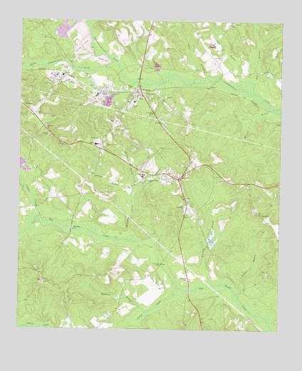
Irwinton, GA USGS Topographic Map
Click on map above to begin viewing in our Map Viewer.

This topographic map contains these locations and features:
Feature Name Type Latitude Longitude GNIS ID View Map
Ball BranchStreamN32.8460°W83.1371°310757View Map
Bearcamp BranchStreamN32.7679°W83.1557°310950View Map
Bearcamp LakeLakeN32.7851°W83.1565°310951View Map
Bearcamp Lake DamDamN32.7851°W83.1568°336117View Map
Bethel CemeteryCemeteryN32.7696°W83.2385°346777View Map
Bethel ChurchChurchN32.7693°W83.2379°354601View Map
Brenham BranchStreamN32.7568°W83.1882°354846View Map
Brundage CemeteryCemeteryN32.8440°W83.2371°346780View Map
Calhoun SchoolSchoolN32.8126°W83.1902°312159View Map
Calvary ChurchChurchN32.8379°W83.1852°312174View Map
City of IrwintonCivilN32.8108°W83.1737°2404768View Map
County High SchoolSchoolN32.8251°W83.2127°313020View Map
Cowpen CreekStreamN32.7943°W83.2388°313068View Map
Criswell CemeteryCemeteryN32.8554°W83.1646°346785View Map
DedrichPopulated PlaceN32.8526°W83.2293°331533View Map
Dry BranchStreamN32.8471°W83.1404°313652View Map
EdgarsPopulated PlaceN32.8451°W83.2124°331632View Map
Fountain Grove ChurchChurchN32.8307°W83.1993°314309View Map
Friendship CemeteryCemeteryN32.8376°W83.2421°346790View Map
Friendship ChurchChurchN32.8404°W83.2493°355936View Map
Harvill CemeteryCemeteryN32.8099°W83.1929°346793View Map
Helton BranchStreamN32.8015°W83.1952°315309View Map
Holliman CemeteryCemeteryN32.8679°W83.2399°346794View Map
IrwintonPopulated PlaceN32.8113°W83.1727°315946View Map
Irwinton DivisionCivilN32.8594°W83.1862°1936329View Map
Irwinton Police DepartmentBuildingN32.8121°W83.1725°2733632View Map
Irwinton Volunteer Fire DepartmentBuildingN32.8121°W83.1725°2603604View Map
Lavender School (historical)SchoolN32.8029°W83.2315°334932View Map
Liberty CemeteryCemeteryN32.8738°W83.1479°346798View Map
Liberty ChurchChurchN32.8740°W83.1477°316809View Map
Lindsey BranchStreamN32.8015°W83.1952°316900View Map
Little Commissioner CreekStreamN32.8588°W83.2040°316995View Map
McIntyrePopulated PlaceN32.8463°W83.1907°317929View Map
McIntyre Police DepartmentBuildingN32.8470°W83.1938°2734145View Map
McIntyre Volunteer Fire DepartmentBuildingN32.8470°W83.1938°2603883View Map
Mount Zion ChurchChurchN32.8254°W83.2288°318986View Map
Nelson BranchStreamN32.8513°W83.1582°319245View Map
New Bethels ChurchChurchN32.7999°W83.1702°319287View Map
Pitman BranchStreamN32.7646°W83.1449°320754View Map
Porter CreekStreamN32.7668°W83.1732°321067View Map
Sacred Heart ChurchChurchN32.8315°W83.2374°322032View Map
Shepherd CemeteryCemeteryN32.8299°W83.2071°346815View Map
Thompson BridgeBridgeN32.7763°W83.1810°324099View Map
Town BranchStreamN32.8015°W83.1952°324240View Map
Town of McIntyreCivilN32.8466°W83.2011°2406133View Map
Walters CemeteryCemeteryN32.7971°W83.1335°324818View Map
Wheeler BranchStreamN32.8399°W83.1274°325115View Map
Wilkinson CountyCivilN32.8024°W83.1712°346824View Map
Wilkinson County CourthouseBuildingN32.8107°W83.1738°346826View Map
Wilkinson County Elementary SchoolSchoolN32.8249°W83.2115°346827View Map
Wilkinson County High SchoolSchoolN32.8249°W83.2138°346828View Map
Wilkinson County JailBuildingN32.8096°W83.1737°2733971View Map
Wilkinson County Middle SchoolSchoolN32.8251°W83.2129°346829View Map
Wilkinson County SheriffBuildingN32.8107°W83.1739°2733743View Map
Wilkinson Lookout TowerTowerN32.8296°W83.2393°344382View Map
WrileyPopulated PlaceN32.8485°W83.1582°326601View Map

Note: Coordinates in the location and feature list above are referenced to NAD83 datum.


Copyright (C) 2008-2024 Ryan Niemi / Sunset Dynamics ... All Rights Reserved