TopoQuest Logo
Do you find TopoQuest useful?
Help keep TopoQuest running and adding new maps/features by donating!
Bitcoin:  19c7KJd3qBynnjoSw5npx9KScwjBe4ifkT
Litecoin:  LXs6TkuXGGXo1vDsWCkWVdjQX94eUKd6ui
Home View Maps Find Maps Find Places Resources & Links


Nicklesville, Georgia Topographic Map

USGS Map Title: Nicklesville, GA
USGS Map MRC: 32083F1
DRG (GeoTIFF) Download: o32083f1.tif


Neighboring USGS Topographic Map Quads:


  Irwinton, GA  
32083G2
 

  Toomsboro, GA  
32083G1
 

  Oconee, GA  
32082G8
 

  Stuckey Boone Lake, GA  
32083F2
 

  Nicklesville, GA  
32083F1
 

  Cow Hell Swamp, GA  
32082F8
 

  Danville East, GA  
32083E2
 

  Dudley, GA  
32083E1
 

  Dublin, GA  
32082E8


Map MRC Location:

N33°
W84°
N33°
W83°
H8 H7 H6 H5 H4 H3 H2 H1
G8 G7 G6 G5 G4 G3 G2 G1
F8 F7 F6 F5 F4 F3 F2 F1
E8 E7 E6 E5 E4 E3 E2 E1
D8 D7 D6 D5 D4 D3 D2 D1
C8 C7 C6 C5 C4 C3 C2 C1
B8 B7 B6 B5 B4 B3 B2 B1
A8 A7 A6 A5 A4 A3 A2 A1
N32°
W84°
N32°
W83°

Nicklesville, GA USGS 1:24K Topographic Map Preview:
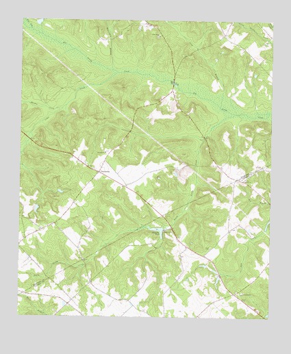
Nicklesville, GA USGS Topographic Map
Click on map above to begin viewing in our Map Viewer.

This topographic map contains these locations and features:
Feature Name Type Latitude Longitude GNIS ID View Map
Allentown-Toomsboro Division (historical)CensusN32.7218°W83.0699°1936075View Map
Beaverdam BranchStreamN32.7290°W83.0788°310992View Map
Big Sandy CemeteryCemeteryN32.6949°W83.0829°346778View Map
Big Sandy ChurchChurchN32.6943°W83.0821°354725View Map
Cedar CreekStreamN32.7282°W83.0768°312457View Map
Centerville Baptist ChurchChurchN32.6271°W83.0604°346507View Map
Centerville CemeteryCemeteryN32.6277°W83.0618°346508View Map
Chappells MillPopulated PlaceN32.6615°W83.0526°355119View Map
Chappells PondReservoirN32.6619°W83.0566°312573View Map
Chappells Pond DamDamN32.6627°W83.0529°335888View Map
Greens Mill (historical)LocaleN32.6474°W83.0915°346545View Map
Hagin-Fordham CemeteryCemeteryN32.6882°W83.0476°346792View Map
Hall BridgeBridgeN32.7240°W83.0485°315030View Map
Hardy Chapel School (historical)SchoolN32.6585°W83.0465°346548View Map
Horse BranchStreamN32.6260°W83.1110°310343View Map
Jordon Stream ChurchChurchN32.7435°W83.0557°316282View Map
LindseyPopulated PlaceN32.6615°W83.1138°346799View Map
Long BranchStreamN32.7135°W83.0251°317329View Map
Maiden CreekStreamN32.7129°W83.1040°317635View Map
Mills LakeReservoirN32.7485°W83.1165°336120View Map
Mills Lake DamDamN32.7485°W83.1165°336119View Map
Mount Olive CemeteryCemeteryN32.6493°W83.0929°346805View Map
Mount Olive ChurchChurchN32.6488°W83.0927°318756View Map
Mount Tilla ChurchChurchN32.6874°W83.0882°318895View Map
NicklesvillePopulated PlaceN32.6863°W83.0854°326421View Map
Nicklesville Volunteer Fire DepartmentBuildingN32.6860°W83.0847°2604582View Map
Oconee ChurchChurchN32.6829°W83.0124°319895View Map
South Sandy CreekStreamN32.7113°W83.0179°323281View Map
Spring HillPopulated PlaceN32.6352°W83.0174°346625View Map
Spring Hill CemeteryCemeteryN32.6354°W83.0135°346626View Map
Spring Hill ChurchChurchN32.6357°W83.0129°323428View Map
Taylors PondReservoirN32.6718°W83.1165°336108View Map
Taylors Pond DamDamN32.6718°W83.1165°336107View Map
Townsend LakeReservoirN32.6412°W83.0255°341262View Map
Townsend Lake DamDamN32.6435°W83.0249°341261View Map
Water ForkStreamN32.7465°W83.1202°324888View Map

Note: Coordinates in the location and feature list above are referenced to NAD83 datum.


Copyright (C) 2008-2024 Ryan Niemi / Sunset Dynamics ... All Rights Reserved