TopoQuest Logo
Do you find TopoQuest useful?
Help keep TopoQuest running and adding new maps/features by donating!
Bitcoin:  19c7KJd3qBynnjoSw5npx9KScwjBe4ifkT
Litecoin:  LXs6TkuXGGXo1vDsWCkWVdjQX94eUKd6ui
Home View Maps Find Maps Find Places Resources & Links


Ishpeming, Michigan Topographic Map

USGS Map Title: Ishpeming, MI
USGS Map MRC: 46087D6
DRG (GeoTIFF) Download: o46087d6.tif


Neighboring USGS Topographic Map Quads:


  Diorite, MI  
46087E7
 

  Negaunee SW, MI  
46087E6
 

  Negaunee, MI  
46087E5
 

  Greenwood, MI  
46087D7
 

  Ishpeming, MI  
46087D6
 

  Palmer, MI  
46087D5
 

  Chabeneau Lake, MI  
46087C7
 

  Green Hills, MI  
46087C6
 

  Cataract Basin, MI  
46087C5


Map MRC Location:

N47°
W88°
N47°
W87°
H8 H7 H6 H5 H4 H3 H2 H1
G8 G7 G6 G5 G4 G3 G2 G1
F8 F7 F6 F5 F4 F3 F2 F1
E8 E7 E6 E5 E4 E3 E2 E1
D8 D7 D6 D5 D4 D3 D2 D1
C8 C7 C6 C5 C4 C3 C2 C1
B8 B7 B6 B5 B4 B3 B2 B1
A8 A7 A6 A5 A4 A3 A2 A1
N46°
W88°
N46°
W87°

Ishpeming, MI USGS 1:24K Topographic Map Preview:
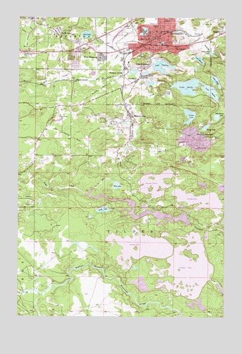
Ishpeming, MI USGS Topographic Map
Click on map above to begin viewing in our Map Viewer.

This topographic map contains these locations and features:
Feature Name Type Latitude Longitude GNIS ID View Map
Apostolic Lutheran ChurchChurchN46.4881°W87.7136°2336520View Map
Aspen Ridge SchoolSchoolN46.4802°W87.7295°2336568View Map
Bethel Lutheran ChurchChurchN46.4914°W87.6639°2336529View Map
Bible Baptist ChurchChurchN46.4892°W87.7100°2336519View Map
Blue LakeLakeN46.4297°W87.6903°621639View Map
Central Elementary SchoolSchoolN46.4894°W87.6653°2336567View Map
Christ the King Lutheran ChurchChurchN46.4789°W87.7175°2336518View Map
City of IshpemingCivilN46.4862°W87.6658°1626532View Map
Cleveland SchoolSchoolN46.4877°W87.6551°623459View Map
Cliff Lookout TowerTowerN46.4499°W87.6299°1623287View Map
Cliffs MinesMineN46.4905°W87.6740°623469View Map
Cliffs Shaft Mine Historical MarkerParkN46.4925°W87.6783°2336776View Map
Cliffs Shaft Mine MuseumBuildingN46.4911°W87.6756°2336584View Map
Ely CreekStreamN46.4255°W87.7071°625548View Map
Ely FallsFallsN46.4389°W87.6889°2336598View Map
Faith Lutheran ChurchChurchN46.4425°W87.7403°2336516View Map
Foster LakeLakeN46.4542°W87.6367°626316View Map
FrenchtownPopulated PlaceN46.4733°W87.6790°626487View Map
Good News Assembly of God ChurchChurchN46.4886°W87.7083°2336522View Map
Good Shepherd FellowshipChurchN46.4903°W87.6633°2336527View Map
Grace Episcopal ChurchChurchN46.4917°W87.6675°2336530View Map
Grass LakeSwampN46.4685°W87.6596°627213View Map
Green CreekStreamN46.4255°W87.7071°627292View Map
Gunpowder LakeLakeN46.4853°W87.6335°627543View Map
Hope Free Evangelical Lutheran ChurchChurchN46.4872°W87.7075°2336517View Map
IshpemingPopulated PlaceN46.4885°W87.6676°629103View Map
Ishpeming City LibraryBuildingN46.4842°W87.6700°2336537View Map
Ishpeming High SchoolSchoolN46.4892°W87.6647°2336579View Map
Ishpeming Police DepartmentBuildingN46.4894°W87.6712°2336535View Map
Ishpeming Post OfficePost OfficeN46.4914°W87.6667°2336533View Map
Ishpeming StationLocaleN46.4875°W87.6772°2336534View Map
Ishpeming Township Fire DepartmentBuildingN46.4877°W87.7123°2626853View Map
Ishpeming Township Police DepartmentBuildingN46.4877°W87.7122°2737467View Map
Ishpeming Township Recreation AreaParkN46.4881°W87.7100°2336797View Map
Ishpeming Volunteer Fire DepartmentBuildingN46.4894°W87.6711°2336536View Map
Jasper Knob Scenic OverlookLocaleN46.4867°W87.6539°2336582View Map
Jehovah's WitnessesChurchN46.4856°W87.7200°2336521View Map
Laestadian ChurchChurchN46.4819°W87.6867°2336514View Map
Lake AngelinePopulated PlaceN46.4783°W87.6760°629961View Map
Lake AngelineLakeN46.4796°W87.6635°620125View Map
Lake Angeline ParkParkN46.4817°W87.6672°2336583View Map
Lake BancroftLakeN46.4941°W87.6742°620542View Map
Lake Bancroft ParkParkN46.4931°W87.6775°2336586View Map
Lake MillerLakeN46.4735°W87.6308°632400View Map
Lake MinnieLakeN46.4826°W87.6410°632466View Map
Lake OgdenLakeN46.4702°W87.6350°633952View Map
Lake SallyReservoirN46.4712°W87.6481°637125View Map
Last BluffCliffN46.4988°W87.6779°630179View Map
Long LakeLakeN46.4197°W87.6983°630955View Map
Marquette County Medical Care FacilityHospitalN46.4722°W87.6858°2336587View Map
Michigan Department of Natural Resources Ishpeming Field OfficeBuildingN46.4852°W87.7280°2626854View Map
National MinePopulated PlaceN46.4585°W87.6815°633227View Map
National Mine Post Office (historical)Post OfficeN46.4586°W87.6814°2336646View Map
North LakePopulated PlaceN46.4935°W87.7276°633596View Map
Old Fashion Baptist ChurchChurchN46.4878°W87.6633°2336525View Map
Partridge CreekStreamN46.4944°W87.6543°634439View Map
Phelps Middle SchoolSchoolN46.4938°W87.6646°628240View Map
Pilot KnobSummitN46.4944°W87.6774°634893View Map
Rock LakeLakeN46.4927°W87.7091°636084View Map
Saint John the Evangelist ChurchChurchN46.4878°W87.6692°2336524View Map
SalisburyPopulated PlaceN46.4749°W87.6771°637121View Map
Salisbury United Methodist ChurchChurchN46.4733°W87.6783°2336532View Map
Schoolhouse LakeLakeN46.4585°W87.6300°637427View Map
Stoneville Post Office (historical)Post OfficeN46.4639°W87.7256°2336631View Map
Suicide Bowl Ski JumpsLocaleN46.4822°W87.6267°2336505View Map
Summit MountainSummitN46.4499°W87.6301°639061View Map
Tilden LakeLakeN46.4591°W87.6464°1614859View Map
Tilden MineMineN46.4455°W87.6368°1614860View Map
Tilden MineMineN46.4474°W87.6499°1614861View Map
Tilden Post Office (historical)Post OfficeN46.4583°W87.6444°2336627View Map
Trinity Lutheran ChurchChurchN46.4914°W87.6636°2336528View Map
United Evangelical Covenant ChurchChurchN46.4978°W87.6656°2336523View Map
United Presbyterian ChurchChurchN46.4919°W87.6686°2336531View Map
West IshpemingPopulated PlaceN46.4835°W87.7010°1616125View Map
West Ishpeming Census Designated PlaceCensusN46.4884°W87.7170°2393843View Map
Westwood High SchoolSchoolN46.4822°W87.7255°2336590View Map
White City FallsFallsN46.3900°W87.7186°2336620View Map
Winthrop JunctionPopulated PlaceN46.4760°W87.6871°1616652View Map

Note: Coordinates in the location and feature list above are referenced to NAD83 datum.


Copyright (C) 2008-2024 Ryan Niemi / Sunset Dynamics ... All Rights Reserved