TopoQuest Logo
Do you find TopoQuest useful?
Help keep TopoQuest running and adding new maps/features by donating!
Bitcoin:  19c7KJd3qBynnjoSw5npx9KScwjBe4ifkT
Litecoin:  LXs6TkuXGGXo1vDsWCkWVdjQX94eUKd6ui
Home View Maps Find Maps Find Places Resources & Links


Negaunee SW, Michigan Topographic Map

USGS Map Title: Negaunee SW, MI
USGS Map MRC: 46087E6
DRG (GeoTIFF) Download: o46087e6.tif


Neighboring USGS Topographic Map Quads:


  Silver Lake Basin, MI  
46087F7
 

  Negaunee NW, MI  
46087F6
 

  Buckroe, MI  
46087F5
 

  Diorite, MI  
46087E7
 

  Negaunee SW, MI  
46087E6
 

  Negaunee, MI  
46087E5
 

  Greenwood, MI  
46087D7
 

  Ishpeming, MI  
46087D6
 

  Palmer, MI  
46087D5


Map MRC Location:

N47°
W88°
N47°
W87°
H8 H7 H6 H5 H4 H3 H2 H1
G8 G7 G6 G5 G4 G3 G2 G1
F8 F7 F6 F5 F4 F3 F2 F1
E8 E7 E6 E5 E4 E3 E2 E1
D8 D7 D6 D5 D4 D3 D2 D1
C8 C7 C6 C5 C4 C3 C2 C1
B8 B7 B6 B5 B4 B3 B2 B1
A8 A7 A6 A5 A4 A3 A2 A1
N46°
W88°
N46°
W87°

Negaunee SW, MI USGS 1:24K Topographic Map Preview:
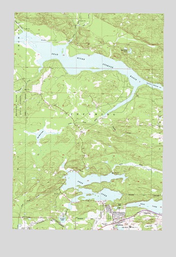
Negaunee SW, MI USGS Topographic Map
Click on map above to begin viewing in our Map Viewer.

This topographic map contains these locations and features:
Feature Name Type Latitude Longitude GNIS ID View Map
Al Quaal Recreation AreaParkN46.5119°W87.6622°2336574View Map
Baby LakeLakeN46.5136°W87.6601°620405View Map
Barnhardt CreekStreamN46.5949°W87.7274°620630View Map
Bethany Lutheran ChurchChurchN46.5078°W87.6597°2336511View Map
Big Mud LakeLakeN46.5544°W87.7273°621339View Map
Birchview Elementary SchoolSchoolN46.5106°W87.6619°2336572View Map
Boise CreekStreamN46.6177°W87.6971°621692View Map
Cambria-Jackson MineMineN46.5077°W87.6287°622504View Map
Carp CreekStreamN46.5174°W87.6746°622751View Map
Clark CreekStreamN46.6060°W87.7071°623347View Map
Cooper CreekStreamN46.5124°W87.7043°623784View Map
Cooper LakeLakeN46.5059°W87.7080°623789View Map
Country Village RV ParkLocaleN46.5025°W87.6744°2336538View Map
Dead River Storage BasinReservoirN46.5705°W87.6650°624414View Map
Deer CreekStreamN46.6174°W87.6979°624465View Map
Deer LakeReservoirN46.5192°W87.6818°624490View Map
Gold Mine CreekStreamN46.5235°W87.7101°619751View Map
Ishpeming CemeteryCemeteryN46.5074°W87.6687°629102View Map
Ishpeming: Historic Ski Center Historical MarkerParkN46.5042°W87.6650°2336775View Map
Lake BaconLakeN46.5009°W87.6598°620420View Map
Lily PondSwampN46.5022°W87.6365°630408View Map
Little Dead RiverStreamN46.5824°W87.6482°630608View Map
Little LakeLakeN46.5128°W87.6636°630665View Map
Lloyd MineMineN46.5005°W87.7374°630845View Map
Mather Mine AMineN46.5016°W87.6518°631731View Map
Morris MineMineN46.5002°W87.7424°632715View Map
Mother Baseball DiamondParkN46.5019°W87.6531°2336577View Map
Saint Joseph ChurchChurchN46.5103°W87.6664°2336512View Map
Silver CreekStreamN46.6138°W87.7421°637925View Map
Silver Mine LakesLakeN46.6030°W87.6531°637965View Map
Teal LakeLakeN46.5131°W87.6283°1614644View Map
Teal Lake Medical CenterHospitalN46.5083°W87.6447°2336575View Map
Temple Beth SholomChurchN46.5131°W87.6675°2336513View Map
UPHS Bell HospitalHospitalN46.5049°W87.6849°2336580View Map
Wesley United Methodist ChurchChurchN46.5064°W87.6606°2336515View Map
Willow CreekStreamN46.5986°W87.6700°2569435View Map
WJPD-AM (Ishpeming)TowerN46.5044°W87.6796°1625236View Map
Zhulkie CreekStreamN46.5630°W87.6807°1616924View Map

Note: Coordinates in the location and feature list above are referenced to NAD83 datum.


Copyright (C) 2008-2024 Ryan Niemi / Sunset Dynamics ... All Rights Reserved