TopoQuest Logo
Do you find TopoQuest useful?
Help keep TopoQuest running and adding new maps/features by donating!
Bitcoin:  19c7KJd3qBynnjoSw5npx9KScwjBe4ifkT
Litecoin:  LXs6TkuXGGXo1vDsWCkWVdjQX94eUKd6ui
Home View Maps Find Maps Find Places Resources & Links


Ismay North, Montana Topographic Map

USGS Map Title: Ismay North, MT
USGS Map MRC: 46104E7
DRG (GeoTIFF) Download: o46104e7.tif


Neighboring USGS Topographic Map Quads:


  Mildred, MT  
46104F8
 

  Mildred NE, MT  
46104F7
 

  Dorothy Draw, MT  
46104F6
 

  Loony Hollow, MT  
46104E8
 

  Ismay North, MT  
46104E7
 

  Ayer Spring, MT  
46104E6
 

  Bracket Butte, MT  
46104D8
 

  Ismay South, MT  
46104D7
 

  Westmore, MT  
46104D6


Map MRC Location:

N47°
W105°
N47°
W104°
H8 H7 H6 H5 H4 H3 H2 H1
G8 G7 G6 G5 G4 G3 G2 G1
F8 F7 F6 F5 F4 F3 F2 F1
E8 E7 E6 E5 E4 E3 E2 E1
D8 D7 D6 D5 D4 D3 D2 D1
C8 C7 C6 C5 C4 C3 C2 C1
B8 B7 B6 B5 B4 B3 B2 B1
A8 A7 A6 A5 A4 A3 A2 A1
N46°
W105°
N46°
W104°

Ismay North, MT USGS 1:24K Topographic Map Preview:
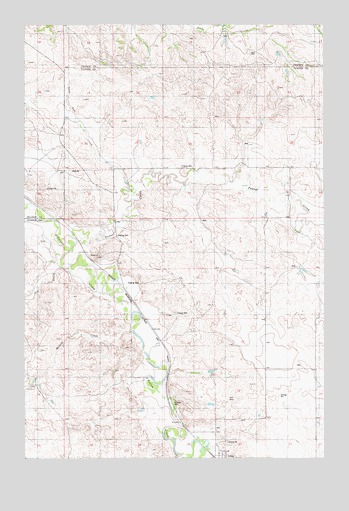
Ismay North, MT USGS Topographic Map
Click on map above to begin viewing in our Map Viewer.

This topographic map contains these locations and features:
Feature Name Type Latitude Longitude GNIS ID View Map
09N54E24BD__01 WellWellN46.5200°W104.8719°816627View Map
09N55E02DDCD01 WellWellN46.5117°W104.7783°816586View Map
09N55E03AADC01 WellWellN46.5664°W104.7772°816851View Map
09N55E05BC__01 WellWellN46.5628°W104.8358°816833View Map
09N55E09BD__01 WellWellN46.5483°W104.8097°816759View Map
09N55E17C___01 WellWellN46.5292°W104.8339°816681View Map
09N55E17DB__01 WellWellN46.5303°W104.8255°816686View Map
09N55E21CBDB01 WellWellN46.5158°W104.8133°816609View Map
09N55E22DDCD01 WellWellN46.5550°W104.7613°816796View Map
09N55E27BB__01 WellWellN46.5089°W104.7941°816576View Map
09N55E27CA__01 WellWellN46.5017°W104.7888°816547View Map
09N55E27CA__02 WellWellN46.5017°W104.7888°816548View Map
09N55E27CCAA01 WellWellN46.5000°W104.7916°816542View Map
09N55E28BB__01 WellWellN46.5089°W104.8150°816577View Map
10N55E23AA__01 WellWellN46.6103°W104.7575°817102View Map
10N55E28DCCC01 WellWellN46.5842°W104.8052°816922View Map
10N55E32BDCD01 WellWellN46.5770°W104.8305°816895View Map
10N55E33A___01 WellWellN46.5806°W104.8005°816910View Map
10N55E33AD__01 WellWellN46.5778°W104.7991°816897View Map
10N55E33BDDA01 WellWellN46.5789°W104.8097°816902View Map
10N55E34DBBA01 WellWellN46.5764°W104.7836°816892View Map
10N55E35BDBD01 WellWellN46.5789°W104.7683°816901View Map
Ash CreekStreamN46.5556°W104.8605°768367View Map
Burt School (historical)SchoolN46.5006°W104.7922°1716899View Map
Ismay Rural Volunteer Fire CompanyBuildingN46.5005°W104.7926°2546693View Map
Lone Tree CreekStreamN46.5775°W104.8291°799250View Map
Lone Tree School (historical)SchoolN46.6120°W104.8591°1715714View Map
Malone CreekStreamN46.5370°W104.8311°799222View Map
Millison School (historical)SchoolN46.5936°W104.8055°1716917View Map
O'Fallon Station (historical)LocaleN46.5056°W104.7950°1716851View Map
Pennel CreekStreamN46.5625°W104.8539°775147View Map
Town of IsmayCivilN46.5002°W104.7929°2412796View Map

Note: Coordinates in the location and feature list above are referenced to NAD83 datum.


Copyright (C) 2008-2025 Ryan Niemi / Sunset Dynamics ... All Rights Reserved