TopoQuest Logo
Do you find TopoQuest useful?
Help keep TopoQuest running and adding new maps/features by donating!
Bitcoin:  19c7KJd3qBynnjoSw5npx9KScwjBe4ifkT
Litecoin:  LXs6TkuXGGXo1vDsWCkWVdjQX94eUKd6ui
Home View Maps Find Maps Find Places Resources & Links


Westmore, Montana Topographic Map

USGS Map Title: Westmore, MT
USGS Map MRC: 46104D6
DRG (GeoTIFF) Download: o46104d6.tif


Neighboring USGS Topographic Map Quads:


  Ismay North, MT  
46104E7
 

  Ayer Spring, MT  
46104E6
 

  Lawrence Creek West, MT  
46104E5
 

  Ismay South, MT  
46104D7
 

  Westmore, MT  
46104D6
 

  Plevna, MT  
46104D5
 

  Bracket Butte SE, MT  
46104C7
 

  T G Creek, MT  
46104C6
 

  Little Pine Creek, MT  
46104C5


Map MRC Location:

N47°
W105°
N47°
W104°
H8 H7 H6 H5 H4 H3 H2 H1
G8 G7 G6 G5 G4 G3 G2 G1
F8 F7 F6 F5 F4 F3 F2 F1
E8 E7 E6 E5 E4 E3 E2 E1
D8 D7 D6 D5 D4 D3 D2 D1
C8 C7 C6 C5 C4 C3 C2 C1
B8 B7 B6 B5 B4 B3 B2 B1
A8 A7 A6 A5 A4 A3 A2 A1
N46°
W105°
N46°
W104°

Westmore, MT USGS 1:24K Topographic Map Preview:
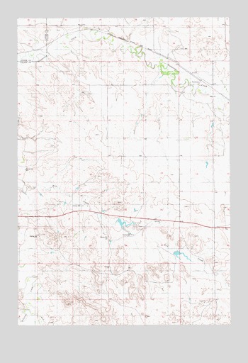
Westmore, MT USGS Topographic Map
Click on map above to begin viewing in our Map Viewer.

This topographic map contains these locations and features:
Feature Name Type Latitude Longitude GNIS ID View Map
07N57E06AC__01 WellWellN46.3972°W104.6422°816018View Map
08N56E01BB__01 WellWellN46.4806°W104.6755°816465View Map
08N56E01CAAD01 WellWellN46.4786°W104.6666°816459View Map
08N56E10AB__01 WellWellN46.4694°W104.7061°816401View Map
08N56E15AD__01 WellWellN46.4528°W104.6991°816341View Map
08N56E25DC__01 WellWellN46.4181°W104.6616°816148View Map
08N56E27BCDA01 WellWellN46.4236°W104.7125°816183View Map
08N56E29AC__01 WellWellN46.4233°W104.7466°816182View Map
08N56E29CDA_01 WellWellN46.4181°W104.7491°816149View Map
08N56E34ACA_01 WellWellN46.4111°W104.7019°816097View Map
08N57E05CCAD01 WellWellN46.4742°W104.6308°816427View Map
08N57E06CDDC01 WellWellN46.4728°W104.6469°816419View Map
08N57E06DBCA01 WellWellN46.4772°W104.6444°816441View Map
08N57E18BC__01 WellWellN46.4528°W104.6533°816340View Map
08N57E20CC__01 WellWellN46.4319°W104.6325°816236View Map
08N57E32BA__01 WellWellN46.4119°W104.6269°816104View Map
09N55E25CD__01 WellWellN46.4981°W104.7469°816530View Map
09N55E25DC__01 WellWellN46.4981°W104.7416°816529View Map
09N56E28DDBC01 WellWellN46.4989°W104.6747°816535View Map
09N56E30DDDD01 WellWellN46.4972°W104.7130°816525View Map
09N56E31DA__01 WellWellN46.4889°W104.7158°816497View Map
Columbia Elevator (historical)LocaleN46.4756°W104.6427°1688648View Map
Congregational Church (historical)ChurchN46.4742°W104.6450°1688655View Map
Ehret Land Reservoir DamDamN46.4283°W104.6638°796173View Map
Farmers Elevator (historical)LocaleN46.4758°W104.6441°1688649View Map
Pine CreekStreamN46.3794°W104.7416°775238View Map
Plevna DivisionCivilN46.3842°W104.6431°1940693View Map
WestmoreLocaleN46.4750°W104.6422°1688624View Map
WestmorePopulated PlaceN46.4742°W104.6450°778325View Map
Westmore Post Office (historical)Post OfficeN46.4733°W104.6438°1688674View Map
Westmore School (historical)SchoolN46.4742°W104.6450°1688901View Map

Note: Coordinates in the location and feature list above are referenced to NAD83 datum.


Copyright (C) 2008-2025 Ryan Niemi / Sunset Dynamics ... All Rights Reserved