TopoQuest Logo
Do you find TopoQuest useful?
Help keep TopoQuest running and adding new maps/features by donating!
Bitcoin:  19c7KJd3qBynnjoSw5npx9KScwjBe4ifkT
Litecoin:  LXs6TkuXGGXo1vDsWCkWVdjQX94eUKd6ui
Home View Maps Find Maps Find Places Resources & Links


Mildred, Montana Topographic Map

USGS Map Title: Mildred, MT
USGS Map MRC: 46104F8
DRG (GeoTIFF) Download: o46104f8.tif


Neighboring USGS Topographic Map Quads:


  Fallon, MT  
46105G1
 

  Marsh SW, MT  
46104G8
 

  Simons Butte, MT  
46104G7
 

  Flat Top Butte NE, MT  
46105F1
 

  Mildred, MT  
46104F8
 

  Mildred NE, MT  
46104F7
 

  Little Whitney Creek, MT  
46105E1
 

  Loony Hollow, MT  
46104E8
 

  Ismay North, MT  
46104E7


Map MRC Location:

N47°
W105°
N47°
W104°
H8 H7 H6 H5 H4 H3 H2 H1
G8 G7 G6 G5 G4 G3 G2 G1
F8 F7 F6 F5 F4 F3 F2 F1
E8 E7 E6 E5 E4 E3 E2 E1
D8 D7 D6 D5 D4 D3 D2 D1
C8 C7 C6 C5 C4 C3 C2 C1
B8 B7 B6 B5 B4 B3 B2 B1
A8 A7 A6 A5 A4 A3 A2 A1
N46°
W105°
N46°
W104°

Mildred, MT USGS 1:24K Topographic Map Preview:
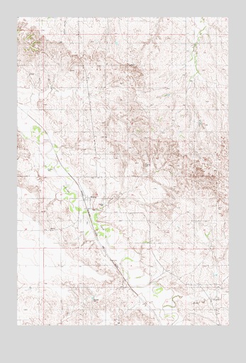
Mildred, MT USGS Topographic Map
Click on map above to begin viewing in our Map Viewer.

This topographic map contains these locations and features:
Feature Name Type Latitude Longitude GNIS ID View Map
10N53E13AA__01 WellWellN46.6258°W104.9877°817225View Map
10N54E04DC__01 WellWellN46.6433°W104.9302°817390View Map
10N54E04DDDD01 WellWellN46.6425°W104.9225°817383View Map
10N54E11CBBD01 WellWellN46.6339°W104.8997°817309View Map
11N54E02BCAA01 WellWellN46.7389°W104.8969°818031View Map
11N54E19CCBA01 WellWellN46.6886°W104.9827°817787View Map
11N54E28CC__01 WellWellN46.6722°W104.9405°817683View Map
11N54E28CCAC01 WellWellN46.6731°W104.9397°817696View Map
11N54E29AC__01 WellWellN46.6795°W104.9511°817737View Map
11N54E29CA__01 WellWellN46.6758°W104.9561°817719View Map
11N54E29CACB01 WellWellN46.6750°W104.9589°817710View Map
11N54E29CACB01 WellWellN46.6756°W104.9586°817715View Map
11N54E29CACD01 WellWellN46.6736°W104.9586°817699View Map
11N54E29CBCD01 WellWellN46.6745°W104.9616°817705View Map
11N54E29CBCD01 WellWellN46.6745°W104.9633°817706View Map
11N54E29CBDC01 WellWellN46.6731°W104.9630°817697View Map
11N54E29CBDC01 WellWellN46.6747°W104.9608°817707View Map
11N54E30DD__01 WellWellN46.6722°W104.9666°817684View Map
11N54E30DDA_01 WellWellN46.6725°W104.9658°817688View Map
11N54E30DDAD01 WellWellN46.6733°W104.9644°817698View Map
11N54E32ABCB01 WellWellN46.6689°W104.9527°817643View Map
11N54E33BBBD01 WellWellN46.6695°W104.9408°817649View Map
11N54E35DCDC01 WellWellN46.6564°W104.8866°817517View Map
Bagley Elevator (historical)LocaleN46.6764°W104.9605°1715769View Map
Columbia Elevator (historical)LocaleN46.6764°W104.9605°1715768View Map
Frieda Jones School (historical)SchoolN46.6272°W104.9011°1715694View Map
Marshall DamDamN46.6361°W104.9552°799198View Map
Meyers School (historical)SchoolN46.7289°W104.8864°1715715View Map
MildredLocaleN46.6767°W104.9608°1715650View Map
MildredPopulated PlaceN46.6758°W104.9600°774199View Map
Mildred Community ChurchChurchN46.6761°W104.9572°1715771View Map
Mildred Post Office (historical)Post OfficeN46.6767°W104.9589°1715649View Map
Mildred School (historical)SchoolN46.6764°W104.9583°1715716View Map
O'Fallon Creek BridgeBridgeN46.6725°W104.9594°1715758View Map
Pine CreekStreamN46.6314°W104.9152°775239View Map
Saint John the Baptist Church (historical)ChurchN46.6753°W104.9572°1715770View Map

Note: Coordinates in the location and feature list above are referenced to NAD83 datum.


Copyright (C) 2008-2025 Ryan Niemi / Sunset Dynamics ... All Rights Reserved