TopoQuest Logo
Do you find TopoQuest useful?
Help keep TopoQuest running and adding new maps/features by donating!
Bitcoin:  19c7KJd3qBynnjoSw5npx9KScwjBe4ifkT
Litecoin:  LXs6TkuXGGXo1vDsWCkWVdjQX94eUKd6ui
Home View Maps Find Maps Find Places Resources & Links


Jachin, Alabama Topographic Map

USGS Map Title: Jachin, AL
USGS Map MRC: 32088B2
DRG (GeoTIFF) Download: o32088b2.tif


Neighboring USGS Topographic Map Quads:


  Ward, AL  
32088C3
 

  Gaston, AL  
32088C2
 

  Whitfield, AL  
32088C1
 

  Lisman, AL  
32088B3
 

  Jachin, AL  
32088B2
 

  Pennington, AL  
32088B1
 

  Land, AL  
32088A3
 

  Butler, AL  
32088A2
 

  Putnam, AL  
32088A1


Map MRC Location:

N33°
W89°
N33°
W88°
H8 H7 H6 H5 H4 H3 H2 H1
G8 G7 G6 G5 G4 G3 G2 G1
F8 F7 F6 F5 F4 F3 F2 F1
E8 E7 E6 E5 E4 E3 E2 E1
D8 D7 D6 D5 D4 D3 D2 D1
C8 C7 C6 C5 C4 C3 C2 C1
B8 B7 B6 B5 B4 B3 B2 B1
A8 A7 A6 A5 A4 A3 A2 A1
N32°
W89°
N32°
W88°

Jachin, AL USGS 1:24K Topographic Map Preview:
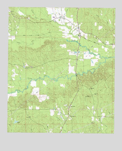
Jachin, AL USGS Topographic Map
Click on map above to begin viewing in our Map Viewer.

This topographic map contains these locations and features:
Feature Name Type Latitude Longitude GNIS ID View Map
Allison Lookout TowerTowerN32.1621°W88.1545°164272View Map
Bogue ChittoStreamN32.1768°W88.2228°114671View Map
Chapel HillPopulated PlaceN32.2399°W88.1886°115950View Map
Christ Temple ChurchChurchN32.1413°W88.1759°139981View Map
Christopher Chapel CemeteryCemeteryN32.2407°W88.1889°139982View Map
Christopher Chapel United Methodist ChurchChurchN32.2404°W88.1886°139983View Map
Clear CreekStreamN32.2165°W88.1692°116224View Map
Clear Creek Baptist ChurchChurchN32.2249°W88.1664°139984View Map
D T Hannah Lake DamDamN32.1351°W88.2417°130196View Map
Donald Hesselman LakeReservoirN32.1917°W88.2312°130260View Map
Donald Hesselman Lake DamDamN32.1901°W88.2300°130261View Map
Fuller BranchStreamN32.2246°W88.1761°118744View Map
Hannah LakeReservoirN32.1358°W88.2401°119686View Map
JachinPopulated PlaceN32.2299°W88.1684°155114View Map
Keahey Hunting ClubLocaleN32.2113°W88.1681°154721View Map
Lisman DivisionCivilN32.2427°W88.2134°165697View Map
Little WalkerPopulated PlaceN32.1504°W88.1778°121904View Map
Little Walker Christian Methodist Episcopal ChurchChurchN32.1415°W88.1761°152120View Map
Morning Star Baptist ChurchChurchN32.1640°W88.1484°152380View Map
Morning Star CemeteryCemeteryN32.1699°W88.1539°123057View Map
Morning Star ChurchChurchN32.1535°W88.1770°140064View Map
Mount Olive Baptist ChurchChurchN32.1401°W88.2242°152459View Map
Mount Olive CemeteryCemeteryN32.1401°W88.2245°140068View Map
Neals CreekStreamN32.2321°W88.1839°152587View Map
Pleasant Valley Baptist ChurchChurchN32.1893°W88.2289°153013View Map
RobjohnPopulated PlaceN32.2140°W88.1272°125740View Map
Shady Grove Christian Methodist Episcopal ChurchChurchN32.2457°W88.2475°153381View Map
Smith BranchStreamN32.2329°W88.1861°126999View Map
Sunshine School (historical)SchoolN32.1418°W88.1397°140135View Map
Tanyard CreekStreamN32.2374°W88.2020°140139View Map
Townsend BranchStreamN32.2376°W88.1353°140143View Map
Townsend CreekStreamN32.2399°W88.2195°153712View Map
Williams Crossroads (historical)LocaleN32.2246°W88.1550°140158View Map
Yantley CreekStreamN32.2001°W88.1342°154043View Map

Note: Coordinates in the location and feature list above are referenced to NAD83 datum.


Copyright (C) 2008-2025 Ryan Niemi / Sunset Dynamics ... All Rights Reserved