TopoQuest Logo
Do you find TopoQuest useful?
Help keep TopoQuest running and adding new maps/features by donating!
Bitcoin:  19c7KJd3qBynnjoSw5npx9KScwjBe4ifkT
Litecoin:  LXs6TkuXGGXo1vDsWCkWVdjQX94eUKd6ui
Home View Maps Find Maps Find Places Resources & Links


Whitfield, Alabama Topographic Map

USGS Map Title: Whitfield, AL
USGS Map MRC: 32088C1
DRG (GeoTIFF) Download: o32088c1.tif


Neighboring USGS Topographic Map Quads:


  Bellamy, AL  
32088D2
 

  Coatopa, AL  
32088D1
 

  Jefferson, AL  
32087D8
 

  Gaston, AL  
32088C2
 

  Whitfield, AL  
32088C1
 

  Myrtlewood North, AL  
32087C8
 

  Jachin, AL  
32088B2
 

  Pennington, AL  
32088B1
 

  Myrtlewood South, AL  
32087B8


Map MRC Location:

N33°
W89°
N33°
W88°
H8 H7 H6 H5 H4 H3 H2 H1
G8 G7 G6 G5 G4 G3 G2 G1
F8 F7 F6 F5 F4 F3 F2 F1
E8 E7 E6 E5 E4 E3 E2 E1
D8 D7 D6 D5 D4 D3 D2 D1
C8 C7 C6 C5 C4 C3 C2 C1
B8 B7 B6 B5 B4 B3 B2 B1
A8 A7 A6 A5 A4 A3 A2 A1
N32°
W89°
N32°
W88°

Whitfield, AL USGS 1:24K Topographic Map Preview:
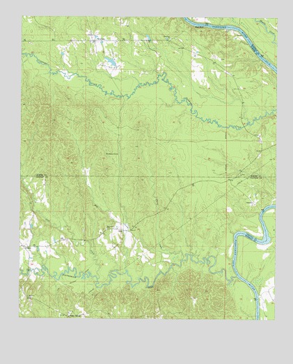
Whitfield, AL USGS Topographic Map
Click on map above to begin viewing in our Map Viewer.

This topographic map contains these locations and features:
Feature Name Type Latitude Longitude GNIS ID View Map
American Can Company DamDamN32.3551°W88.0800°130484View Map
American Can Company LakeReservoirN32.3566°W88.0812°130483View Map
Bethlehem CemeteryCemeteryN32.2871°W88.0828°114111View Map
Bethlehem Church (historical)ChurchN32.2863°W88.0820°139948View Map
Black BluffCliffN32.3715°W88.0381°158788View Map
Black Bluff CemeteryCemeteryN32.3646°W88.0511°158425View Map
Black Bluff ChurchChurchN32.3665°W88.0522°114395View Map
Black Bluff Landing (historical)LocaleN32.3718°W88.0439°134091View Map
Bullock BranchStreamN32.2882°W88.1020°139960View Map
Burll CreekStreamN32.2746°W88.0453°115241View Map
Cane CreekStreamN32.2665°W88.0867°115545View Map
Cetahoma LandingLocaleN32.2818°W88.0033°137584View Map
Crooms BarBarN32.3529°W88.0000°134119View Map
Crooms Lower LandingLocaleN32.3571°W88.0075°134120View Map
Crooms Upper LandingLocaleN32.3704°W88.0270°134121View Map
Cypress BranchStreamN32.3718°W88.0281°116987View Map
Double BarBarN32.2946°W88.0059°137600View Map
Dry CreekStreamN32.2704°W88.0728°117534View Map
Ebenezer Baptist ChurchChurchN32.3649°W88.0917°158126View Map
EdnaPopulated PlaceN32.2868°W88.0742°156299View Map
Indian SpringsPopulated PlaceN32.2524°W88.1009°156511View Map
Kinterbish CreekStreamN32.2679°W88.0186°157997View Map
Liberty LandingLocaleN32.2590°W88.0081°137620View Map
Maggs BluffCliffN32.2799°W88.0203°140044View Map
Montevallo ChurchChurchN32.3096°W88.0170°134193View Map
OakchiaPopulated PlaceN32.2985°W88.0106°156817View Map
Oakchia Fire Tower (historical)TowerN32.3243°W88.0081°134223View Map
Oakchia Landing (historical)LocaleN32.2951°W88.0075°140078View Map
PelhamPopulated PlaceN32.2796°W88.1200°152867View Map
Pelham United Methodist ChurchChurchN32.2793°W88.1175°140086View Map
Persimmon GrovePopulated PlaceN32.3182°W88.0772°156874View Map
Pine Grove ChurchChurchN32.2582°W88.1195°124785View Map
Robinson (historical)Populated PlaceN32.3688°W88.0145°1730265View Map
Saint Matthew Baptist ChurchChurchN32.3218°W88.0036°158132View Map
Steiners LandingLocaleN32.2846°W88.0203°140134View Map
T C Null DamDamN32.3551°W88.0350°130482View Map
T C Null LakeReservoirN32.3551°W88.0350°130481View Map
Troy (historical)Populated PlaceN32.3679°W88.0425°134276View Map
Turkey ShoalsBarN32.2851°W88.0175°137675View Map
WhitfieldPopulated PlaceN32.3654°W88.0903°153977View Map
Whitfield ChurchChurchN32.3654°W88.0939°134285View Map
Whitfield Volunteer Fire DepartmentBuildingN32.3652°W88.0906°2691466View Map
Zion ChurchChurchN32.2871°W88.0709°129336View Map

Note: Coordinates in the location and feature list above are referenced to NAD83 datum.


Copyright (C) 2008-2025 Ryan Niemi / Sunset Dynamics ... All Rights Reserved