TopoQuest Logo
Do you find TopoQuest useful?
Help keep TopoQuest running and adding new maps/features by donating!
Bitcoin:  19c7KJd3qBynnjoSw5npx9KScwjBe4ifkT
Litecoin:  LXs6TkuXGGXo1vDsWCkWVdjQX94eUKd6ui
Home View Maps Find Maps Find Places Resources & Links


Gaston, Alabama Topographic Map

USGS Map Title: Gaston, AL
USGS Map MRC: 32088C2
DRG (GeoTIFF) Download: o32088c2.tif


Neighboring USGS Topographic Map Quads:


  York, AL  
32088D3
 

  Bellamy, AL  
32088D2
 

  Coatopa, AL  
32088D1
 

  Ward, AL  
32088C3
 

  Gaston, AL  
32088C2
 

  Whitfield, AL  
32088C1
 

  Lisman, AL  
32088B3
 

  Jachin, AL  
32088B2
 

  Pennington, AL  
32088B1


Map MRC Location:

N33°
W89°
N33°
W88°
H8 H7 H6 H5 H4 H3 H2 H1
G8 G7 G6 G5 G4 G3 G2 G1
F8 F7 F6 F5 F4 F3 F2 F1
E8 E7 E6 E5 E4 E3 E2 E1
D8 D7 D6 D5 D4 D3 D2 D1
C8 C7 C6 C5 C4 C3 C2 C1
B8 B7 B6 B5 B4 B3 B2 B1
A8 A7 A6 A5 A4 A3 A2 A1
N32°
W89°
N32°
W88°

Gaston, AL USGS 1:24K Topographic Map Preview:
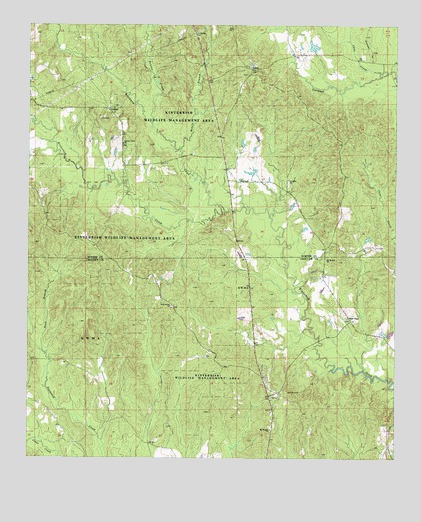
Gaston, AL USGS Topographic Map
Click on map above to begin viewing in our Map Viewer.

This topographic map contains these locations and features:
Feature Name Type Latitude Longitude GNIS ID View Map
Allison Derby DamDamN32.3668°W88.1534°130488View Map
Allison Derby LakeReservoirN32.3689°W88.1534°130487View Map
Brockway CreekStreamN32.3229°W88.1847°114937View Map
Bryan Store (historical)LocaleN32.3024°W88.1506°139957View Map
Burnam BranchStreamN32.2754°W88.1356°139961View Map
Campbell CemeteryCemeteryN32.3607°W88.1756°134103View Map
Cane CreekStreamN32.3615°W88.1306°115546View Map
Cedar Grove Baptist Church (historical)ChurchN32.3174°W88.2431°158124View Map
Cooper Mission Christian Methodist Episcopal ChurchChurchN32.2671°W88.1670°150898View Map
Cotohaga BeatCivilN32.3501°W88.1834°165638View Map
DerbyPopulated PlaceN32.3624°W88.1745°156267View Map
GastonPopulated PlaceN32.3510°W88.2236°156397View Map
Gaston ValleyLocaleN32.3426°W88.2178°134143View Map
Gaston Valley ChurchChurchN32.3410°W88.2181°118864View Map
Hickory Hill (historical)LocaleN32.3307°W88.1820°134157View Map
Hickory Hill Fire Tower (historical)TowerN32.3343°W88.1461°134158View Map
Hickory Hunting ClubLocaleN32.3368°W88.1947°134159View Map
Jack BranchStreamN32.2549°W88.2492°120743View Map
Mobile BranchStreamN32.3396°W88.1986°122919View Map
Mount Moriah Missionary Baptist ChurchChurchN32.3076°W88.1486°152443View Map
Mount Pisgah Baptist ChurchChurchN32.2585°W88.1672°152484View Map
Pine Grove African Methodist Episcopal Zion ChurchChurchN32.2943°W88.2014°152916View Map
Polecat CreekStreamN32.3468°W88.2081°153025View Map
Pritchetts Store (historical)LocaleN32.2813°W88.1881°140094View Map
Saint Johns ChurchChurchN32.3304°W88.1617°153255View Map
Saint Thomas African Methodist Episcopal Zion ChurchChurchN32.2829°W88.1270°154724View Map
Sand BranchStreamN32.2810°W88.2447°126297View Map
ShortsLocaleN32.3304°W88.1745°134253View Map
Shorts ChurchChurchN32.3307°W88.1775°126821View Map
Slay BranchStreamN32.2549°W88.2245°140129View Map
Ward Chapel African Methodist Episcopal Zion ChurchChurchN32.2907°W88.1411°153883View Map
Ward Chapel CemeteryCemeteryN32.2907°W88.1411°1805550View Map
Watkins Store (historical)LocaleN32.2515°W88.2178°140156View Map

Note: Coordinates in the location and feature list above are referenced to NAD83 datum.


Copyright (C) 2008-2025 Ryan Niemi / Sunset Dynamics ... All Rights Reserved