TopoQuest Logo
Do you find TopoQuest useful?
Help keep TopoQuest running and adding new maps/features by donating!
Bitcoin:  19c7KJd3qBynnjoSw5npx9KScwjBe4ifkT
Litecoin:  LXs6TkuXGGXo1vDsWCkWVdjQX94eUKd6ui
Home View Maps Find Maps Find Places Resources & Links


Jefferson, Maine Topographic Map

USGS Map Title: Jefferson, ME
USGS Map MRC: 44069B4
DRG (GeoTIFF) Download: o44069b4.tif


Neighboring USGS Topographic Map Quads:


  Weeks Mills, ME  
44069C5
 

  Razorville, ME  
44069C4
 

  Washington, ME  
44069C3
 

  North Whitefield, ME  
44069B5
 

  Jefferson, ME  
44069B4
 

  Union, ME  
44069B3
 

  Damariscotta, ME  
44069A5
 

  Waldoboro West, ME  
44069A4
 

  Waldoboro East, ME  
44069A3


Map MRC Location:

N45°
W70°
N45°
W69°
H8 H7 H6 H5 H4 H3 H2 H1
G8 G7 G6 G5 G4 G3 G2 G1
F8 F7 F6 F5 F4 F3 F2 F1
E8 E7 E6 E5 E4 E3 E2 E1
D8 D7 D6 D5 D4 D3 D2 D1
C8 C7 C6 C5 C4 C3 C2 C1
B8 B7 B6 B5 B4 B3 B2 B1
A8 A7 A6 A5 A4 A3 A2 A1
N44°
W70°
N44°
W69°

Jefferson, ME USGS 1:24K Topographic Map Preview:
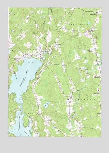
Jefferson, ME USGS Topographic Map
Click on map above to begin viewing in our Map Viewer.

This topographic map contains these locations and features:
Feature Name Type Latitude Longitude GNIS ID View Map
Benner BrookStreamN44.1406°W69.4128°562048View Map
Bird Feather IslandIslandN44.1909°W69.4808°2628402View Map
Bodge HillSummitN44.2083°W69.4926°562642View Map
Bogues CornerPopulated PlaceN44.1679°W69.3784°579146View Map
Camp KieveLocaleN44.1279°W69.4967°1909741View Map
Camp WavusPopulated PlaceN44.1859°W69.4909°563422View Map
Cooks PondLakeN44.1560°W69.4482°564321View Map
Damariscotta LakeLakeN44.1472°W69.4867°564753View Map
Damariscotta Lake FarmLocaleN44.2026°W69.4750°1909760View Map
Damariscotta Lake State ParkParkN44.1976°W69.4539°1909761View Map
Davis StreamStreamN44.1990°W69.4578°564828View Map
Eugley HillSummitN44.1412°W69.4473°565952View Map
Fairview CemeteryCemeteryN44.2117°W69.4417°566011View Map
First Baptist ChurchChurchN44.2045°W69.4753°1909789View Map
Flanders CornerPopulated PlaceN44.1901°W69.4042°579309View Map
Forest Lake CemeteryCemeteryN44.1409°W69.4431°566391View Map
GlobePopulated PlaceN44.2270°W69.3884°579337View Map
Great BayBayN44.1981°W69.4695°567120View Map
Haskell HillSummitN44.2245°W69.4631°567734View Map
JeffersonPopulated PlaceN44.2067°W69.4525°568784View Map
Jefferson Post OfficePost OfficeN44.2039°W69.4630°2789357View Map
Jefferson Village SchoolSchoolN44.2042°W69.4564°1909825View Map
Jefferson Volunteer Fire and Rescue Station 1BuildingN44.2019°W69.4578°2552684View Map
Jefferson Volunteer Fire and Rescue StorageBuildingN44.2002°W69.4525°2552971View Map
Kennedy CornerPopulated PlaceN44.1940°W69.4248°579449View Map
Kieve Wavus Education SchoolSchoolN44.1263°W69.4988°2738243View Map
Meadow BrookStreamN44.1859°W69.3923°571070View Map
Morang CoveBayN44.1384°W69.4717°571658View Map
North JeffersonPopulated PlaceN44.2137°W69.4373°572353View Map
North WaldoboroPopulated PlaceN44.1842°W69.3753°572424View Map
Oliver CemeteryCemeteryN44.2020°W69.3809°572742View Map
Orffs CornerPopulated PlaceN44.1637°W69.4148°572765View Map
Pitcher BrookStreamN44.2179°W69.4245°573456View Map
Robinson RidgeRidgeN44.1731°W69.4298°574334View Map
Robinson Ridge FieldAirportN44.1774°W69.4312°582167View Map
Saint Giles ChurchChurchN44.1995°W69.4920°574715View Map
Stickney CornerPopulated PlaceN44.2454°W69.3820°576342View Map
The NarrowsGapN44.1523°W69.4823°576867View Map
Tobias PondLakeN44.1340°W69.4387°577139View Map
West Branch Davis StreamStreamN44.2059°W69.4503°578046View Map

Note: Coordinates in the location and feature list above are referenced to NAD83 datum.


Copyright (C) 2008-2025 Ryan Niemi / Sunset Dynamics ... All Rights Reserved