TopoQuest Logo
Do you find TopoQuest useful?
Help keep TopoQuest running and adding new maps/features by donating!
Bitcoin:  19c7KJd3qBynnjoSw5npx9KScwjBe4ifkT
Litecoin:  LXs6TkuXGGXo1vDsWCkWVdjQX94eUKd6ui
Home View Maps Find Maps Find Places Resources & Links


North Whitefield, Maine Topographic Map

USGS Map Title: North Whitefield, ME
USGS Map MRC: 44069B5
DRG (GeoTIFF) Download: o44069b5.tif


Neighboring USGS Topographic Map Quads:


  Togus Pond, ME  
44069C6
 

  Weeks Mills, ME  
44069C5
 

  Razorville, ME  
44069C4
 

  East Pittston, ME  
44069B6
 

  North Whitefield, ME  
44069B5
 

  Jefferson, ME  
44069B4
 

  Wiscasset, ME  
44069A6
 

  Damariscotta, ME  
44069A5
 

  Waldoboro West, ME  
44069A4


Map MRC Location:

N45°
W70°
N45°
W69°
H8 H7 H6 H5 H4 H3 H2 H1
G8 G7 G6 G5 G4 G3 G2 G1
F8 F7 F6 F5 F4 F3 F2 F1
E8 E7 E6 E5 E4 E3 E2 E1
D8 D7 D6 D5 D4 D3 D2 D1
C8 C7 C6 C5 C4 C3 C2 C1
B8 B7 B6 B5 B4 B3 B2 B1
A8 A7 A6 A5 A4 A3 A2 A1
N44°
W70°
N44°
W69°

North Whitefield, ME USGS 1:24K Topographic Map Preview:
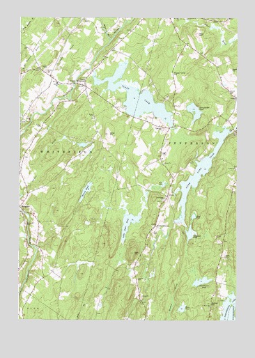
North Whitefield, ME USGS Topographic Map
Click on map above to begin viewing in our Map Viewer.

This topographic map contains these locations and features:
Feature Name Type Latitude Longitude GNIS ID View Map
Boynton-Trask DamDamN44.1658°W69.5358°1774322View Map
Brooks Turner HillSummitN44.2270°W69.5370°563019View Map
Bunker HillSummitN44.1320°W69.5149°563179View Map
Bunker Hill ChurchChurchN44.1309°W69.5145°563183View Map
Calvary CemeteryCemeteryN44.2284°W69.6100°563368View Map
Carlton BrookStreamN44.1767°W69.6237°563566View Map
Clary LakeReservoirN44.2170°W69.5580°564058View Map
Clary Saw Mill DamDamN44.2281°W69.5829°1773995View Map
Deer Meadow PondLakeN44.1412°W69.5197°564994View Map
Dyer HillSummitN44.1528°W69.5590°565464View Map
Dyer Long PondReservoirN44.1863°W69.5211°565471View Map
Finn BrookStreamN44.2231°W69.5937°566152View Map
Flood PondLakeN44.1680°W69.5246°566319View Map
Ford CemeteryCemeteryN44.1611°W69.5478°566374View Map
Health and Welfare CampLocaleN44.1945°W69.5420°1909812View Map
Highland CemeteryCemeteryN44.2042°W69.5425°568033View Map
Hopkins CemeteryCemeteryN44.1419°W69.5570°568249View Map
Horn PondLakeN44.1299°W69.5309°568267View Map
Jefferson Volunteer Fire and Rescue Station 2BuildingN44.1404°W69.5563°2553082View Map
Jones HillSummitN44.2020°W69.5741°568963View Map
Kerr PondLakeN44.1809°W69.5415°569130View Map
Little Dyer PondLakeN44.1648°W69.5619°569760View Map
Musquash PondLakeN44.1609°W69.5268°572021View Map
North WhitefieldPopulated PlaceN44.2220°W69.5873°572427View Map
North Whitefield Fire Department (historical)BuildingN44.2226°W69.5879°2552940View Map
Noyes CemeteryCemeteryN44.2098°W69.5826°572532View Map
Peter MountainSummitN44.2431°W69.5230°573230View Map
Potter CemeteryCemeteryN44.2365°W69.5725°1909916View Map
Preble CemeteryCemeteryN44.2053°W69.6128°573769View Map
Prestile StreamReservoirN44.2034°W69.5245°1774387View Map
Saint Denis ChurchChurchN44.2287°W69.6137°574701View Map
Shepherd CemeteryCemeteryN44.2176°W69.5000°575382View Map
South JeffersonPopulated PlaceN44.1640°W69.5470°579718View Map
Three Corner PondReservoirN44.2128°W69.5268°577053View Map
Three Corner Pond DamDamN44.2050°W69.5281°1774324View Map
Town of JeffersonCivilN44.1848°W69.5085°582535View Map
Town of WhitefieldCivilN44.2052°W69.6126°582811View Map
Trask Lawn CemeteryCemeteryN44.1748°W69.5414°577281View Map
United ChurchChurchN44.1740°W69.5428°577558View Map
Weary PondLakeN44.1784°W69.5867°577914View Map
Weeks CemeteryCemeteryN44.1515°W69.5064°577973View Map
West Branch Sheepscot RiverStreamN44.2406°W69.5728°578091View Map
Whitefield CemeteryCemeteryN44.1645°W69.6212°578379View Map
Whitefield Elementary SchoolSchoolN44.2229°W69.6036°578380View Map
Whitefield Fire and RescueBuildingN44.2234°W69.6066°2553047View Map
Whitefield Post OfficePost OfficeN44.2209°W69.5849°1909985View Map

Note: Coordinates in the location and feature list above are referenced to NAD83 datum.


Copyright (C) 2008-2024 Ryan Niemi / Sunset Dynamics ... All Rights Reserved