TopoQuest Logo
Do you find TopoQuest useful?
Help keep TopoQuest running and adding new maps/features by donating!
Bitcoin:  19c7KJd3qBynnjoSw5npx9KScwjBe4ifkT
Litecoin:  LXs6TkuXGGXo1vDsWCkWVdjQX94eUKd6ui
Home View Maps Find Maps Find Places Resources & Links


Jenkins, Missouri Topographic Map

USGS Map Title: Jenkins, MO
USGS Map MRC: 36093G6
DRG (GeoTIFF) Download: o36093g6.tif


Neighboring USGS Topographic Map Quads:


  Verona, MO  
36093H7
 

  Aurora, MO  
36093H6
 

  Crane, MO  
36093H5
 

  McDowell, MO  
36093G7
 

  Jenkins, MO  
36093G6
 

  Elsey, MO  
36093G5
 

  Cassville, MO  
36093F7
 

  Shell Knob, MO  
36093F6
 

  Cape Fair, MO  
36093F5


Map MRC Location:

N37°
W94°
N37°
W93°
H8 H7 H6 H5 H4 H3 H2 H1
G8 G7 G6 G5 G4 G3 G2 G1
F8 F7 F6 F5 F4 F3 F2 F1
E8 E7 E6 E5 E4 E3 E2 E1
D8 D7 D6 D5 D4 D3 D2 D1
C8 C7 C6 C5 C4 C3 C2 C1
B8 B7 B6 B5 B4 B3 B2 B1
A8 A7 A6 A5 A4 A3 A2 A1
N36°
W94°
N36°
W93°

Jenkins, MO USGS 1:24K Topographic Map Preview:
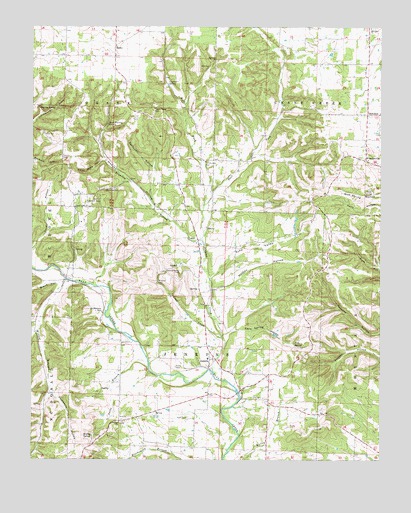
Jenkins, MO USGS Topographic Map
Click on map above to begin viewing in our Map Viewer.

This topographic map contains these locations and features:
Feature Name Type Latitude Longitude GNIS ID View Map
Aurora Rural Fire Department Station 2BuildingN36.8707°W93.7167°2621321View Map
Bean Factory SpringSpringN36.8470°W93.7230°713770View Map
Black HollowValleyN36.8015°W93.7419°714293View Map
Brantley BranchStreamN36.8134°W93.6888°714641View Map
Cave SpringSpringN36.7837°W93.6560°715527View Map
Cave Spring HollowValleyN36.7867°W93.6791°715549View Map
Clay Hill School (historical)SchoolN36.8742°W93.7255°742567View Map
Clio CemeteryCemeteryN36.7678°W93.6666°716001View Map
Clio School (historical)SchoolN36.7570°W93.6652°742570View Map
Coon CreekStreamN36.7853°W93.6816°716240View Map
Core HollowValleyN36.8101°W93.7499°716310View Map
Echo ValleyValleyN36.8026°W93.6858°717392View Map
Gardener HollowValleyN36.8342°W93.7066°718337View Map
Gum SpringSpringN36.8267°W93.6285°718925View Map
Hobson HollowValleyN36.8137°W93.6902°719653View Map
Jacks BranchStreamN36.7781°W93.7080°720197View Map
JenkinsPopulated PlaceN36.7787°W93.6860°720287View Map
Jenkins CreekStreamN36.7751°W93.6849°720293View Map
Jenkins Lookout TowerTowerN36.8253°W93.7255°755237View Map
Jenkins Rural Fire Department HeadquartersBuildingN36.7706°W93.6752°2621734View Map
Jenkins School (historical)SchoolN36.7792°W93.6870°732875View Map
Kane CemeteryCemeteryN36.7620°W93.6938°720470View Map
Lead Mine HollowValleyN36.8364°W93.7244°720864View Map
LeannPopulated PlaceN36.8128°W93.6902°741007View Map
Leann CemeteryCemeteryN36.8128°W93.6915°2681290View Map
Leann School (historical)SchoolN36.8128°W93.6913°732873View Map
Liberty Union ChurchChurchN36.8228°W93.7344°721007View Map
Lone Elm School (historical)SchoolN36.7617°W93.7113°742571View Map
MadryPopulated PlaceN36.8695°W93.7202°741035View Map
Mars Hill CemeteryCemeteryN36.8749°W93.6282°721897View Map
Mars Hill ChurchChurchN36.8748°W93.6291°721898View Map
Nathan HollowValleyN36.7992°W93.6855°723125View Map
Ozark School (historical)SchoolN36.8362°W93.6882°742568View Map
Pokeberry HollowValleyN36.7692°W93.7427°724697View Map
Potter CemeteryCemeteryN36.7770°W93.6982°724791View Map
Roaring SpringSpringN36.8512°W93.7480°725376View Map
RoarkLocaleN36.7906°W93.7255°740432View Map
Roark HollowValleyN36.7867°W93.7491°725384View Map
Roark Post Office (historical)Post OfficeN36.7906°W93.7255°759828View Map
ScholtenPopulated PlaceN36.8498°W93.6296°726111View Map
Scholten School (historical)SchoolN36.8494°W93.6278°732874View Map
Shiloah ChurchChurchN36.7609°W93.7185°726357View Map
Stubblefield CemeteryCemeteryN36.7928°W93.7246°727193View Map
Township of Crane CreekCivilN36.8728°W93.6481°766253View Map
Township of JenkinsCivilN36.7806°W93.6916°766256View Map
Upshaw SpringSpringN36.8587°W93.7013°728080View Map
West Fork Jenkins CreekStreamN36.8234°W93.6883°728565View Map
WheelervillePopulated PlaceN36.8362°W93.6294°728694View Map
Willow BranchStreamN36.8023°W93.7383°752920View Map
Willow Branch School (historical)SchoolN36.7703°W93.7421°742569View Map
Worley SpringSpringN36.7567°W93.7285°729149View Map

Note: Coordinates in the location and feature list above are referenced to NAD83 datum.


Copyright (C) 2008-2025 Ryan Niemi / Sunset Dynamics ... All Rights Reserved