TopoQuest Logo
Do you find TopoQuest useful?
Help keep TopoQuest running and adding new maps/features by donating!
Bitcoin:  19c7KJd3qBynnjoSw5npx9KScwjBe4ifkT
Litecoin:  LXs6TkuXGGXo1vDsWCkWVdjQX94eUKd6ui
Home View Maps Find Maps Find Places Resources & Links


Crane, Missouri Topographic Map

USGS Map Title: Crane, MO
USGS Map MRC: 36093H5
DRG (GeoTIFF) Download: o36093h5.tif


Neighboring USGS Topographic Map Quads:


  Chesapeake, MO  
37093A6
 

  Billings, MO  
37093A5
 

  Republic, MO  
37093A4
 

  Aurora, MO  
36093H6
 

  Crane, MO  
36093H5
 

  Hurley, MO  
36093H4
 

  Jenkins, MO  
36093G6
 

  Elsey, MO  
36093G5
 

  Galena, MO  
36093G4


Map MRC Location:

N37°
W94°
N37°
W93°
H8 H7 H6 H5 H4 H3 H2 H1
G8 G7 G6 G5 G4 G3 G2 G1
F8 F7 F6 F5 F4 F3 F2 F1
E8 E7 E6 E5 E4 E3 E2 E1
D8 D7 D6 D5 D4 D3 D2 D1
C8 C7 C6 C5 C4 C3 C2 C1
B8 B7 B6 B5 B4 B3 B2 B1
A8 A7 A6 A5 A4 A3 A2 A1
N36°
W94°
N36°
W93°

Crane, MO USGS 1:24K Topographic Map Preview:
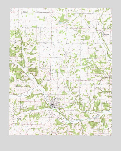
Crane, MO USGS Topographic Map
Click on map above to begin viewing in our Map Viewer.

This topographic map contains these locations and features:
Feature Name Type Latitude Longitude GNIS ID View Map
Blackjack School (historical)SchoolN36.9259°W93.5385°742550View Map
Bland SpringSpringN36.9178°W93.5038°732896View Map
BradfieldPopulated PlaceN36.9662°W93.5746°740344View Map
Brown Springs SchoolSchoolN36.9756°W93.5060°732898View Map
Browns SpringPopulated PlaceN36.9739°W93.5107°735534View Map
Bur Oak HollowValleyN36.8817°W93.5677°715059View Map
Cedar Hill SchoolSchoolN36.8956°W93.5174°742548View Map
Center RidgeRidgeN36.9809°W93.5169°715653View Map
Charity CemeteryCemeteryN36.9659°W93.5819°715739View Map
Charity School (historical)SchoolN36.9731°W93.5835°742549View Map
City of CraneCivilN36.9027°W93.5716°2393662View Map
CranePopulated PlaceN36.9053°W93.5716°716460View Map
Crane CemeteryCemeteryN36.9047°W93.5572°2703073View Map
Crane City Fire DepartmentBuildingN36.9039°W93.5725°2621023View Map
Crane Police DepartmentBuildingN36.9043°W93.5721°2752129View Map
Crane Post OfficePost OfficeN36.9047°W93.5733°2782824View Map
Crane School (historical)SchoolN36.8962°W93.5713°732899View Map
Crane Structure Number 1 DamDamN36.9084°W93.5702°763397View Map
Crane Structure Number 1 ReservoirReservoirN36.9084°W93.5702°763398View Map
Dodge HollowValleyN36.9001°W93.5724°716939View Map
Elm SpringSpringN36.9642°W93.6105°717533View Map
Hilton HollowValleyN36.8867°W93.5563°719624View Map
Hood CemeteryCemeteryN36.9306°W93.5396°719772View Map
Little Crane CreekStreamN36.9239°W93.5891°721194View Map
Little Crane ValleyValleyN36.9223°W93.5916°721195View Map
Masonic CemeteryCemeteryN36.9048°W93.5574°721956View Map
McCord BranchStreamN36.8998°W93.5074°722054View Map
North Stone Northeast Barry County Fire District Station 23BuildingN36.9134°W93.5794°2620268View Map
Oak Grove CemeteryCemeteryN36.9289°W93.5796°723561View Map
Oak Grove School (historical)LocaleN36.9284°W93.5794°742551View Map
Pierson ChurchChurchN36.9662°W93.5741°724324View Map
QuailPopulated PlaceN36.8951°W93.5155°741181View Map
Rickman SpringSpringN36.9320°W93.5063°725289View Map
Shiloh ChurchChurchN36.9651°W93.5563°726369View Map
Steele CemeteryCemeteryN36.9884°W93.5249°727051View Map
Steele SpringSpringN36.9556°W93.5066°727053View Map
Terrapin SpringSpringN36.9114°W93.5221°727538View Map
Township of GrantCivilN36.9576°W93.5689°767427View Map
Township of PierceCivilN36.8917°W93.5599°767431View Map

Note: Coordinates in the location and feature list above are referenced to NAD83 datum.


Copyright (C) 2008-2024 Ryan Niemi / Sunset Dynamics ... All Rights Reserved