TopoQuest Logo
Do you find TopoQuest useful?
Help keep TopoQuest running and adding new maps/features by donating!
Bitcoin:  19c7KJd3qBynnjoSw5npx9KScwjBe4ifkT
Litecoin:  LXs6TkuXGGXo1vDsWCkWVdjQX94eUKd6ui
Home View Maps Find Maps Find Places Resources & Links


McDowell, Missouri Topographic Map

USGS Map Title: McDowell, MO
USGS Map MRC: 36093G7
DRG (GeoTIFF) Download: o36093g7.tif


Neighboring USGS Topographic Map Quads:


  Monett, MO  
36093H8
 

  Verona, MO  
36093H7
 

  Aurora, MO  
36093H6
 

  Purdy, MO  
36093G8
 

  McDowell, MO  
36093G7
 

  Jenkins, MO  
36093G6
 

  Exeter, MO  
36093F8
 

  Cassville, MO  
36093F7
 

  Shell Knob, MO  
36093F6


Map MRC Location:

N37°
W94°
N37°
W93°
H8 H7 H6 H5 H4 H3 H2 H1
G8 G7 G6 G5 G4 G3 G2 G1
F8 F7 F6 F5 F4 F3 F2 F1
E8 E7 E6 E5 E4 E3 E2 E1
D8 D7 D6 D5 D4 D3 D2 D1
C8 C7 C6 C5 C4 C3 C2 C1
B8 B7 B6 B5 B4 B3 B2 B1
A8 A7 A6 A5 A4 A3 A2 A1
N36°
W94°
N36°
W93°

McDowell, MO USGS 1:24K Topographic Map Preview:
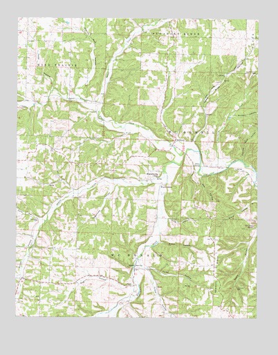
McDowell, MO USGS Topographic Map
Click on map above to begin viewing in our Map Viewer.

This topographic map contains these locations and features:
Feature Name Type Latitude Longitude GNIS ID View Map
Baldwin HollowValleyN36.8348°W93.7630°713596View Map
Bennett RidgeRidgeN36.7698°W93.7721°713954View Map
Bethel ChurchChurchN36.8653°W93.8699°714042View Map
Bethel School (historical)SchoolN36.8606°W93.8699°732866View Map
Brights SpringSpringN36.8051°W93.8005°735528View Map
Brights Spring KnollSummitN36.8092°W93.8013°714705View Map
Bullington CemeteryCemeteryN36.7906°W93.8638°715029View Map
Calls HollowValleyN36.7906°W93.8627°715208View Map
Calton CreekStreamN36.8401°W93.8313°715210View Map
Camp Bliss HollowValleyN36.8234°W93.7838°715240View Map
Cedar Bluff School (historical)SchoolN36.7988°W93.8022°732871View Map
Cross HollowValleyN36.7695°W93.8071°749533View Map
Dog HollowValleyN36.7623°W93.8158°716956View Map
Easyville ChurchChurchN36.8415°W93.8483°717369View Map
Gunter CreekStreamN36.8123°W93.7991°718940View Map
Gunter HollowValleyN36.8076°W93.8038°718941View Map
Hilton SpringSpringN36.8142°W93.7830°719625View Map
Kemp HollowValleyN36.7712°W93.8088°720526View Map
King HollowValleyN36.7920°W93.7963°720612View Map
Little Flat CreekStreamN36.8184°W93.7877°721232View Map
Log ChurchChurchN36.7584°W93.8627°721407View Map
Lone Hill School (historical)SchoolN36.8681°W93.7971°732867View Map
Marbut School (historical)SchoolN36.8392°W93.8388°2710111View Map
McDowellPopulated PlaceN36.8242°W93.7933°722092View Map
McDowell Post OfficePost OfficeN36.8242°W93.7933°1940220View Map
McDowell School (historical)SchoolN36.8276°W93.7946°732868View Map
Mill HollowValleyN36.8095°W93.7805°722348View Map
Onion HollowValleyN36.7820°W93.8008°723826View Map
Prairie Run HollowValleyN36.8426°W93.8435°724877View Map
Sparks CemeteryCemeteryN36.7637°W93.8149°726829View Map
Sparks School (historical)SchoolN36.7634°W93.8140°732872View Map
Stansberry CreekStreamN36.8137°W93.7652°735866View Map
Star CityPopulated PlaceN36.7703°W93.8138°727015View Map
Star School (historical)SchoolN36.8051°W93.7510°732869View Map
Sugartree HollowValleyN36.8053°W93.8258°727266View Map
Swallow Bluff HollowValleyN36.8159°W93.7580°727353View Map
Todd HollowValleyN36.8426°W93.8455°727692View Map
Township of McDonaldCivilN36.7755°W93.8244°766259View Map
Township of McDowellCivilN36.8243°W93.7866°766260View Map
Victory ChurchChurchN36.7831°W93.7727°728188View Map
Victory School (historical)SchoolN36.7823°W93.7719°732870View Map
Wall Bluff SpringSpringN36.7884°W93.7521°728272View Map

Note: Coordinates in the location and feature list above are referenced to NAD83 datum.


Copyright (C) 2008-2025 Ryan Niemi / Sunset Dynamics ... All Rights Reserved