TopoQuest Logo
Do you find TopoQuest useful?
Help keep TopoQuest running and adding new maps/features by donating!
Bitcoin:  19c7KJd3qBynnjoSw5npx9KScwjBe4ifkT
Litecoin:  LXs6TkuXGGXo1vDsWCkWVdjQX94eUKd6ui
Home View Maps Find Maps Find Places Resources & Links


Verona, Missouri Topographic Map

USGS Map Title: Verona, MO
USGS Map MRC: 36093H7
DRG (GeoTIFF) Download: o36093h7.tif


Neighboring USGS Topographic Map Quads:


  Stotts City, MO  
37093A8
 

  Mount Vernon, MO  
37093A7
 

  Chesapeake, MO  
37093A6
 

  Monett, MO  
36093H8
 

  Verona, MO  
36093H7
 

  Aurora, MO  
36093H6
 

  Purdy, MO  
36093G8
 

  McDowell, MO  
36093G7
 

  Jenkins, MO  
36093G6


Map MRC Location:

N37°
W94°
N37°
W93°
H8 H7 H6 H5 H4 H3 H2 H1
G8 G7 G6 G5 G4 G3 G2 G1
F8 F7 F6 F5 F4 F3 F2 F1
E8 E7 E6 E5 E4 E3 E2 E1
D8 D7 D6 D5 D4 D3 D2 D1
C8 C7 C6 C5 C4 C3 C2 C1
B8 B7 B6 B5 B4 B3 B2 B1
A8 A7 A6 A5 A4 A3 A2 A1
N36°
W94°
N36°
W93°

Verona, MO USGS 1:24K Topographic Map Preview:
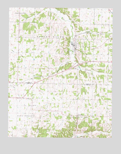
Verona, MO USGS Topographic Map
Click on map above to begin viewing in our Map Viewer.

This topographic map contains these locations and features:
Feature Name Type Latitude Longitude GNIS ID View Map
Browning HollowValleyN36.9495°W93.7983°714795View Map
Calton CemeteryCemeteryN36.8784°W93.7952°715209View Map
Chat CreekStreamN36.9776°W93.7530°715751View Map
Crescent School (historical)SchoolN36.9320°W93.8094°746447View Map
Douger BranchStreamN36.9748°W93.7977°717003View Map
GlobePopulated PlaceN36.9309°W93.8455°740876View Map
Kings Prairie School (historical)SchoolN36.9056°W93.8508°732852View Map
Line School (historical)SchoolN36.9295°W93.7733°746446View Map
Monett Rural Fire Association Station 2BuildingN36.8962°W93.8280°2620588View Map
New Liberty ChurchChurchN36.9059°W93.8458°723274View Map
Pleasant RidgePopulated PlaceN36.8964°W93.7916°724579View Map
Pleasant Ridge Census Designated PlaceCensusN36.8971°W93.7919°2587103View Map
Pleasant Ridge School (historical)SchoolN36.8962°W93.7921°732853View Map
Spring River CemeteryCemeteryN36.9420°W93.7921°726946View Map
Town of VeronaCivilN36.9631°W93.7936°2397714View Map
Township of Kings PrairieCivilN36.8773°W93.8681°766257View Map
Township of Pleasant RidgeCivilN36.8915°W93.7923°766266View Map
Township of Spring RiverCivilN36.9705°W93.8143°766889View Map
VeronaPopulated PlaceN36.9639°W93.7958°728175View Map
Verona Elementary SchoolSchoolN36.9608°W93.7938°2710311View Map
Verona High SchoolSchoolN36.9611°W93.7938°2710310View Map
Verona Police DepartmentBuildingN36.9646°W93.7960°2752251View Map
Verona Post OfficePost OfficeN36.9627°W93.7960°2782603View Map
Verona Volunteer Fire DepartmentBuildingN36.9647°W93.7959°2621730View Map
Wade School (historical)SchoolN36.9884°W93.7721°746445View Map
Wheeler School (historical)SchoolN36.9426°W93.8596°746443View Map
Wilkes School (historical)SchoolN36.9875°W93.7990°746444View Map
Wolf School (historical)SchoolN36.9714°W93.8588°746442View Map

Note: Coordinates in the location and feature list above are referenced to NAD83 datum.


Copyright (C) 2008-2025 Ryan Niemi / Sunset Dynamics ... All Rights Reserved