TopoQuest Logo
Do you find TopoQuest useful?
Help keep TopoQuest running and adding new maps/features by donating!
Bitcoin:  19c7KJd3qBynnjoSw5npx9KScwjBe4ifkT
Litecoin:  LXs6TkuXGGXo1vDsWCkWVdjQX94eUKd6ui
Home View Maps Find Maps Find Places Resources & Links


Aragon, New Mexico Topographic Map

USGS Map Title: Aragon, NM
USGS Map MRC: 33108H5
DRG (GeoTIFF) Download: o33108h5.tif


Neighboring USGS Topographic Map Quads:


  Gallo Mountains West, NM  
34108A6
 

  Gallo Mountains East, NM  
34108A5
 

  Slaughter Mesa, NM  
34108A4
 

  Queens Head, NM  
33108H6
 

  Aragon, NM  
33108H5
 

  Tularosa Canyon, NM  
33108H4
 

  Cruzville, NM  
33108G6
 

  Squirrel Springs Canyon, NM  
33108G5
 

  John Kerr Peak, NM  
33108G4


Map MRC Location:

N34°
W109°
N34°
W108°
H8 H7 H6 H5 H4 H3 H2 H1
G8 G7 G6 G5 G4 G3 G2 G1
F8 F7 F6 F5 F4 F3 F2 F1
E8 E7 E6 E5 E4 E3 E2 E1
D8 D7 D6 D5 D4 D3 D2 D1
C8 C7 C6 C5 C4 C3 C2 C1
B8 B7 B6 B5 B4 B3 B2 B1
A8 A7 A6 A5 A4 A3 A2 A1
N33°
W109°
N33°
W108°

Aragon, NM USGS 1:24K Topographic Map Preview:
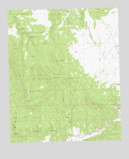
Aragon, NM USGS Topographic Map
Click on map above to begin viewing in our Map Viewer.

This topographic map contains these locations and features:
Feature Name Type Latitude Longitude GNIS ID View Map
Apache MountainSummitN33.9342°W108.6123°903230View Map
Apache Mountain TankReservoirN33.9227°W108.6037°903231View Map
Apache SpringSpringN33.8949°W108.6187°903238View Map
AragonPopulated PlaceN33.8812°W108.5390°923552View Map
Aragon Census Designated PlaceCensusN33.8899°W108.5202°2584050View Map
Banta SpringSpringN33.8857°W108.5798°903544View Map
Bull Camp CanyonValleyN33.9609°W108.5292°904173View Map
Castillo TankReservoirN33.9590°W108.5483°904829View Map
Cruzville - Apache Creek / Aragon Fire Department AragonBuildingN33.8816°W108.5360°2658145View Map
Deep WellWellN33.9801°W108.5384°905674View Map
E Robertson TankReservoirN33.9884°W108.5248°913257View Map
Fort Tularosa (historical)MilitaryN33.8811°W108.5383°932882View Map
Horse Pasture TankReservoirN33.9300°W108.5235°907105View Map
Indio Road TankReservoirN33.9635°W108.5045°907239View Map
Jacob Draw TankReservoirN33.9559°W108.6000°907296View Map
Kline TankReservoirN33.9545°W108.5490°913258View Map
Malpais SpringSpringN33.9681°W108.5855°908379View Map
Mata SpringSpringN33.9744°W108.5995°908459View Map
Means TankReservoirN33.9979°W108.5204°908551View Map
Miller SpringSpringN33.8896°W108.6212°908754View Map
Negrito SpringsSpringN33.9350°W108.5740°909041View Map
Negrito TankReservoirN33.9456°W108.5621°913249View Map
Negro CanyonValleyN33.8806°W108.5562°909044View Map
New Red Steer TankReservoirN33.8981°W108.6172°909064View Map
NH TankReservoirN33.9992°W108.5970°909003View Map
Orono SpringSpringN33.9939°W108.5570°913255View Map
Owl Water SpringSpringN33.8979°W108.5589°909408View Map
Pit TankReservoirN33.8971°W108.5821°909740View Map
Rankin TankReservoirN33.9987°W108.5258°910012View Map
Red Steer SpringSpringN33.8834°W108.6206°910082View Map
Rock SpringSpringN33.9784°W108.5893°910378View Map
Sand Flat Airstrip (historical)AirportN33.9562°W108.5237°913256View Map
Sand SpringSpringN33.9636°W108.6201°910734View Map
Sand TankReservoirN33.9754°W108.5706°910736View Map
Santonino SchoolSchoolN33.8820°W108.5406°910810View Map
Spring TankReservoirN33.8980°W108.6005°911341View Map
Tularosa MountainSummitN33.9067°W108.5259°911850View Map
Tularosa MountainsRangeN33.9067°W108.5259°920719View Map
Tularosa SpringSpringN33.9039°W108.5032°911851View Map
Tularosa TankReservoirN33.9264°W108.5342°911852View Map
Willow Bush SpringSpringN33.8854°W108.5945°912398View Map

Note: Coordinates in the location and feature list above are referenced to NAD83 datum.


Copyright (C) 2008-2024 Ryan Niemi / Sunset Dynamics ... All Rights Reserved