TopoQuest Logo
Do you find TopoQuest useful?
Help keep TopoQuest running and adding new maps/features by donating!
Bitcoin:  19c7KJd3qBynnjoSw5npx9KScwjBe4ifkT
Litecoin:  LXs6TkuXGGXo1vDsWCkWVdjQX94eUKd6ui
Home View Maps Find Maps Find Places Resources & Links


Le Roy, Kansas Topographic Map

USGS Map Title: Le Roy, KS
USGS Map MRC: 38095A6
DRG (GeoTIFF) Download: o38095a6.tif


Neighboring USGS Topographic Map Quads:


  John Redmond Dam, KS  
38095B7
 

  Burlington, KS  
38095B6
 

  Aliceville, KS  
38095B5
 

  Gridley SE, KS  
38095A7
 

  Le Roy, KS  
38095A6
 

  Neosho Falls, KS  
38095A5
 

  Toronto NE, KS  
37095H7
 

  Yates Center, KS  
37095H6
 

  Piqua, KS  
37095H5


Map MRC Location:

N39°
W96°
N39°
W95°
H8 H7 H6 H5 H4 H3 H2 H1
G8 G7 G6 G5 G4 G3 G2 G1
F8 F7 F6 F5 F4 F3 F2 F1
E8 E7 E6 E5 E4 E3 E2 E1
D8 D7 D6 D5 D4 D3 D2 D1
C8 C7 C6 C5 C4 C3 C2 C1
B8 B7 B6 B5 B4 B3 B2 B1
A8 A7 A6 A5 A4 A3 A2 A1
N38°
W96°
N38°
W95°

Le Roy, KS USGS 1:24K Topographic Map Preview:
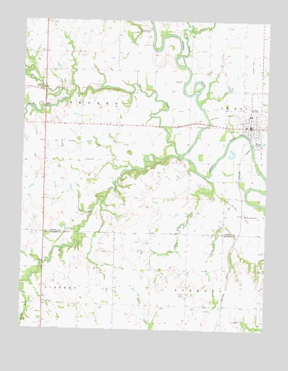
Le Roy, KS USGS Topographic Map
Click on map above to begin viewing in our Map Viewer.

This topographic map contains these locations and features:
Feature Name Type Latitude Longitude GNIS ID View Map
Big CreekStreamN38.0709°W95.6694°478089View Map
Bloody RunStreamN38.0150°W95.7492°474471View Map
Byron (historical)LocaleN38.0098°W95.7225°482694View Map
City of LeRoyCivilN38.0863°W95.6331°2395685View Map
Coffey County Fire District 1 Station 5BuildingN38.0815°W95.6333°2111212View Map
Coffey County Library LeRoy BranchBuildingN38.0841°W95.6339°2694696View Map
Crandall (historical)LocaleN38.0681°W95.7064°481859View Map
Crandell CemeteryCemeteryN38.0685°W95.7187°478084View Map
Desloover Mobile Home ParkPopulated PlaceN38.0873°W95.6305°2694078View Map
Duck CreekStreamN38.0175°W95.7500°478074View Map
Duck CreekStreamN38.0625°W95.6578°478082View Map
Excelsior School (historical)SchoolN38.0092°W95.6286°484231View Map
Fairview School (historical)SchoolN38.0103°W95.6828°484232View Map
First Christian Church of LeroyChurchN38.0847°W95.6318°2690741View Map
Le Roy CemeteryCemeteryN38.0820°W95.6458°478085View Map
Le Roy Co - Operative Association Grain Elevator Number 1LocaleN38.0830°W95.6312°2695178View Map
Le Roy Post OfficePost OfficeN38.0824°W95.6328°2693815View Map
LeRoyPopulated PlaceN38.0839°W95.6344°478086View Map
Leroy Airport (historical)AirportN38.1084°W95.6336°481357View Map
LeRoy Assembly of God ChurchChurchN38.0824°W95.6325°2690768View Map
Leroy City HallBuildingN38.0838°W95.6338°2693062View Map
Leroy City Sewer Treatment PlantLocaleN38.0760°W95.6266°2693489View Map
Leroy Elementary SchoolSchoolN38.0869°W95.6332°481240View Map
LeRoy High SchoolSchoolN38.0870°W95.6339°481241View Map
Leroy Police DepartmentBuildingN38.0837°W95.6339°2503782View Map
LeRoy United Methodist ChurchChurchN38.0846°W95.6347°2690228View Map
Long CreekStreamN38.1070°W95.6678°477478View Map
Lorenz Schlichter Memorial CemeteryCemeteryN38.1212°W95.6922°478087View Map
Moody IntersectionLocaleN38.0461°W95.6364°478083View Map
Neosho City (historical)LocaleN38.0820°W95.7008°482477View Map
North Big CreekStreamN38.0947°W95.7267°477851View Map
Phelps School (historical)SchoolN38.0100°W95.7305°484262View Map
Prairie Rose School (historical)SchoolN38.0386°W95.6839°484270View Map
Seward Avenue Baptist ChurchChurchN38.0586°W95.6542°480062View Map
South Big CreekStreamN38.0947°W95.7267°478088View Map
Southern Coffey County High SchoolSchoolN38.0869°W95.6340°2437501View Map
Township of LeRoyCivilN38.0896°W95.6376°478092View Map
Township of NeoshoCivilN38.0829°W95.7387°477863View Map
Turkey CreekStreamN38.0700°W95.6700°474459View Map

Note: Coordinates in the location and feature list above are referenced to NAD83 datum.


Copyright (C) 2008-2025 Ryan Niemi / Sunset Dynamics ... All Rights Reserved