TopoQuest Logo
Do you find TopoQuest useful?
Help keep TopoQuest running and adding new maps/features by donating!
Bitcoin:  19c7KJd3qBynnjoSw5npx9KScwjBe4ifkT
Litecoin:  LXs6TkuXGGXo1vDsWCkWVdjQX94eUKd6ui
Home View Maps Find Maps Find Places Resources & Links


Johnny Moore Mountain, Colorado Topographic Map

USGS Map Title: Johnny Moore Mountain, CO
USGS Map MRC: 40106F1
DRG (GeoTIFF) Download: o40106f1.tif


Neighboring USGS Topographic Map Quads:


  Eagle Hill, CO  
40106G2
 

  Shipman Mountain, CO  
40106G1
 

  Glendevey, CO  
40105G8
 

  Gould NW, CO  
40106F2
 

  Johnny Moore Mountain, CO  
40106F1
 

  Rawah Lakes, CO  
40105F8
 

  Owl Ridge, CO  
40106E2
 

  Gould, CO  
40106E1
 

  Clark Peak, CO  
40105E8


Map MRC Location:

N41°
W107°
N41°
W106°
H8 H7 H6 H5 H4 H3 H2 H1
G8 G7 G6 G5 G4 G3 G2 G1
F8 F7 F6 F5 F4 F3 F2 F1
E8 E7 E6 E5 E4 E3 E2 E1
D8 D7 D6 D5 D4 D3 D2 D1
C8 C7 C6 C5 C4 C3 C2 C1
B8 B7 B6 B5 B4 B3 B2 B1
A8 A7 A6 A5 A4 A3 A2 A1
N40°
W107°
N40°
W106°

Johnny Moore Mountain, CO USGS 1:24K Topographic Map Preview:
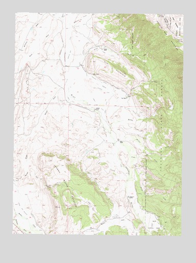
Johnny Moore Mountain, CO USGS Topographic Map
Click on map above to begin viewing in our Map Viewer.

This topographic map contains these locations and features:
Feature Name Type Latitude Longitude GNIS ID View Map
Allen CreekStreamN40.7283°W106.0889°172491View Map
Bolton DrawValleyN40.7127°W106.0871°172494View Map
Bonafide DitchCanalN40.6625°W106.0567°172475View Map
Bonafide Ditch Number 2CanalN40.6444°W106.0336°172489View Map
Brown ParkFlatN40.6416°W106.0672°172496View Map
Bush DrawValleyN40.7468°W106.0950°172463View Map
Canadian Strip MineMineN40.6944°W106.1103°1683310View Map
Carpenter Ditch Number 1CanalN40.7305°W106.0906°172486View Map
Cat CanyonValleyN40.6656°W106.1148°172493View Map
Clear CreekStreamN40.6786°W106.0511°172500View Map
Colter RanchLocaleN40.7153°W106.0672°172469View Map
Dale DitchCanalN40.6958°W106.0345°172479View Map
Dickens RanchLocaleN40.6958°W106.0659°172467View Map
Dodge RanchLocaleN40.7300°W106.0609°172470View Map
Dry CreekStreamN40.6280°W106.0200°172495View Map
Elk MountainSummitN40.7161°W106.0450°172492View Map
Fernando DitchCanalN40.7114°W106.0609°172481View Map
Freeman DitchCanalN40.7458°W106.0817°2712138View Map
Gillette Ditch Number 1CanalN40.6841°W106.0303°172474View Map
Gillette Ditch Number 2CanalN40.6780°W106.0567°172476View Map
Gillette Ditch Number 3CanalN40.6822°W106.0320°172473View Map
Jack Dickens TrailTrailN40.7214°W106.0139°1877375View Map
Johnny Moore MountainSummitN40.6403°W106.0925°172497View Map
Kelley DitchCanalN40.6500°W106.0345°172488View Map
Kelley Highline and Kermode Ditch Number 2CanalN40.6361°W106.0200°172490View Map
Kelly CreekStreamN40.6589°W106.0403°172499View Map
Kenney DitchCanalN40.7436°W106.0770°172487View Map
Kerr MineMineN40.6903°W106.1181°1683311View Map
Lang ProspectMineN40.7197°W106.0981°1683312View Map
Mace RanchLocaleN40.6778°W106.0436°172466View Map
Marr MineMineN40.7094°W106.1161°172471View Map
Marr MinesMineN40.7050°W106.1156°1683313View Map
McKenzie CreekStreamN40.7439°W106.0820°170299View Map
McNally CreekStreamN40.7475°W106.0928°170300View Map
Muddy CreekStreamN40.6861°W106.0570°172503View Map
Muddy ParkFlatN40.6980°W106.0089°172465View Map
Phelan DitchCanalN40.7449°W106.0683°2724005View Map
Pomroy DitchCanalN40.6947°W106.0589°172478View Map
Pomroy Ditch Number 2CanalN40.7000°W106.0814°172477View Map
Ray RanchLocaleN40.7028°W106.0422°172468View Map
Rogerson RanchLocaleN40.6466°W106.0400°172464View Map
Smith DitchCanalN40.6333°W106.0395°202068View Map
Spear and Michigan Highline DitchCanalN40.6333°W106.1089°202069View Map
Spear DitchCanalN40.6555°W106.1222°202067View Map
Sudduth Ditch Number 1CanalN40.7075°W106.0470°172480View Map
Sudduth Ditch Number 5CanalN40.7227°W106.0880°2724280View Map
Toledo DitchCanalN40.7278°W106.0400°172484View Map
Troublesome DitchCanalN40.7161°W106.0725°172482View Map
Vita DitchCanalN40.6519°W106.0289°172472View Map
Willow CreekStreamN40.6778°W106.0464°172504View Map
Winscom MineMineN40.6636°W106.1125°1683314View Map

Note: Coordinates in the location and feature list above are referenced to NAD83 datum.


Copyright (C) 2008-2025 Ryan Niemi / Sunset Dynamics ... All Rights Reserved