TopoQuest Logo
Do you find TopoQuest useful?
Help keep TopoQuest running and adding new maps/features by donating!
Bitcoin:  19c7KJd3qBynnjoSw5npx9KScwjBe4ifkT
Litecoin:  LXs6TkuXGGXo1vDsWCkWVdjQX94eUKd6ui
Home View Maps Find Maps Find Places Resources & Links


Jones, Oklahoma Topographic Map

USGS Map Title: Jones, OK
USGS Map MRC: 35097E3
DRG (GeoTIFF) Download: o35097e3.tif


Neighboring USGS Topographic Map Quads:


  Edmond, OK  
35097F4
 

  Arcadia, OK  
35097F3
 

  Luther, OK  
35097F2
 

  Spencer, OK  
35097E4
 

  Jones, OK  
35097E3
 

  Horseshoe Lake, OK  
35097E2
 

  Midwest City, OK  
35097D4
 

  Choctaw, OK  
35097D3
 

  Harrah, OK  
35097D2


Map MRC Location:

N36°
W98°
N36°
W97°
H8 H7 H6 H5 H4 H3 H2 H1
G8 G7 G6 G5 G4 G3 G2 G1
F8 F7 F6 F5 F4 F3 F2 F1
E8 E7 E6 E5 E4 E3 E2 E1
D8 D7 D6 D5 D4 D3 D2 D1
C8 C7 C6 C5 C4 C3 C2 C1
B8 B7 B6 B5 B4 B3 B2 B1
A8 A7 A6 A5 A4 A3 A2 A1
N35°
W98°
N35°
W97°

Jones, OK USGS 1:24K Topographic Map Preview:
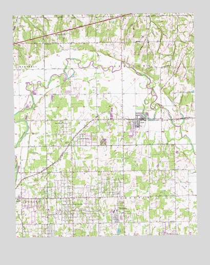
Jones, OK USGS Topographic Map
Click on map above to begin viewing in our Map Viewer.

This topographic map contains these locations and features:
Feature Name Type Latitude Longitude GNIS ID View Map
Bethel Apostolic ChurchChurchN35.5078°W97.3473°1810010View Map
Chitwood CemeteryCemeteryN35.6084°W97.3535°1091317View Map
Choctaw Middle SchoolSchoolN35.5004°W97.2718°1803903View Map
Christian Valley Missionary ChurchChurchN35.5078°W97.3436°1810011View Map
Church of God in ChristChurchN35.5223°W97.3392°1810014View Map
City of SpencerCivilN35.5108°W97.3715°2411952View Map
Dunjee High SchoolSchoolN35.5142°W97.3075°1092298View Map
Dunjee ParkPopulated PlaceN35.5134°W97.3006°1092299View Map
Eastern Oklahoma County Technology CenterSchoolN35.5169°W97.2670°1803904View Map
Ewing CemeteryCemeteryN35.5515°W97.3407°2677929View Map
Faith Mission ChurchChurchN35.5078°W97.3481°1810012View Map
First Baptist ChurchChurchN35.5628°W97.2906°1798405View Map
First Baptist Church of HicksChurchN35.5037°W97.3536°1810013View Map
Greater Coates Temple ChurchChurchN35.5131°W97.3436°1810016View Map
Green PasturesPopulated PlaceN35.5223°W97.3359°1093380View Map
Green Pastures Elementary SchoolSchoolN35.5156°W97.3525°1819348View Map
Hillcrest Memory GardensCemeteryN35.5250°W97.3036°1093771View Map
Hillwood Baptist ChurchChurchN35.5514°W97.3470°1810018View Map
Holy Land TempleChurchN35.5364°W97.3450°1810019View Map
Hopcus Farms Airport (historical)AirportN35.5920°W97.3281°1102518View Map
Israel Chapel ChurchChurchN35.5101°W97.3075°1810020View Map
JonesPopulated PlaceN35.5659°W97.2870°1094256View Map
Jones Elementary SchoolSchoolN35.5593°W97.2995°1793738View Map
Jones Fire DepartmentBuildingN35.5655°W97.2909°2658633View Map
Jones Full Gospel Bible ChurchChurchN35.5656°W97.2792°1798406View Map
Jones High SchoolSchoolN35.5613°W97.2902°1793737View Map
Jones Independent Order of Odd Fellows CemeteryCemeteryN35.5522°W97.2992°2677971View Map
Jones Police DepartmentBuildingN35.5655°W97.2859°2757585View Map
Lewis ParkParkN35.5181°W97.3014°1094595View Map
Lillard and Woodard CemeteryCemeteryN35.6020°W97.2655°1094638View Map
Lily of the Valley CogicChurchN35.5595°W97.3417°1810021View Map
Mary Mahoney DamDamN35.5017°W97.3053°1751808View Map
Mary Mahoney ReservoirReservoirN35.5017°W97.3053°1751809View Map
Morning Star Baptist ChurchChurchN35.5287°W97.3536°1810022View Map
Mount Moriah ChurchChurchN35.5556°W97.3298°1095578View Map
Oaklawn Memorial GardensCemeteryN35.5519°W97.3392°1095576View Map
Oklahoma City Fire Department Station 27BuildingN35.5370°W97.3354°2658659View Map
Oklahoma City Fire Department Station 4BuildingN35.6148°W97.2510°2658652View Map
Oknoname 7 DamDamN35.6217°W97.2986°1752347View Map
Oknoname 7 ReservoirReservoirN35.6215°W97.2990°1752348View Map
Oknoname 8 DamDamN35.5801°W97.2520°1752345View Map
Oknoname 8 ReservoirReservoirN35.5801°W97.2520°1752346View Map
Parker Elementary SchoolSchoolN35.5143°W97.3073°2712935View Map
Parker Elementary SchoolSchoolN35.5145°W97.3056°1819350View Map
Pate LakeReservoirN35.6193°W97.3699°1754245View Map
Pate Lake DamDamN35.6201°W97.3703°1754244View Map
Pleasant Valley ChurchChurchN35.6142°W97.3398°1096763View Map
Rose Hill SchoolSchoolN35.5645°W97.3423°1097441View Map
Saint James Baptist ChurchChurchN35.5148°W97.3050°1810026View Map
Saint Johns CME ChurchChurchN35.5078°W97.3459°1810027View Map
Saint Luke Baptist ChurchChurchN35.5223°W97.3534°1810028View Map
Saint Mary Ukrainian Orthodox ChurchChurchN35.5679°W97.2910°2677941View Map
Saint Pauls Baptist ChurchChurchN35.5287°W97.3409°1810029View Map
Salem ChurchChurchN35.5948°W97.2692°1097654View Map
Shibboleth Jesus Divine ChurchChurchN35.5634°W97.2920°1798407View Map
Spencer Elementary SchoolSchoolN35.5217°W97.3727°1819349View Map
Town of JonesCivilN35.5662°W97.2901°2412809View Map
Township of ChoctawCivilN35.5209°W97.2920°1824760View Map
Township of CrutchoCivilN35.5195°W97.3670°1824759View Map
Township of HartzellCivilN35.5959°W97.3642°1824756View Map
Township of SpringerCivilN35.5959°W97.2920°1824757View Map
True Vine Independent Baptist ChurchChurchN35.5131°W97.3481°1810031View Map

Note: Coordinates in the location and feature list above are referenced to NAD83 datum.


Copyright (C) 2008-2025 Ryan Niemi / Sunset Dynamics ... All Rights Reserved