TopoQuest Logo
Do you find TopoQuest useful?
Help keep TopoQuest running and adding new maps/features by donating!
Bitcoin:  19c7KJd3qBynnjoSw5npx9KScwjBe4ifkT
Litecoin:  LXs6TkuXGGXo1vDsWCkWVdjQX94eUKd6ui
Home View Maps Find Maps Find Places Resources & Links


Horseshoe Lake, Oklahoma Topographic Map

USGS Map Title: Horseshoe Lake, OK
USGS Map MRC: 35097E2
DRG (GeoTIFF) Download: o35097e2.tif


Neighboring USGS Topographic Map Quads:


  Arcadia, OK  
35097F3
 

  Luther, OK  
35097F2
 

  Wellston, OK  
35097F1
 

  Jones, OK  
35097E3
 

  Horseshoe Lake, OK  
35097E2
 

  Luther SE, OK  
35097E1
 

  Choctaw, OK  
35097D3
 

  Harrah, OK  
35097D2
 

  McLoud, OK  
35097D1


Map MRC Location:

N36°
W98°
N36°
W97°
H8 H7 H6 H5 H4 H3 H2 H1
G8 G7 G6 G5 G4 G3 G2 G1
F8 F7 F6 F5 F4 F3 F2 F1
E8 E7 E6 E5 E4 E3 E2 E1
D8 D7 D6 D5 D4 D3 D2 D1
C8 C7 C6 C5 C4 C3 C2 C1
B8 B7 B6 B5 B4 B3 B2 B1
A8 A7 A6 A5 A4 A3 A2 A1
N35°
W98°
N35°
W97°

Horseshoe Lake, OK USGS 1:24K Topographic Map Preview:
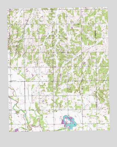
Horseshoe Lake, OK USGS Topographic Map
Click on map above to begin viewing in our Map Viewer.

This topographic map contains these locations and features:
Feature Name Type Latitude Longitude GNIS ID View Map
Booher DamDamN35.6051°W97.1703°1751122View Map
Booher LakeReservoirN35.6047°W97.1701°1751123View Map
Choctaw CreekStreamN35.5020°W97.2228°1091326View Map
Douglas ChurchChurchN35.6237°W97.2467°1092165View Map
East Fork Wildhorse CreekStreamN35.6231°W97.1845°1092398View Map
Hickory Hills Volunteer Fire DepartmentBuildingN35.5788°W97.1836°2658646View Map
Horseshoe LakeLakeN35.5088°W97.1713°1093961View Map
Jones Middle SchoolSchoolN35.5515°W97.2461°1793739View Map
Mills CemeteryCemeteryN35.5073°W97.1378°1095421View Map
Mission Field (historical)AirportN35.5417°W97.2173°1102494View Map
Oklahoma AcademySchoolN35.5341°W97.2011°2712821View Map
PoolePopulated PlaceN35.6089°W97.2267°1100755View Map
Saint Mary CemeteryCemeteryN35.5392°W97.1767°1097627View Map
Saint Paul Baptist CemeteryCemeteryN35.6083°W97.1589°2677980View Map
Saint Paul ChurchChurchN35.5798°W97.1831°1097642View Map
Summit Ridge CemeteryCemeteryN35.5364°W97.2028°1095559View Map
Township of DeweyCivilN35.5959°W97.1948°1824758View Map
Township of ElkCivilN35.5195°W97.1948°1824761View Map
West Fork Wildhorse CreekStreamN35.6145°W97.1881°1099562View Map
Wolf Ridge DamDamN35.5484°W97.1870°1752393View Map
Wolf Ridge LakeReservoirN35.5465°W97.1875°1752394View Map

Note: Coordinates in the location and feature list above are referenced to NAD83 datum.


Copyright (C) 2008-2025 Ryan Niemi / Sunset Dynamics ... All Rights Reserved