TopoQuest Logo
Do you find TopoQuest useful?
Help keep TopoQuest running and adding new maps/features by donating!
Bitcoin:  19c7KJd3qBynnjoSw5npx9KScwjBe4ifkT
Litecoin:  LXs6TkuXGGXo1vDsWCkWVdjQX94eUKd6ui
Home View Maps Find Maps Find Places Resources & Links


Joy Hollow, Texas Topographic Map

USGS Map Title: Joy Hollow, TX
USGS Map MRC: 29099H8
DRG (GeoTIFF) Download: o29099h8.tif


Neighboring USGS Topographic Map Quads:


  Devils Sinkhole, TX  
30100A1
 

  Earwood Creek SW, TX  
30099A8
 

  Earwood Creek, TX  
30099A7
 

  Hackberry, TX  
29100H1
 

  Joy Hollow, TX  
29099H8
 

  Bee Cave Hollow, TX  
29099H7
 

  Vance, TX  
29100G1
 

  Jo Jan Van Camp, TX  
29099G8
 

  Owl Hollow, TX  
29099G7


Map MRC Location:

N30°
W100°
N30°
W99°
H8 H7 H6 H5 H4 H3 H2 H1
G8 G7 G6 G5 G4 G3 G2 G1
F8 F7 F6 F5 F4 F3 F2 F1
E8 E7 E6 E5 E4 E3 E2 E1
D8 D7 D6 D5 D4 D3 D2 D1
C8 C7 C6 C5 C4 C3 C2 C1
B8 B7 B6 B5 B4 B3 B2 B1
A8 A7 A6 A5 A4 A3 A2 A1
N29°
W100°
N29°
W99°

Joy Hollow, TX USGS 1:24K Topographic Map Preview:
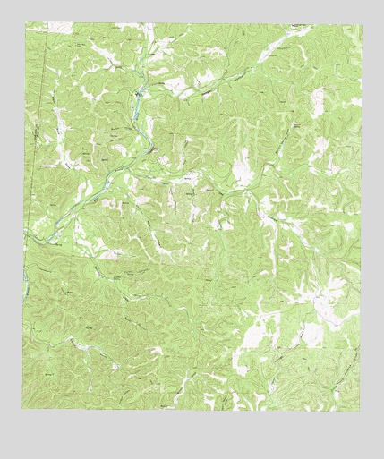
Joy Hollow, TX USGS Topographic Map
Click on map above to begin viewing in our Map Viewer.

This topographic map contains these locations and features:
Feature Name Type Latitude Longitude GNIS ID View Map
Barnett SpringSpringN29.9674°W99.9004°1330071View Map
Barnett Spring DrawValleyN29.9549°W99.9071°1330073View Map
Blue HoleLakeN29.9502°W99.9542°1330906View Map
Cedar CanyonValleyN29.9487°W99.9459°1332384View Map
Eagle CliffCliffN29.9591°W99.9523°1334837View Map
Eagle RanchLocaleN29.9772°W99.9581°1334856View Map
Eagle Ranch Lake Number 2ReservoirN29.9685°W99.9587°1864066View Map
Eagle Ranch Lake Number 2 DamDamN29.9685°W99.9587°1864065View Map
East Rose DrawValleyN29.9463°W99.9696°1334985View Map
Greenwood Valley RanchLocaleN29.9997°W99.9009°1337001View Map
Haw HollowValleyN29.9512°W99.9404°1337463View Map
Home HollowValleyN29.9496°W99.9406°1338002View Map
Horse HollowValleyN29.9114°W99.9624°1338104View Map
Joy HollowValleyN29.9536°W99.9617°1338895View Map
Kaolin MineMineN29.9949°W99.9762°1338952View Map
Morriss SpringSpringN29.9585°W99.9587°1998345View Map
Mullen HollowValleyN29.9647°W99.9575°1342264View Map
Ranger HollowValleyN29.9785°W99.9566°1344794View Map
Sanchez DrawValleyN29.9290°W99.9916°1346487View Map
Sanchez SpringSpringN29.9177°W99.9665°1346489View Map
Turkey CanyonValleyN29.9169°W99.9662°1348853View Map
West Rose DrawValleyN29.9424°W99.9789°1349793View Map

Note: Coordinates in the location and feature list above are referenced to NAD83 datum.


Copyright (C) 2008-2025 Ryan Niemi / Sunset Dynamics ... All Rights Reserved