TopoQuest Logo
Do you find TopoQuest useful?
Help keep TopoQuest running and adding new maps/features by donating!
Bitcoin:  19c7KJd3qBynnjoSw5npx9KScwjBe4ifkT
Litecoin:  LXs6TkuXGGXo1vDsWCkWVdjQX94eUKd6ui
Home View Maps Find Maps Find Places Resources & Links


Vance, Texas Topographic Map

USGS Map Title: Vance, TX
USGS Map MRC: 29100G1
DRG (GeoTIFF) Download: o29100g1.tif


Neighboring USGS Topographic Map Quads:


  Cub Lake, TX  
29100H2
 

  Hackberry, TX  
29100H1
 

  Joy Hollow, TX  
29099H8
 

  Half Moon Prairie, TX  
29100G2
 

  Vance, TX  
29100G1
 

  Jo Jan Van Camp, TX  
29099G8
 

  Kelley Peak, TX  
29100F2
 

  Camp Wood, TX  
29100F1
 

  Crown Mountain, TX  
29099F8


Map MRC Location:

N30°
W101°
N30°
W100°
H8 H7 H6 H5 H4 H3 H2 H1
G8 G7 G6 G5 G4 G3 G2 G1
F8 F7 F6 F5 F4 F3 F2 F1
E8 E7 E6 E5 E4 E3 E2 E1
D8 D7 D6 D5 D4 D3 D2 D1
C8 C7 C6 C5 C4 C3 C2 C1
B8 B7 B6 B5 B4 B3 B2 B1
A8 A7 A6 A5 A4 A3 A2 A1
N29°
W101°
N29°
W100°

Vance, TX USGS 1:24K Topographic Map Preview:
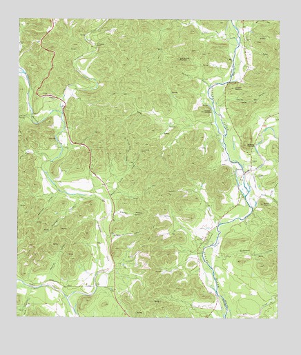
Vance, TX USGS Topographic Map
Click on map above to begin viewing in our Map Viewer.

This topographic map contains these locations and features:
Feature Name Type Latitude Longitude GNIS ID View Map
Blackhawk HollowValleyN29.8023°W100.1058°1352367View Map
Blue HoleLakeN29.8252°W100.1070°1352457View Map
Bullhead CreekStreamN29.8105°W100.0167°1353282View Map
Bullhead MountainSummitN29.8230°W100.0156°1353285View Map
Cedar CreekStreamN29.7572°W100.1006°1354066View Map
Daley HollowValleyN29.8319°W100.0322°1355551View Map
Flying Bull RanchLocaleN29.8097°W100.0106°1357514View Map
Flying Bull Ranch AirportAirportN29.8094°W100.0134°1386205View Map
Greenhouse SpringSpringN29.8644°W100.0884°1358399View Map
Hunter HollowValleyN29.8414°W100.0262°1359840View Map
Little Hackberry CreekStreamN29.8355°W100.1042°1374585View Map
Mail Trail DrawValleyN29.8671°W100.0209°1374780View Map
Perkins HollowValleyN29.8472°W100.0340°1365064View Map
Perkins MountainSummitN29.8366°W100.0365°1365066View Map
Polecat CreekStreamN29.8530°W100.1229°1375520View Map
Racetrack HollowValleyN29.7732°W100.0322°1365939View Map
Reagan HollowValleyN29.7843°W100.0822°1366083View Map
Reasnor HollowValleyN29.7676°W100.1094°1366089View Map
Rock HollowValleyN29.7594°W100.1195°1375785View Map
Round Hole DrawValleyN29.7945°W100.0809°1366924View Map
Round Hole SpringSpringN29.8201°W100.0666°1366925View Map
Seep Spring MountainSummitN29.8591°W100.0484°1367937View Map
Spring HollowValleyN29.8010°W100.0038°1369019View Map
Stewart HollowValleyN29.7948°W100.0801°1369190View Map
Sweeten HollowValleyN29.7982°W100.0968°1369473View Map
Terry HollowValleyN29.8008°W100.0106°1369744View Map
Turnpike MountainSummitN29.8466°W100.0220°1370304View Map
VancePopulated PlaceN29.8158°W100.0137°1370582View Map
W Round Hole DrawValleyN29.8132°W100.0720°1370695View Map

Note: Coordinates in the location and feature list above are referenced to NAD83 datum.


Copyright (C) 2008-2025 Ryan Niemi / Sunset Dynamics ... All Rights Reserved